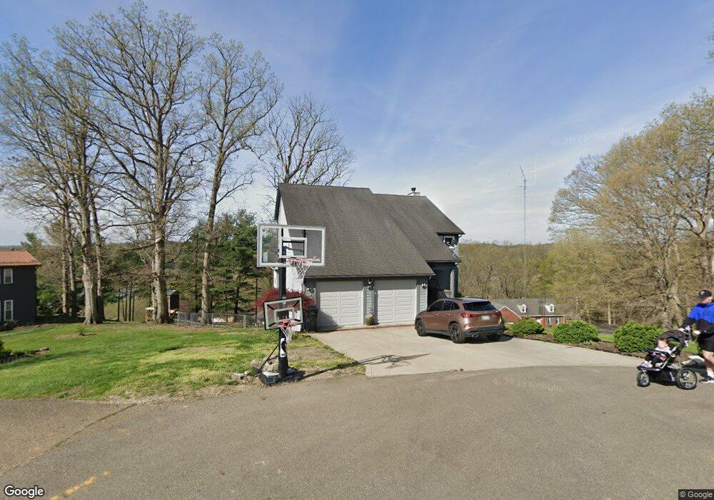
5615 Pleasant View Dr Nashport, OH 43830
Estimated Value: $359,000 - $550,000
3
Beds
3
Baths
3,700
Sq Ft
$128/Sq Ft
Est. Value
About This Home
This home is located at 5615 Pleasant View Dr, Nashport, OH 43830 and is currently estimated at $473,901, approximately $128 per square foot. 5615 Pleasant View Dr is a home located in Muskingum County with nearby schools including Tri-Valley High School.
Ownership History
Date
Name
Owned For
Owner Type
Purchase Details
Closed on
Sep 28, 2005
Sold by
Schlaegel John and Schlaegel Sondra
Bought by
Maxwell Michael J and Anderson Heather R
Current Estimated Value
Home Financials for this Owner
Home Financials are based on the most recent Mortgage that was taken out on this home.
Original Mortgage
$309,000
Interest Rate
5.93%
Mortgage Type
Fannie Mae Freddie Mac
Purchase Details
Closed on
Dec 20, 2001
Sold by
Conrad Doran
Bought by
Schlaegel John and Schlaegel Sandra
Create a Home Valuation Report for This Property
The Home Valuation Report is an in-depth analysis detailing your home's value as well as a comparison with similar homes in the area
Home Values in the Area
Average Home Value in this Area
Purchase History
| Date | Buyer | Sale Price | Title Company |
|---|---|---|---|
| Maxwell Michael J | $265,400 | -- | |
| Schlaegel John | $5,000 | -- |
Source: Public Records
Mortgage History
| Date | Status | Borrower | Loan Amount |
|---|---|---|---|
| Closed | Maxwell Michael J | $309,000 |
Source: Public Records
Tax History Compared to Growth
Tax History
| Year | Tax Paid | Tax Assessment Tax Assessment Total Assessment is a certain percentage of the fair market value that is determined by local assessors to be the total taxable value of land and additions on the property. | Land | Improvement |
|---|---|---|---|---|
| 2024 | $4,865 | $133,315 | $14,735 | $118,580 |
| 2023 | $4,523 | $112,805 | $12,845 | $99,960 |
| 2022 | $4,416 | $112,805 | $12,845 | $99,960 |
| 2021 | $4,021 | $112,805 | $12,845 | $99,960 |
| 2020 | $3,577 | $98,070 | $11,165 | $86,905 |
| 2019 | $3,577 | $98,070 | $11,165 | $86,905 |
| 2018 | $3,431 | $98,070 | $11,165 | $86,905 |
| 2017 | $3,248 | $88,375 | $11,165 | $77,210 |
| 2016 | $3,291 | $88,380 | $11,170 | $77,210 |
| 2015 | $3,285 | $88,380 | $11,170 | $77,210 |
| 2013 | $3,635 | $79,280 | $11,170 | $68,110 |
Source: Public Records
Map
Nearby Homes
- 5605 Pleasant View Dr
- 6080 Poplar Dr
- 6805 Dillon Hills Dr
- 6730 Dillon Hills Dr
- 6850 Newark Rd
- 6365 Brentcrest Dr
- 6355 Brentcrest Dr
- 5880 Ballard Rd
- 6740 Swing A Long Ln
- 5295 Milford Dr
- 5290 Hampton Ct
- 5220 Hampton Ct
- 0 Dillon Hills Dr Unit 5150920
- 0 Dillon Hills Dr Unit 225032050
- 5240 Stonegate Dr
- 5260 Stonegate Dr
- 5050 Wilshire Dr
- 5270 Stonegate Dr
- 5255 Stonegate Dr
- 5265 Stonegate Dr
- 5605 Pleasant View Dr Unit D
- 5600 Pleasant View Dr
- 5610 Pleasant View Dr
- 5520 Woodside Dr
- 5550 Woodside Dr
- 0 Woodside Rd
- 5655 Pleasant View Dr
- 5630 Pleasant View Dr
- 5600 Woodside Dr
- 5560 Woodside Dr
- 5570 Woodside Dr
- 5500 Woodside Dr
- 5590 Woodside Dr
- 5660 Woodside Dr
- 5870 Poplar Dr
- 5935 Poplar Dr
- 6020 Poplar Dr
- 5660 Pleasant View Dr
- 6015 Poplar Dr
- 0 Poplar Dr Unit 4490467