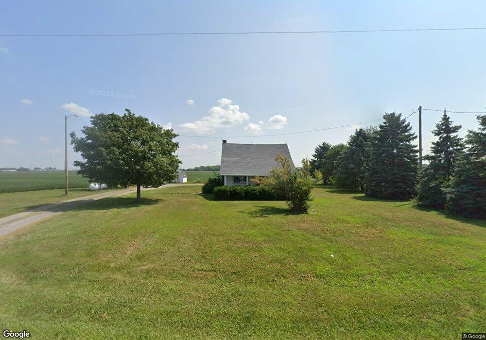
5615 Us Route 127 van Wert, OH 45891
Estimated Value: $96,173 - $150,000
--
Bed
1
Bath
868
Sq Ft
$144/Sq Ft
Est. Value
About This Home
This home is located at 5615 Us Route 127, van Wert, OH 45891 and is currently estimated at $125,043, approximately $144 per square foot. 5615 Us Route 127 is a home located in Van Wert County with nearby schools including Lincolnview Elementary School, Lincolnview Junior/Senior High School, and Lifelinks Community School.
Ownership History
Date
Name
Owned For
Owner Type
Purchase Details
Closed on
Sep 29, 2020
Sold by
Thomas Sandra Lee
Bought by
State Of Ohio and Department Of Transportation
Current Estimated Value
Purchase Details
Closed on
Oct 14, 2019
Sold by
Stein Lisa J and Estate Of Mary J Farr
Bought by
Thomas Sandra Lee
Home Financials for this Owner
Home Financials are based on the most recent Mortgage that was taken out on this home.
Original Mortgage
$53,350
Interest Rate
3.5%
Mortgage Type
New Conventional
Create a Home Valuation Report for This Property
The Home Valuation Report is an in-depth analysis detailing your home's value as well as a comparison with similar homes in the area
Home Values in the Area
Average Home Value in this Area
Purchase History
| Date | Buyer | Sale Price | Title Company |
|---|---|---|---|
| State Of Ohio | $2,200 | None Available | |
| Thomas Sandra Lee | $55,000 | Attorneys Title Agency |
Source: Public Records
Mortgage History
| Date | Status | Borrower | Loan Amount |
|---|---|---|---|
| Previous Owner | Thomas Sandra Lee | $53,350 |
Source: Public Records
Tax History Compared to Growth
Tax History
| Year | Tax Paid | Tax Assessment Tax Assessment Total Assessment is a certain percentage of the fair market value that is determined by local assessors to be the total taxable value of land and additions on the property. | Land | Improvement |
|---|---|---|---|---|
| 2024 | $671 | $21,550 | $4,860 | $16,690 |
| 2023 | $671 | $21,550 | $4,860 | $16,690 |
| 2022 | $648 | $15,310 | $3,810 | $11,500 |
| 2021 | $652 | $15,310 | $3,810 | $11,500 |
| 2020 | $667 | $15,720 | $4,220 | $11,500 |
| 2019 | $526 | $13,410 | $3,730 | $9,680 |
| 2018 | $176 | $13,040 | $3,360 | $9,680 |
| 2017 | $175 | $13,040 | $3,360 | $9,680 |
| 2016 | $130 | $12,590 | $3,360 | $9,230 |
| 2015 | $129 | $12,590 | $3,360 | $9,230 |
| 2014 | $133 | $12,590 | $3,360 | $9,230 |
| 2013 | $160 | $12,590 | $3,360 | $9,230 |
Source: Public Records
Map
Nearby Homes
- 692 N Market St
- 142 Gleason Ave
- 668 N Washington St
- 623 N Cherry St
- 1006 Kear Rd
- 633 N Washington St
- 517 N Walnut St
- 138 E 2nd St
- 4083 Liberty Union Rd
- 228 W 2nd St
- 303 Middle St
- 919 E Sycamore St
- 218 Burt St
- 13945 Lincoln Hwy
- 205 N Chestnut St
- 214 N Jefferson St
- 202 N Jefferson St
- 000 Lincoln Hwy
- 14934 Lincoln Hwy
- 00 Lincoln Hwy