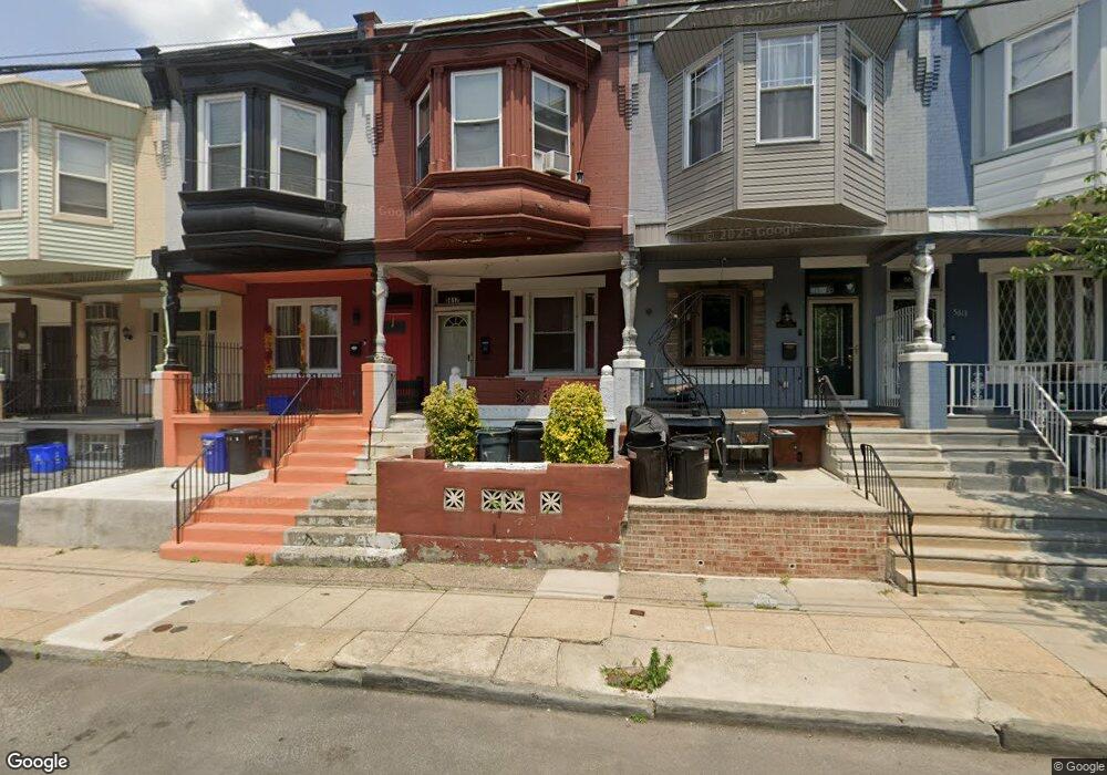
5617 Musgrave St Philadelphia, PA 19144
East Germantown NeighborhoodEstimated Value: $146,000 - $203,000
4
Beds
1
Bath
1,588
Sq Ft
$115/Sq Ft
Est. Value
About This Home
This home is located at 5617 Musgrave St, Philadelphia, PA 19144 and is currently estimated at $182,663, approximately $115 per square foot. 5617 Musgrave St is a home located in Philadelphia County with nearby schools including Oak Street Elementary School, Martin Luther King High School, and Mastery Charter School - Francis D. Pastorius Elemen.
Ownership History
Date
Name
Owned For
Owner Type
Purchase Details
Closed on
Mar 24, 2008
Sold by
King Verdel Mobley and Estate Of Johnnie L Mobley
Bought by
Gilyard Quin K
Current Estimated Value
Home Financials for this Owner
Home Financials are based on the most recent Mortgage that was taken out on this home.
Original Mortgage
$105,050
Outstanding Balance
$66,815
Interest Rate
6.22%
Mortgage Type
FHA
Estimated Equity
$115,848
Purchase Details
Closed on
May 23, 1998
Sold by
King Verdell Mobley and Estate Of Johnnie L Mobley
Bought by
King Verdell Mobley
Create a Home Valuation Report for This Property
The Home Valuation Report is an in-depth analysis detailing your home's value as well as a comparison with similar homes in the area
Home Values in the Area
Average Home Value in this Area
Purchase History
| Date | Buyer | Sale Price | Title Company |
|---|---|---|---|
| Gilyard Quin K | $105,900 | None Available | |
| King Verdell Mobley | -- | -- |
Source: Public Records
Mortgage History
| Date | Status | Borrower | Loan Amount |
|---|---|---|---|
| Open | Gilyard Quin K | $105,050 |
Source: Public Records
Tax History Compared to Growth
Tax History
| Year | Tax Paid | Tax Assessment Tax Assessment Total Assessment is a certain percentage of the fair market value that is determined by local assessors to be the total taxable value of land and additions on the property. | Land | Improvement |
|---|---|---|---|---|
| 2026 | $1,467 | $156,800 | $31,360 | $125,440 |
| 2025 | $1,467 | $156,800 | $31,360 | $125,440 |
| 2024 | $1,467 | $156,800 | $31,360 | $125,440 |
| 2023 | $1,467 | $104,800 | $20,900 | $83,900 |
| 2022 | $992 | $104,800 | $20,900 | $83,900 |
| 2021 | $992 | $0 | $0 | $0 |
| 2020 | $992 | $0 | $0 | $0 |
| 2019 | $1,036 | $0 | $0 | $0 |
| 2018 | $1,179 | $0 | $0 | $0 |
| 2017 | $1,179 | $0 | $0 | $0 |
| 2016 | $1,179 | $0 | $0 | $0 |
| 2015 | $1,056 | $0 | $0 | $0 |
| 2014 | -- | $78,800 | $7,038 | $71,762 |
| 2012 | -- | $6,368 | $976 | $5,392 |
Source: Public Records
Map
Nearby Homes
- 617 E Locust Ave
- 604 E Locust Ave
- 5610 Mcmahon St
- 1000 E Woodlawn St
- 543 E Locust Ave
- 5626 Mcmahon St
- 5625 Crowson St
- 5502 Crowson St
- 616 E Stafford St
- 626 E Stafford St
- 527 E Chelten Ave
- 5688 90 Magnolia St
- 809 E Locust Ave
- 436 E Chelten Ave
- 863 E Chelten Ave
- 802 E Chelten Ave
- 839 E Locust Ave
- 459 E Price St
- 41-43 E Rittenhouse St
- 740 E Rittenhouse St
- 5619 Musgrave St
- 5615 Musgrave St
- 5621 Musgrave St
- 5613 Musgrave St
- 5623 Musgrave St
- 5611 Musgrave St
- 5625 Musgrave St
- 5627 Musgrave St
- 5612 Stokes St
- 5616 Stokes St
- 5629 Musgrave St
- 5618 Stokes St
- 5614 Stokes St
- 566 E Woodlawn St
- 5620 Stokes St
- 605 E Locust Ave
- 603 E Locust Ave
- 607 E Locust Ave
- 601 E Locust Ave
- 5610 Stokes St