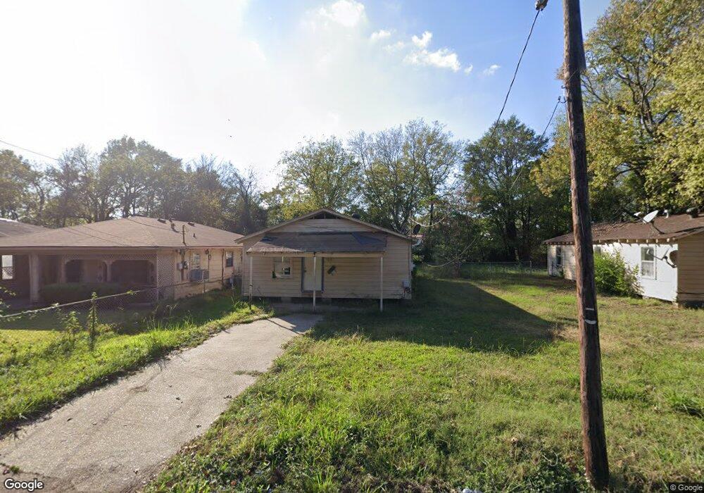
5618 Norton St Shreveport, LA 71109
Mooretown and Hollywood Heights NeighborhoodEstimated Value: $46,479 - $54,000
2
Beds
2
Baths
1,032
Sq Ft
$49/Sq Ft
Est. Value
About This Home
This home is located at 5618 Norton St, Shreveport, LA 71109 and is currently estimated at $50,370, approximately $48 per square foot. 5618 Norton St is a home with nearby schools including Oak Park Elementary School, Judson Fundamental Elementary School, and Fairfield Magnet School.
Ownership History
Date
Name
Owned For
Owner Type
Purchase Details
Closed on
Jul 8, 2025
Sold by
Parish Of Caddo
Bought by
Parish Of Caddo
Current Estimated Value
Purchase Details
Closed on
Jun 21, 2013
Sold by
I Harris Properties Llc
Bought by
The City Of Shreveport
Purchase Details
Closed on
Jun 14, 2013
Sold by
I Harris Properties L L C
Bought by
Ofcaddo Parish
Purchase Details
Closed on
May 21, 2013
Sold by
Harris David Wayne and Harris Alicia Lafaye
Bought by
Sneed Harris Spencer Allen and Sneed Harris Britney
Create a Home Valuation Report for This Property
The Home Valuation Report is an in-depth analysis detailing your home's value as well as a comparison with similar homes in the area
Home Values in the Area
Average Home Value in this Area
Purchase History
| Date | Buyer | Sale Price | Title Company |
|---|---|---|---|
| Parish Of Caddo | $679 | None Listed On Document | |
| The City Of Shreveport | $267 | None Available | |
| Ofcaddo Parish | $534 | None Available | |
| Sneed Harris Spencer Allen | $2,500 | None Available |
Source: Public Records
Tax History Compared to Growth
Tax History
| Year | Tax Paid | Tax Assessment Tax Assessment Total Assessment is a certain percentage of the fair market value that is determined by local assessors to be the total taxable value of land and additions on the property. | Land | Improvement |
|---|---|---|---|---|
| 2024 | $350 | $2,247 | $332 | $1,915 |
| 2023 | $356 | $2,231 | $316 | $1,915 |
| 2022 | $339 | $2,129 | $316 | $1,813 |
| 2021 | $334 | $2,129 | $316 | $1,813 |
| 2020 | $334 | $2,129 | $316 | $1,813 |
| 2019 | $344 | $2,129 | $316 | $1,813 |
| 2018 | $269 | $2,129 | $316 | $1,813 |
| 2017 | $350 | $2,129 | $316 | $1,813 |
| 2015 | $318 | $2,457 | $316 | $2,141 |
| 2014 | $332 | $2,540 | $320 | $2,220 |
| 2013 | -- | $2,540 | $320 | $2,220 |
Source: Public Records
Map
Nearby Homes
- 5415 Norton St
- 4302 Illinois Ave
- 0 Miles St
- 5600 Norton St
- 3924 Miles St
- 3922 Miles St
- 4310 Saint Louis Ave
- 4056 Powell St
- 5222 Broadway Ave
- 4130 Mayfield St
- 4136 Mayfield St
- 3735 Tate St
- 3812 Mayfield St
- 4536 Curtis Ln
- 3918 Adrian St
- 6208 Jewella Ave
- 3841 Flora Ave
- 4122 Carver St
- 4102 Via St
- 4210 Via St
- 5630 Norton St
- 5610 Norton St
- 5702 Norton St
- 5613 Roberts St
- 5613 Roberts St
- 5701 Norton St
- 5703 Norton St
- 5707 Norton St
- 5609 Roberts St
- 5522 Norton St
- 5601 Norton St
- 5712 Norton St
- 5518 Norton St
- 5529 Roberts St
- 5616 Broadway Ave
- 5612 Broadway Ave
- 5620 Broadway Ave
- 5608 Broadway Ave
- 5604 Broadway Ave
- 5704 Broadway Ave