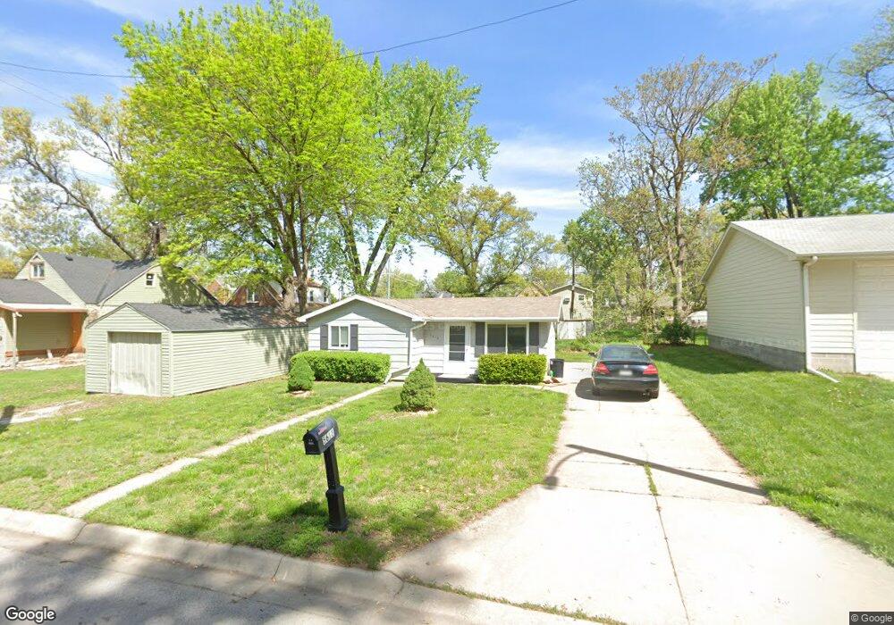
5618 Saint Paul Ave Lincoln, NE 68507
University Place NeighborhoodEstimated Value: $116,000 - $155,000
1
Bed
1
Bath
498
Sq Ft
$269/Sq Ft
Est. Value
About This Home
This home is located at 5618 Saint Paul Ave, Lincoln, NE 68507 and is currently estimated at $133,780, approximately $268 per square foot. 5618 Saint Paul Ave is a home located in Lancaster County with nearby schools including Brownell Elementary School, Mickle Middle School, and Lincoln Northeast High School.
Ownership History
Date
Name
Owned For
Owner Type
Purchase Details
Closed on
Aug 1, 2011
Sold by
Davison Cole Henry
Bought by
Pierce Jeffrey W and Pierce Cynthia L
Current Estimated Value
Purchase Details
Closed on
Jun 18, 2004
Sold by
Ross Ray J and Ross Maryanne K
Bought by
Davison Cole Henry
Home Financials for this Owner
Home Financials are based on the most recent Mortgage that was taken out on this home.
Original Mortgage
$32,500
Interest Rate
6.12%
Mortgage Type
Seller Take Back
Create a Home Valuation Report for This Property
The Home Valuation Report is an in-depth analysis detailing your home's value as well as a comparison with similar homes in the area
Home Values in the Area
Average Home Value in this Area
Purchase History
| Date | Buyer | Sale Price | Title Company |
|---|---|---|---|
| Pierce Jeffrey W | $42,000 | Nlta | |
| Davison Cole Henry | $35,000 | -- |
Source: Public Records
Mortgage History
| Date | Status | Borrower | Loan Amount |
|---|---|---|---|
| Previous Owner | Davison Cole Henry | $32,500 |
Source: Public Records
Tax History Compared to Growth
Tax History
| Year | Tax Paid | Tax Assessment Tax Assessment Total Assessment is a certain percentage of the fair market value that is determined by local assessors to be the total taxable value of land and additions on the property. | Land | Improvement |
|---|---|---|---|---|
| 2025 | $1,218 | $106,200 | $25,800 | $80,400 |
| 2024 | $1,218 | $88,100 | $24,000 | $64,100 |
| 2023 | $1,477 | $88,100 | $24,000 | $64,100 |
| 2022 | $1,288 | $64,600 | $18,000 | $46,600 |
| 2021 | $1,218 | $64,600 | $18,000 | $46,600 |
| 2020 | $1,091 | $57,100 | $18,000 | $39,100 |
| 2019 | $1,091 | $57,100 | $18,000 | $39,100 |
| 2018 | $1,006 | $52,400 | $18,000 | $34,400 |
| 2017 | $1,015 | $52,400 | $18,000 | $34,400 |
| 2016 | $997 | $51,200 | $15,000 | $36,200 |
| 2015 | $990 | $51,200 | $15,000 | $36,200 |
| 2014 | $920 | $47,300 | $15,000 | $32,300 |
| 2013 | -- | $47,300 | $15,000 | $32,300 |
Source: Public Records
Map
Nearby Homes
- 2700 N 56th St
- 5815 Saint Paul Ave
- 2946 N 56th St
- 5601 Greenwood St
- 6019 Baldwin Ave
- 6020 Huntington Ave
- 5202 Adams St
- 6015 Huntington Ave
- 5202 Greenwood St
- 5125 Greenwood St
- 5720 Knox St
- 5144 Greenwood St
- 6045 Leighton Ave
- 2933 N 50th St
- 5441 Colby St
- 2513 N 63rd St
- 5845 Gladstone St
- 2000 N 53rd St
- 3319 N 60th St
- 5102 Judson St
- 2716 N 56th St
- 2707 N 57th St
- 2717 N 57th St
- 5625 Saint Paul Ave
- 2636 N 56th St
- 5627 Madison Ave
- 5635 Saint Paul Ave
- 5635 Madison Ave
- 2729 N 57th St
- 5601 Madison Ave
- 2645 N 57th St
- 2745 N 57th St
- 2616 N 56th St
- 2700 N 57th St
- 5707 Saint Paul Ave
- 5701 Madison Ave
- 5630 Baldwin Ave
- 2640 N 57th St
- 5640 Baldwin Ave
- 5620 Baldwin Ave