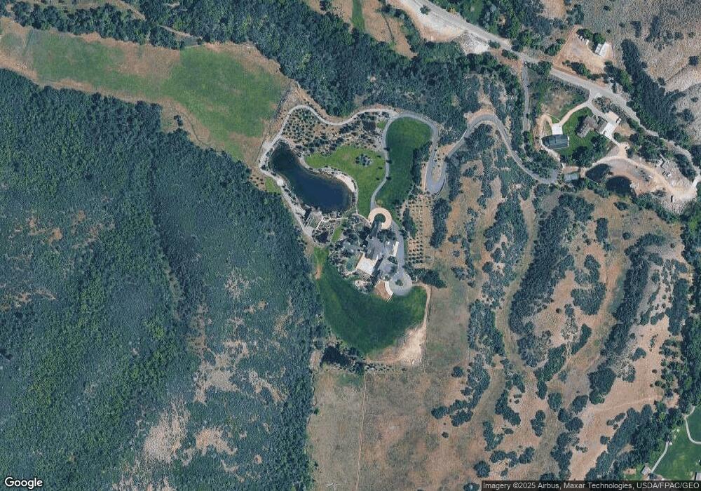
5618 Southfork Rd Unit 1 Sundance, UT 84604
Estimated Value: $1,664,000 - $27,001,338
6
Beds
12
Baths
15,891
Sq Ft
$902/Sq Ft
Est. Value
About This Home
This home is located at 5618 Southfork Rd Unit 1, Sundance, UT 84604 and is currently estimated at $14,332,669, approximately $901 per square foot. 5618 Southfork Rd Unit 1 is a home located in Utah County with nearby schools including Foothill Elementary School, Canyon View Junior High School, and Orem High School.
Ownership History
Date
Name
Owned For
Owner Type
Purchase Details
Closed on
Nov 25, 2017
Sold by
Devore Garrett
Bought by
Cook Julie Larson and Cook Gregory Paul
Current Estimated Value
Purchase Details
Closed on
Mar 7, 2011
Sold by
Yjg Partners Ltd
Bought by
Devore Garrett
Purchase Details
Closed on
Dec 31, 2009
Sold by
Yjg Partners Ltd
Bought by
Devore Garrett
Create a Home Valuation Report for This Property
The Home Valuation Report is an in-depth analysis detailing your home's value as well as a comparison with similar homes in the area
Home Values in the Area
Average Home Value in this Area
Purchase History
| Date | Buyer | Sale Price | Title Company |
|---|---|---|---|
| Cook Julie Larson | -- | Bartlett Title Ins Agency In | |
| Cook Julie Larson | -- | Bartlett Title Ins Agcy Inc | |
| Devore Garrett | -- | Provo Land Title Company | |
| Devore Garrett | -- | Provo Land Title Company |
Source: Public Records
Tax History Compared to Growth
Tax History
| Year | Tax Paid | Tax Assessment Tax Assessment Total Assessment is a certain percentage of the fair market value that is determined by local assessors to be the total taxable value of land and additions on the property. | Land | Improvement |
|---|---|---|---|---|
| 2025 | $132,455 | $14,789,900 | $1,380,900 | $13,409,000 |
| 2024 | $133,300 | $15,717,900 | $0 | $0 |
| 2023 | $133,300 | $16,974,400 | $0 | $0 |
| 2022 | $159,059 | $19,717,200 | $1,402,200 | $18,315,000 |
| 2021 | $168,767 | $17,389,700 | $1,081,100 | $16,308,600 |
| 2020 | $158,964 | $16,107,400 | $1,006,800 | $15,100,600 |
| 2019 | $133,759 | $14,093,200 | $1,006,800 | $13,086,400 |
| 2018 | $126,750 | $12,696,600 | $1,006,800 | $11,689,800 |
| 2017 | $113,541 | $11,071,800 | $0 | $0 |
| 2016 | $114,412 | $10,406,800 | $0 | $0 |
| 2015 | $46,045 | $3,991,100 | $0 | $0 |
| 2014 | $27,635 | $2,387,490 | $0 | $0 |
Source: Public Records
Map
Nearby Homes
- 5618 E South Fork Rd
- 3740 E Provo Canyon Rd Unit 13
- 6716 Fairfax Dr
- 1392 N 1500 E Unit 45
- 4150 N 444 W
- 4519 N Norfolk Cir
- 645 W 890 N
- 4519 N Norfolk Cir Unit 188
- 9800 S Old Hwy 189 Hwy
- 9676 S Old Hwy 189
- 9157 Juniper Dr
- 9000 Meadow Dr Unit A43
- 8494 Choke Cherry Ln Unit 21
- 2788 E Stewart Rd
- 8806 N Stewart Rd Unit 1A
- 8806 N Stewart Rd Unit 2b
- 8806 N Stewart Rd Unit 1B
- 8806 N Stewart Rd Unit 3B
- 8878 N Timphaven Rd Man Rd Unit 4
- 8887 N Timphaven Rd Unit 15
- 5618 Southfork Rd
- 5618 Southfork Rd Unit 1
- 5686 Southfork Rd
- 5665 Southfork Rd
- 5665 Southfork Rd
- 5931 S Fork Rd
- 6029 N Shadyside Dr
- 6037 N Shadyside Dr
- 6043 N Shadyside Dr
- 6049 N Shadyside Dr
- 6057 N Shadyside Dr
- 6100 N Shady Side Dr
- 6100 N Shady Side Dr Unit LOT 7
- 0 S Fork Rd
- 6133 N Shady Side Dr
- 6109 N 4945 E