--
Bed
1
Bath
1,296
Sq Ft
8.03
Acres
About This Home
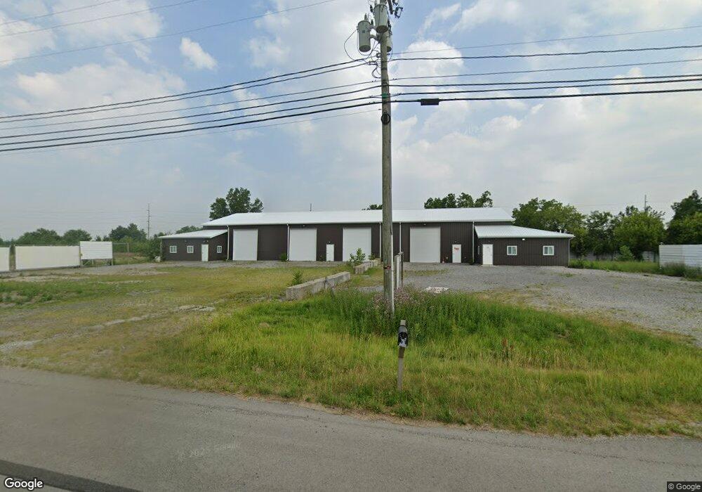
This home is located at 5618 U S 20a, Delta, OH 43515. 5618 U S 20a is a home located in Fulton County with nearby schools including Delta Elementary School, Pike-Delta-York Middle School, and Pike-Delta-York High School.
Ownership History
Date
Name
Owned For
Owner Type
Purchase Details
Closed on
Apr 16, 2021
Sold by
Scrapco Llc
Bought by
Bcm Empire Properties Llc
Home Financials for this Owner
Home Financials are based on the most recent Mortgage that was taken out on this home.
Original Mortgage
$350,000
Outstanding Balance
$315,322
Interest Rate
3%
Mortgage Type
Purchase Money Mortgage
Purchase Details
Closed on
Jan 15, 2021
Sold by
Zappone Nicola
Bought by
Scrapco Llc
Purchase Details
Closed on
May 1, 2015
Sold by
Zappone Dustin
Bought by
Zappone Nicola
Purchase Details
Closed on
Sep 10, 2014
Sold by
Wyse Kathy A
Bought by
Zappone Dustin and Zappone Nicola
Purchase Details
Closed on
Jan 1, 1990
Bought by
Ricker Robert F and Ricker Grace I
Create a Home Valuation Report for This Property
The Home Valuation Report is an in-depth analysis detailing your home's value as well as a comparison with similar homes in the area
Home Values in the Area
Average Home Value in this Area
Purchase History
| Date | Buyer | Sale Price | Title Company |
|---|---|---|---|
| Bcm Empire Properties Llc | $500,000 | None Available | |
| Bcm Empire Properties Llc | -- | None Listed On Document | |
| Scrapco Llc | -- | None Available | |
| Zappone Nicola | -- | Attorney | |
| Zappone Dustin | $20,000 | Attorney | |
| Ricker Robert F | -- | -- |
Source: Public Records
Mortgage History
| Date | Status | Borrower | Loan Amount |
|---|---|---|---|
| Open | Bcm Empire Properties Llc | $350,000 | |
| Closed | Bcm Empire Properties Llc | $350,000 |
Source: Public Records
Tax History Compared to Growth
Tax History
| Year | Tax Paid | Tax Assessment Tax Assessment Total Assessment is a certain percentage of the fair market value that is determined by local assessors to be the total taxable value of land and additions on the property. | Land | Improvement |
|---|---|---|---|---|
| 2024 | $12,975 | $143,260 | $24,920 | $118,340 |
| 2023 | $9,226 | $143,260 | $24,920 | $118,340 |
| 2022 | $9,966 | $143,260 | $24,920 | $118,340 |
| 2021 | $10,158 | $143,260 | $24,920 | $118,340 |
| 2020 | $10,365 | $143,260 | $24,920 | $118,340 |
| 2019 | $9,287 | $128,040 | $23,560 | $104,480 |
| 2018 | $5,638 | $128,040 | $23,560 | $104,480 |
| 2017 | $5,061 | $113,480 | $23,560 | $89,920 |
| 2016 | $1,838 | $24,920 | $14,910 | $10,010 |
| 2015 | $1,875 | $24,920 | $14,910 | $10,010 |
| 2014 | -- | $13,550 | $12,040 | $1,510 |
| 2013 | $1,043 | $20,970 | $6,690 | $14,280 |
Source: Public Records
Map
Nearby Homes
- 929 Linwood Ave
- 11 Meadow Lane Dr
- 703 Linwood Ave
- 701 Palmwood St
- 600 Fernwood St
- 518 Providence St
- 305 Mckinley St
- 413 Fernwood St
- 421 Providence St
- 500 Sandalwood Ln
- 308 Monroe St
- 434 Monroe St
- 452 Monroe St
- 6854 County Road 3
- 3121 County Road Ef
- 5390 County Road D
- 7893 County Road 2
- 9163 County Road F
- 4265 County Road 3
- 2076 County Rd E
- 5618 Us Highway 20a
- 5618 Us Highway 20a
- 7053 County Road 5 2 Unit 4
- 7053 Co Rd 5-2
- 6931 County Road E Unit 5-2
- 5720 Us Highway 20a
- 5529 Us Highway 20a
- 0 Co Road 5-2 County Rd Unit 6044766
- 0 Co Road 5-2 County Rd Unit 6044765
- 0 Co Road 5-2 County Rd Unit 6044763
- 5750 County Road G
- 5810 County Road G Unit 6-3
- 5791 County Road G
- 5389 Us Highway 20a
- 5388 Us Highway 20a
- 5320 Us Highway 20a
- 7330 County Road 5 2
- 5270 Us Highway 20a
- 5332 US Highway 20a
- LOT 8 Industrial Dr