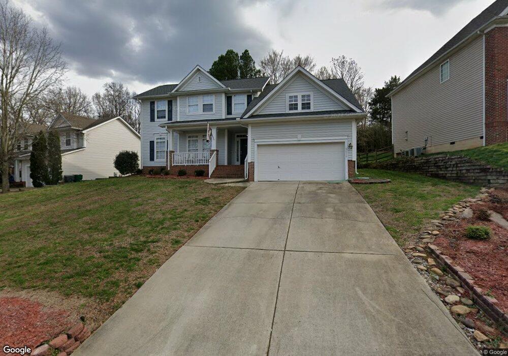
5619 Branthurst Dr Charlotte, NC 28269
Davis Lake-Eastfield NeighborhoodEstimated Value: $445,383 - $485,000
4
Beds
4
Baths
2,653
Sq Ft
$175/Sq Ft
Est. Value
About This Home
This home is located at 5619 Branthurst Dr, Charlotte, NC 28269 and is currently estimated at $465,096, approximately $175 per square foot. 5619 Branthurst Dr is a home located in Mecklenburg County with nearby schools including Croft Community Elementary, John M. Alexander Middle School, and North Mecklenburg High.
Ownership History
Date
Name
Owned For
Owner Type
Purchase Details
Closed on
Jan 14, 2019
Sold by
Thomas Paul T and Thomas Linda O
Bought by
Rosenthal Jeffrey A
Current Estimated Value
Home Financials for this Owner
Home Financials are based on the most recent Mortgage that was taken out on this home.
Original Mortgage
$293,092
Outstanding Balance
$258,723
Interest Rate
4.8%
Mortgage Type
FHA
Estimated Equity
$206,373
Purchase Details
Closed on
May 12, 2000
Sold by
Weekley Homes Lp
Bought by
Thomas Paul T and Thomas Linda O
Home Financials for this Owner
Home Financials are based on the most recent Mortgage that was taken out on this home.
Original Mortgage
$153,200
Interest Rate
8.28%
Mortgage Type
Purchase Money Mortgage
Create a Home Valuation Report for This Property
The Home Valuation Report is an in-depth analysis detailing your home's value as well as a comparison with similar homes in the area
Home Values in the Area
Average Home Value in this Area
Purchase History
| Date | Buyer | Sale Price | Title Company |
|---|---|---|---|
| Rosenthal Jeffrey A | $298,500 | None Available | |
| Thomas Paul T | $192,000 | -- |
Source: Public Records
Mortgage History
| Date | Status | Borrower | Loan Amount |
|---|---|---|---|
| Open | Rosenthal Jeffrey A | $293,092 | |
| Previous Owner | Thomas Paul T | $153,200 | |
| Closed | Thomas Paul T | $19,100 |
Source: Public Records
Tax History Compared to Growth
Tax History
| Year | Tax Paid | Tax Assessment Tax Assessment Total Assessment is a certain percentage of the fair market value that is determined by local assessors to be the total taxable value of land and additions on the property. | Land | Improvement |
|---|---|---|---|---|
| 2025 | $3,348 | $421,900 | $85,000 | $336,900 |
| 2024 | $3,348 | $421,900 | $85,000 | $336,900 |
| 2023 | $3,234 | $421,900 | $85,000 | $336,900 |
| 2022 | $2,815 | $278,700 | $50,000 | $228,700 |
| 2021 | $2,804 | $278,700 | $50,000 | $228,700 |
| 2020 | $2,797 | $276,500 | $50,000 | $226,500 |
| 2019 | $2,760 | $276,500 | $50,000 | $226,500 |
| 2018 | $2,498 | $184,800 | $35,000 | $149,800 |
| 2017 | $2,455 | $184,800 | $35,000 | $149,800 |
| 2016 | $2,446 | $184,800 | $35,000 | $149,800 |
| 2015 | $2,434 | $184,400 | $35,000 | $149,400 |
| 2014 | $2,430 | $184,400 | $35,000 | $149,400 |
Source: Public Records
Map
Nearby Homes
- 10119 Fieldstone Ct
- 4205 Canipe Dr
- 9626 Whitewood Trail
- 8030 Downy Oak Ln
- 8038 Downy Oak Ln
- 11012 Engelmann Ln
- 11026 Engelmann Ln
- 11109 Pond Valley Ct
- 11030 Engelmann Ln
- 7414 Meridale Forest Dr
- 10916 Tower Oak Dr
- 11038 Engelmann Ln
- 9419 Silverdale Ln
- 9122 Pagoda Oak Dr
- 9122 Pagoda Oak Dr
- 9110 Pagoda Oak Dr
- 9110 Pagoda Oak Dr
- 6144 Vasey St
- 6140 Vasey St
- 6136 Vasey St
- 5619 Branthurst Dr Unit 15
- 5611 Branthurst Dr
- 5627 Branthurst Dr
- 5635 Branthurst Dr
- 5607 Branthurst Dr
- 5604 Edgewier Ct
- 5608 Edgewier Ct
- 5608 Edgeweir Ct
- 5604 Edgeweir Ct
- 5624 Branthurst Dr
- 5618 Branthurst Dr
- 5641 Branthurst Dr
- 5612 Branthurst Dr
- 5630 Branthurst Dr
- 5603 Branthurst Dr
- 5602 Branthurst Dr
- 5616 Edgewier Ct
- 5605 Edgewier Ct
- 5636 Branthurst Dr
- 5605 Edgeweir Ct
