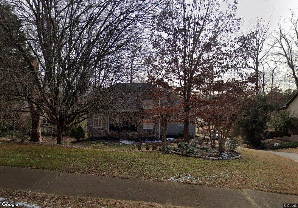
5619 Brookstone Dr NW Unit 1 Acworth, GA 30101
Estimated Value: $522,621 - $605,000
4
Beds
5
Baths
3,021
Sq Ft
$189/Sq Ft
Est. Value
About This Home
This home is located at 5619 Brookstone Dr NW Unit 1, Acworth, GA 30101 and is currently estimated at $571,155, approximately $189 per square foot. 5619 Brookstone Dr NW Unit 1 is a home located in Cobb County with nearby schools including Pickett's Mill Elementary School, Durham Middle School, and Allatoona High School.
Ownership History
Date
Name
Owned For
Owner Type
Purchase Details
Closed on
Jul 16, 1999
Sold by
Charter Bank & Trust Company
Bought by
Kartheiser Peter J and Kartheiser Beverly G
Current Estimated Value
Home Financials for this Owner
Home Financials are based on the most recent Mortgage that was taken out on this home.
Original Mortgage
$150,000
Interest Rate
7.51%
Mortgage Type
New Conventional
Purchase Details
Closed on
May 5, 1998
Sold by
Russell Robert W and Russell Lisa D
Bought by
Charter Bank & Trust Co
Purchase Details
Closed on
Apr 15, 1998
Sold by
Russell Lisa D
Bought by
Charter B & T
Create a Home Valuation Report for This Property
The Home Valuation Report is an in-depth analysis detailing your home's value as well as a comparison with similar homes in the area
Home Values in the Area
Average Home Value in this Area
Purchase History
| Date | Buyer | Sale Price | Title Company |
|---|---|---|---|
| Kartheiser Peter J | $188,000 | -- | |
| Charter Bank & Trust Co | $151,000 | -- | |
| Charter B & T | $78,140 | -- |
Source: Public Records
Mortgage History
| Date | Status | Borrower | Loan Amount |
|---|---|---|---|
| Closed | Kartheiser Peter J | $150,000 |
Source: Public Records
Tax History Compared to Growth
Tax History
| Year | Tax Paid | Tax Assessment Tax Assessment Total Assessment is a certain percentage of the fair market value that is determined by local assessors to be the total taxable value of land and additions on the property. | Land | Improvement |
|---|---|---|---|---|
| 2024 | $1,326 | $210,388 | $52,000 | $158,388 |
| 2023 | $994 | $168,396 | $34,000 | $134,396 |
| 2022 | $1,200 | $168,396 | $34,000 | $134,396 |
| 2021 | $1,106 | $136,724 | $34,000 | $102,724 |
| 2020 | $1,082 | $128,724 | $26,000 | $102,724 |
| 2019 | $1,082 | $128,724 | $26,000 | $102,724 |
| 2018 | $1,017 | $106,980 | $24,000 | $82,980 |
| 2017 | $887 | $106,980 | $24,000 | $82,980 |
| 2016 | $867 | $99,644 | $24,000 | $75,644 |
| 2015 | $909 | $93,692 | $24,000 | $69,692 |
| 2014 | $930 | $93,692 | $0 | $0 |
Source: Public Records
Map
Nearby Homes
- 1799 Mclain Rd NW
- 5654 Brookstone Dr NW
- The Ashburn Plan at Woodford
- The Rebecca Plan at Woodford
- The Dillard Plan at Woodford
- The Oxford Plan at Woodford
- The Pinehurst Plan at Woodford
- The Trenton Plan at Woodford
- The Vinings Plan at Woodford
- The Bainbridge Plan at Woodford
- The Brooks Plan at Woodford
- The Evans Plan at Woodford
- 5485 Brookstone Dr NW
- 1670 Knob Creek Ct NW
- 002 Knob Creek Ct NW
- 5711 Brynwood Cir NW
- 5894 Amber Glow Ln
- 001 Amber Glow Ln NW
- 2009 Mclain Rd NW
- 1496 Fallsbrook Ct NW
- 5617 Brookstone Dr NW
- 5621 Brookstone Dr NW Unit 1
- 1729 Brookstone Way NW
- 5794 Brookstone View NW
- 1724 Brookstone Way NW
- 5623 Brookstone Dr NW
- 1724 Brookstone Way NW
- 5620 Brookstone Dr NW
- 1735 Brookstone Way NW
- 5618 Brookstone Dr NW
- 5791 Brookstone View NW
- 0 Brookstone Way NW Unit 7598341
- 0 Brookstone Way NW Unit 7546541
- 0 Brookstone Way NW
- 5622 Brookstone Dr NW
- 5616 Brookstone Dr NW
- 0 Brookstone Way Unit 8783732
- 0 Brookstone Way Unit 8585287
- 0 Brookstone Way Unit 8428289
- 0 Brookstone Way