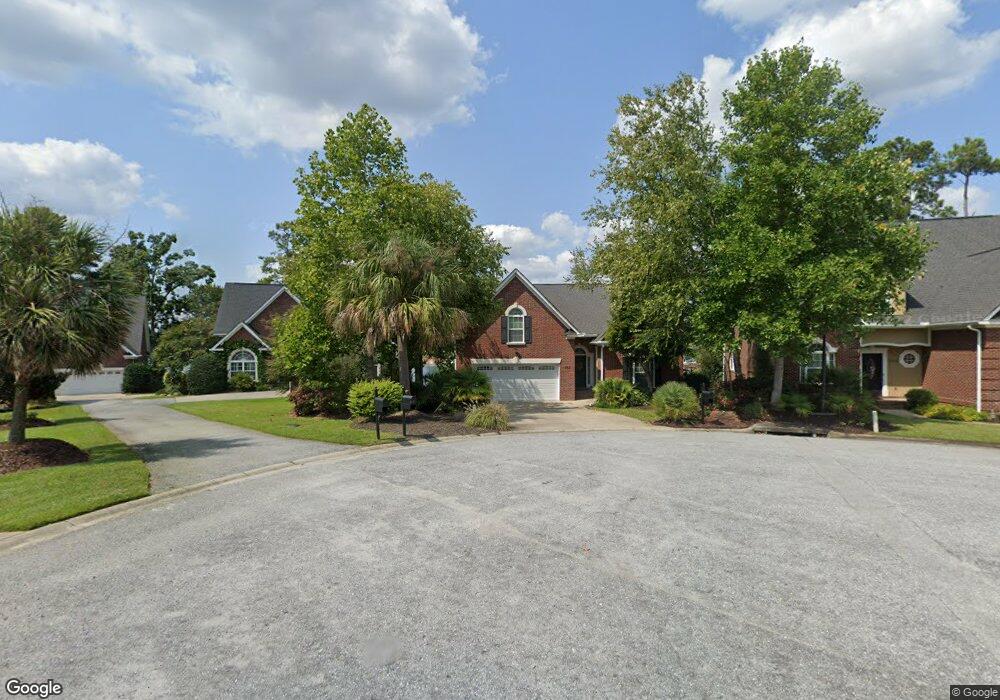
562 Lilypad Ct Chapin, SC 29036
Estimated Value: $312,000 - $717,000
3
Beds
2
Baths
2,079
Sq Ft
$260/Sq Ft
Est. Value
About This Home
This home is located at 562 Lilypad Ct, Chapin, SC 29036 and is currently estimated at $541,572, approximately $260 per square foot. 562 Lilypad Ct is a home with nearby schools including Chapin Elementary School, Chapin Intermediate, and Chapin High School.
Ownership History
Date
Name
Owned For
Owner Type
Purchase Details
Closed on
Feb 2, 2015
Sold by
Estate Of Thomas N Nichols and Nichols Carow E
Bought by
Nichols Carow E
Current Estimated Value
Purchase Details
Closed on
Oct 26, 2006
Sold by
P&K Construction Inc
Bought by
Nichols Thomas N and Nichols Caron E
Home Financials for this Owner
Home Financials are based on the most recent Mortgage that was taken out on this home.
Original Mortgage
$27,700
Interest Rate
6.12%
Mortgage Type
Adjustable Rate Mortgage/ARM
Create a Home Valuation Report for This Property
The Home Valuation Report is an in-depth analysis detailing your home's value as well as a comparison with similar homes in the area
Home Values in the Area
Average Home Value in this Area
Purchase History
| Date | Buyer | Sale Price | Title Company |
|---|---|---|---|
| Nichols Carow E | -- | -- | |
| Nichols Thomas N | $180,000 | None Available |
Source: Public Records
Mortgage History
| Date | Status | Borrower | Loan Amount |
|---|---|---|---|
| Previous Owner | Nichols Thomas N | $27,700 |
Source: Public Records
Tax History Compared to Growth
Tax History
| Year | Tax Paid | Tax Assessment Tax Assessment Total Assessment is a certain percentage of the fair market value that is determined by local assessors to be the total taxable value of land and additions on the property. | Land | Improvement |
|---|---|---|---|---|
| 2024 | $2,129 | $15,165 | $6,645 | $8,520 |
| 2023 | $1,930 | $15,165 | $6,645 | $8,520 |
| 2020 | $2,058 | $15,165 | $6,645 | $8,520 |
| 2019 | $1,770 | $13,187 | $5,824 | $7,363 |
| 2018 | $1,551 | $13,187 | $5,824 | $7,363 |
| 2017 | $1,507 | $13,187 | $5,824 | $7,363 |
| 2016 | $1,553 | $13,187 | $5,824 | $7,363 |
| 2014 | $1,821 | $15,070 | $7,280 | $7,790 |
| 2013 | -- | $15,070 | $7,280 | $7,790 |
Source: Public Records
Map
Nearby Homes
- 510 Lilypad Ct
- 117 Bay Front Dr
- 100 Palm St
- 409 Dutchman Shores Cir
- 161 Dutchman Shores Cir
- 368 Frick Ct
- 3006 Chilmark Rd
- 0 Dreher Island Rd Unit 21647709
- 0 Dreher Island Rd Unit 587193
- 814 Dutchmaster Dr
- 1431 Saugus Ct
- 668 Clipper Trail
- 660 Clipper Trail
- 147 Stuck's Point
- 842 Misty Harbor Rd
- 147 Ventnor Ave
- 108 Pennsylvania Ct
- 153 Rushton Dr
- 1533 Saugus Ct
- 540 Lakeshore Dr