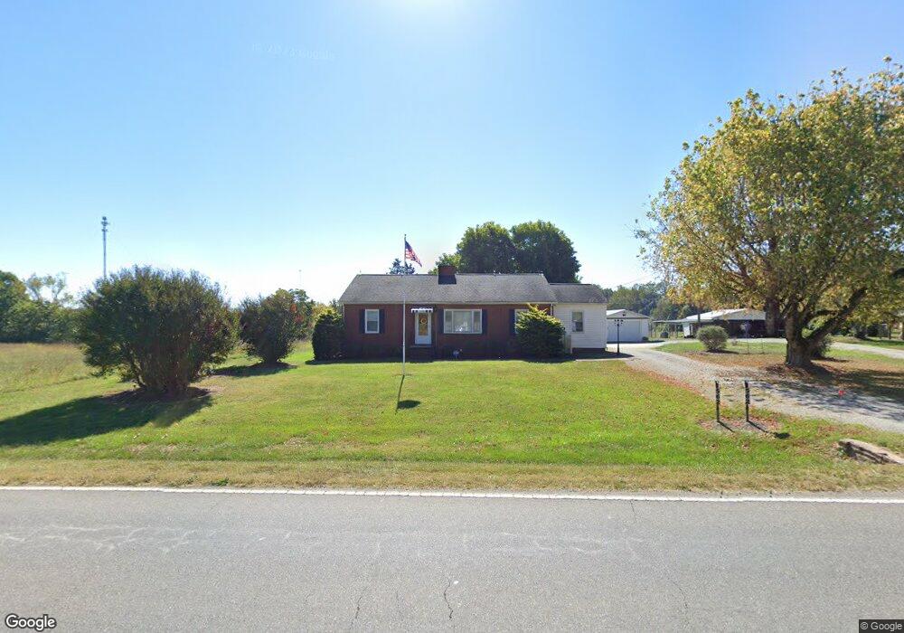
562 Murdock Rd Troutman, NC 28166
Estimated Value: $327,000 - $403,000
3
Beds
1
Bath
2,027
Sq Ft
$179/Sq Ft
Est. Value
About This Home
This home is located at 562 Murdock Rd, Troutman, NC 28166 and is currently estimated at $363,275, approximately $179 per square foot. 562 Murdock Rd is a home located in Iredell County with nearby schools including Troutman Elementary School, Troutman Middle School, and South Iredell High School.
Ownership History
Date
Name
Owned For
Owner Type
Purchase Details
Closed on
Sep 12, 2018
Sold by
Murdock Julia W
Bought by
Heath Phoebe Jo M
Current Estimated Value
Purchase Details
Closed on
May 30, 2018
Sold by
Murdock Kenard M and Murdock Julia W
Bought by
Murdock Kenard M and Murdock Julia W
Purchase Details
Closed on
Oct 5, 2017
Sold by
Murdock Kenard M and Murdock Julia W
Bought by
Murdock Kenard M and Murdock Julia W
Purchase Details
Closed on
Jun 1, 1957
Purchase Details
Closed on
Jun 1, 1901
Create a Home Valuation Report for This Property
The Home Valuation Report is an in-depth analysis detailing your home's value as well as a comparison with similar homes in the area
Home Values in the Area
Average Home Value in this Area
Purchase History
We collect this data history from publicly available records. To have your information removed, we recommend requesting removal directly through your county’s website.
| Date | Buyer | Sale Price | Title Company |
|---|---|---|---|
| Heath Phoebe Jo M | -- | None Available | |
| Murdock Julia W | -- | None Available | |
| Murdock Kenard M | -- | None Available | |
| Murdock Kenard M | -- | None Available | |
| -- | -- | -- | |
| -- | -- | -- |
Source: Public Records
Tax History
| Year | Tax Paid | Tax Assessment Tax Assessment Total Assessment is a certain percentage of the fair market value that is determined by local assessors to be the total taxable value of land and additions on the property. | Land | Improvement |
|---|---|---|---|---|
| 2025 | $1,471 | $235,130 | $103,370 | $131,760 |
| 2024 | $1,471 | $235,130 | $103,370 | $131,760 |
| 2023 | $1,471 | $235,130 | $103,370 | $131,760 |
| 2022 | $865 | $126,220 | $50,290 | $75,930 |
| 2021 | $848 | $126,220 | $50,290 | $75,930 |
| 2020 | $848 | $126,220 | $50,290 | $75,930 |
| 2019 | $816 | $126,220 | $50,290 | $75,930 |
| 2018 | $795 | $124,370 | $50,290 | $74,080 |
| 2017 | $795 | $124,370 | $50,290 | $74,080 |
| 2016 | $795 | $124,370 | $50,290 | $74,080 |
| 2015 | $795 | $124,370 | $50,290 | $74,080 |
| 2014 | $726 | $122,510 | $44,700 | $77,810 |
Source: Public Records
Map
Nearby Homes
- 0 Hoover Rd
- 134 Iredell Ave
- 154 Cotton Field Dr
- 144 Cotton Field Dr
- 109 W Heart Pine Ln
- 106 E Heart Pine Ln
- 108 Old Field Rd
- 116 Farrier Ln
- 131 History Ln
- 106 Planters Dr
- 00 Murdock Rd
- 000 Murdock Rd
- 116 Wedge View Way
- 435 Moose Club Rd
- 105 Brookshire Ln Unit E
- 173 Painted Bunting Dr
- 292 Moose Club Rd
- 445 Moose Club Rd
- 467 Hoover Rd
- 115 Harvest Pointe Dr
- 548 Murdock Rd
- 547 Murdock Rd
- 590 Murdock Rd
- 593 Murdock Rd
- 601 Murdock Rd
- 32+ Ac Hoover Rd
- 525 Murdock Rd
- 112 Hoover Rd
- 367 Duck Creek Rd
- 389 Duck Creek Rd
- 153 Hoover Rd
- 606 Murdock Rd
- 373 Duck Creek Rd
- 612 Murdock Rd
- 359 Duck Creek Rd Unit 361
- 351 Duck Creek Rd
- 162 Hoover Rd
- 343 Duck Creek Rd
- 497 Murdock Rd Unit 499
- 175 Hoover Rd
Your Personal Tour Guide
Ask me questions while you tour the home.