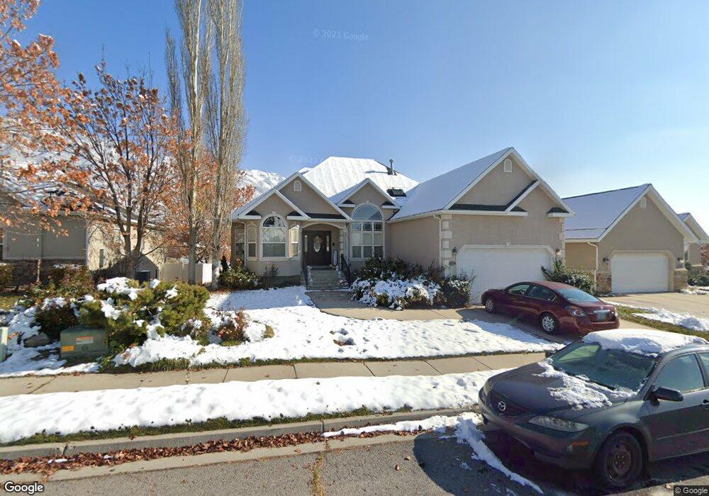
562 N 1280 E American Fork, UT 84003
Estimated Value: $658,000 - $704,936
4
Beds
2
Baths
1,643
Sq Ft
$411/Sq Ft
Est. Value
About This Home
This home is located at 562 N 1280 E, American Fork, UT 84003 and is currently estimated at $675,645, approximately $411 per square foot. 562 N 1280 E is a home located in Utah County with nearby schools including Barratt Elementary School, American Fork Junior High School, and American Fork High School.
Ownership History
Date
Name
Owned For
Owner Type
Purchase Details
Closed on
Jul 14, 2022
Sold by
Julie Smith Siebach Living Trust
Bought by
Dayton Michael and Wakefield Taryn
Current Estimated Value
Home Financials for this Owner
Home Financials are based on the most recent Mortgage that was taken out on this home.
Original Mortgage
$560,000
Outstanding Balance
$535,821
Interest Rate
5.78%
Mortgage Type
New Conventional
Estimated Equity
$139,824
Purchase Details
Closed on
Apr 14, 2020
Sold by
Siebach Julie
Bought by
Siebach Julie and The Julie Smith Siebach Living
Purchase Details
Closed on
Apr 17, 2017
Sold by
Foutz Donald P and Foutz Connie J
Bought by
Siebach Julie
Home Financials for this Owner
Home Financials are based on the most recent Mortgage that was taken out on this home.
Original Mortgage
$170,000
Interest Rate
4.1%
Mortgage Type
New Conventional
Purchase Details
Closed on
Oct 21, 2014
Sold by
Wood J Lyn and Wood Janece
Bought by
Foutz Donald P and Foutz Connie J
Purchase Details
Closed on
Jul 30, 2009
Sold by
Pratt John P and Pratt Ruth M
Bought by
Wood J Lyn and Wood Janece
Home Financials for this Owner
Home Financials are based on the most recent Mortgage that was taken out on this home.
Original Mortgage
$140,000
Interest Rate
5.37%
Mortgage Type
Purchase Money Mortgage
Purchase Details
Closed on
Nov 29, 2004
Sold by
Windsor Property Investments Lc
Bought by
Pratt John P and Pratt Ruth M
Home Financials for this Owner
Home Financials are based on the most recent Mortgage that was taken out on this home.
Original Mortgage
$195,000
Interest Rate
5.65%
Mortgage Type
Balloon
Purchase Details
Closed on
Apr 23, 2003
Sold by
Windsor Property Investments Lc
Bought by
Mcomber Rachel
Purchase Details
Closed on
Apr 11, 2003
Sold by
Mcomber Rachel
Bought by
Windsor Property Investments Lc
Purchase Details
Closed on
May 9, 2002
Sold by
Mcomber David and Mcomber Rachel
Bought by
Windsor Property Investments Lc
Home Financials for this Owner
Home Financials are based on the most recent Mortgage that was taken out on this home.
Original Mortgage
$126,900
Interest Rate
7.18%
Mortgage Type
Seller Take Back
Purchase Details
Closed on
Jun 22, 2001
Sold by
D R Horton Inc
Bought by
Mcomber David and Mcomber Rachel
Home Financials for this Owner
Home Financials are based on the most recent Mortgage that was taken out on this home.
Original Mortgage
$126,900
Interest Rate
7.15%
Create a Home Valuation Report for This Property
The Home Valuation Report is an in-depth analysis detailing your home's value as well as a comparison with similar homes in the area
Home Values in the Area
Average Home Value in this Area
Purchase History
| Date | Buyer | Sale Price | Title Company |
|---|---|---|---|
| Dayton Michael | -- | Masters Title | |
| Siebach Julie | -- | None Available | |
| Siebach Julie | -- | Vanguard Title Ins Agency | |
| Foutz Donald P | -- | Backman Title Services Ltd | |
| Wood J Lyn | -- | Empire Land Title Inc | |
| Pratt John P | -- | Old Republic Title Company | |
| Mcomber Rachel | -- | First American Title Co | |
| Windsor Property Investments Lc | -- | First American Title Ins Co | |
| Windsor Property Investments Lc | -- | First American Title Co | |
| Mcomber David | -- | First American Title Insuran |
Source: Public Records
Mortgage History
| Date | Status | Borrower | Loan Amount |
|---|---|---|---|
| Open | Dayton Michael | $560,000 | |
| Previous Owner | Siebach Julie | $170,000 | |
| Previous Owner | Wood J Lyn | $140,000 | |
| Previous Owner | Pratt John P | $195,000 | |
| Previous Owner | Windsor Property Investments Lc | $126,900 | |
| Previous Owner | Mcomber David | $126,900 |
Source: Public Records
Tax History
| Year | Tax Paid | Tax Assessment Tax Assessment Total Assessment is a certain percentage of the fair market value that is determined by local assessors to be the total taxable value of land and additions on the property. | Land | Improvement |
|---|---|---|---|---|
| 2025 | $3,117 | $360,195 | -- | -- |
| 2024 | $3,117 | $346,280 | $0 | $0 |
| 2023 | $2,925 | $344,520 | $0 | $0 |
| 2022 | $2,752 | $319,935 | $0 | $0 |
| 2021 | $2,419 | $439,300 | $173,400 | $265,900 |
| 2020 | $2,350 | $413,800 | $160,600 | $253,200 |
| 2019 | $2,234 | $406,900 | $153,700 | $253,200 |
| 2018 | $2,100 | $365,800 | $140,100 | $225,700 |
| 2017 | $1,992 | $187,220 | $0 | $0 |
| 2016 | $1,992 | $173,965 | $0 | $0 |
| 2015 | $1,961 | $162,525 | $0 | $0 |
| 2014 | $1,715 | $140,195 | $0 | $0 |
Source: Public Records
Map
Nearby Homes
- 1121 E 580 N
- 462 N 950 E Unit 5
- 912 E Ellens St Unit 1
- 1289 W 1670 N
- 322 N 900 E
- 1897 N 900 W
- 980 W 1800 N
- 837 E 475 N
- 1427 Narra Place
- 1045 N 930 E Unit 58
- 1609 N 900 W
- 1125 N 1270 E
- 1058 N 930 E Unit 64
- 681 W 2760 N
- 1077 N 950 E
- 1089 N 950 E
- 1365 N 990 W
- 674 W 1590 N Unit 11
- 1578 N 750 W Unit 15
- 1434 N 840 W
- 560 N 1280 E
- 548 N 1280 E
- 548 N 1280 E Unit 10
- 574 N 1280 E
- 565 N 1280 E
- 586 N 1280 E
- 1282 E 530 N
- 2329 N 1560 W
- 1277 E 530 N
- 2311 N 1560 W
- 1278 E 600 North Cir
- 1278 E 530 N Unit B
- 1278 E 530 N Unit 5
- 1278 E 600 Cir N
- 1276 E 600 North Cir
- 1276 Temple Meadow Cir
- 1276 E 600 Cir N
- 2347 N 1560 W
- 1274 E 600 North Cir
- 1276 E 530 N
Your Personal Tour Guide
Ask me questions while you tour the home.