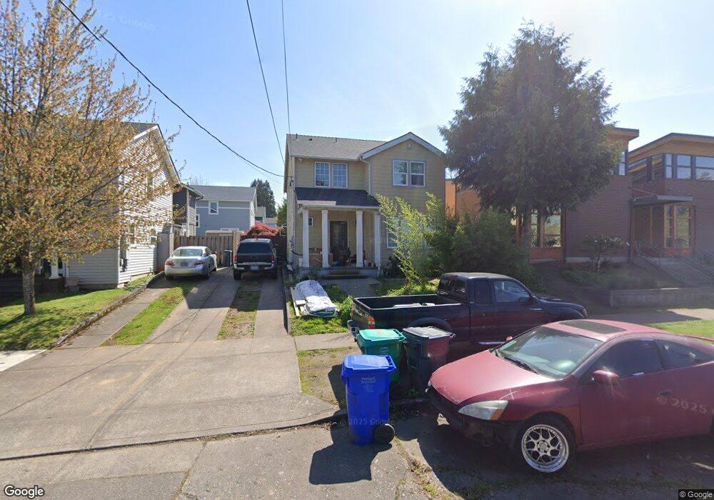
562 N Bryant St Portland, OR 97217
Piedmont NeighborhoodEstimated Value: $406,044 - $592,000
3
Beds
--
Bath
1,282
Sq Ft
$367/Sq Ft
Est. Value
About This Home
This home is located at 562 N Bryant St, Portland, OR 97217 and is currently estimated at $470,261, approximately $366 per square foot. 562 N Bryant St is a home located in Multnomah County with nearby schools including Woodlawn Elementary School, Ockley Green, and Jefferson High School.
Ownership History
Date
Name
Owned For
Owner Type
Purchase Details
Closed on
Nov 21, 2001
Sold by
Portland Habitat For Humanity
Bought by
Ortiz Kristee
Current Estimated Value
Home Financials for this Owner
Home Financials are based on the most recent Mortgage that was taken out on this home.
Original Mortgage
$74,700
Interest Rate
6.57%
Mortgage Type
Seller Take Back
Purchase Details
Closed on
Oct 15, 2001
Sold by
City Of Portland
Bought by
Portland Community Land Trust and Portland Habitat For Humanity
Home Financials for this Owner
Home Financials are based on the most recent Mortgage that was taken out on this home.
Original Mortgage
$74,700
Interest Rate
6.57%
Mortgage Type
Seller Take Back
Create a Home Valuation Report for This Property
The Home Valuation Report is an in-depth analysis detailing your home's value as well as a comparison with similar homes in the area
Home Values in the Area
Average Home Value in this Area
Purchase History
| Date | Buyer | Sale Price | Title Company |
|---|---|---|---|
| Ortiz Kristee | $95,000 | -- | |
| Portland Community Land Trust | -- | First American Title Co |
Source: Public Records
Mortgage History
| Date | Status | Borrower | Loan Amount |
|---|---|---|---|
| Closed | Ortiz Kristee | $74,700 |
Source: Public Records
Tax History Compared to Growth
Tax History
| Year | Tax Paid | Tax Assessment Tax Assessment Total Assessment is a certain percentage of the fair market value that is determined by local assessors to be the total taxable value of land and additions on the property. | Land | Improvement |
|---|---|---|---|---|
| 2025 | -- | -- | -- | -- |
| 2024 | -- | -- | -- | -- |
| 2023 | $0 | $0 | $0 | $0 |
| 2022 | $0 | $0 | $0 | $0 |
| 2021 | $256 | $11,560 | $0 | $0 |
| 2020 | $224 | $11,230 | $0 | $0 |
| 2019 | $277 | $10,910 | $0 | $0 |
| 2018 | $269 | $10,600 | $0 | $0 |
| 2017 | $258 | $10,300 | $0 | $0 |
| 2016 | $236 | $10,000 | $0 | $0 |
| 2015 | $230 | $9,710 | $0 | $0 |
| 2014 | $226 | $9,430 | $0 | $0 |
Source: Public Records
Map
Nearby Homes
- 7024 N Congress Ave
- 6809 N Borthwick Ave
- 6814 N Albina Ave
- 7118 N Vancouver Ave
- 515 N Rosa Parks Way
- 709 N Rosa Parks Way
- 6526 N Michigan Ave
- 23 NE Morgan St
- 7525 N Albina Ave
- 75 NE Dekum St
- 7070 N Montana Ave
- 7634 N Albina Ave
- 6949 N Montana Ave
- 1311 N Bryant St
- 6845 N Montana Ave
- 854 N Baldwin St
- 44 NE Lombard St
- 0 N Montana Ave
- 1428 N Bryant St Unit 2
- 244 NE Buffalo St
- 562 N Bryant St
- 554 N Bryant St
- 554 N Bryant St
- 6935 N Congress Ave
- 6935 N Congress Ave
- 6929 N Congress Ave
- 6929 N Congress Ave
- 6921 N Congress Ave
- 6915 N Congress Ave
- 6915 N Congress Ave
- 7006 N Kerby Ave
- 532 N Bryant St
- 6920 N Congress Ave
- 6911 N Congress Ave
- 7015 N Congress Ave
- 535 N Bryant St
- 6916 N Congress Ave
- 7016 N Kerby Ave
- 7014 N Congress Ave
- 6907 N Congress Ave