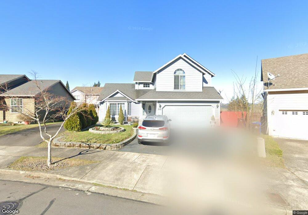
562 NE Anderson Rd Gresham, OR 97030
Powell Valley NeighborhoodEstimated Value: $424,000 - $482,000
About This Home
This home is located at 562 NE Anderson Rd, Gresham, OR 97030 and is currently estimated at $458,366, approximately $282 per square foot. 562 NE Anderson Rd is a home located in Multnomah County with nearby schools including Powell Valley Elementary School, Gordon Russell Middle School, and Sam Barlow High School.
Ownership History
We collect this data history from publicly available records. To have your information removed, we recommend requesting removal directly through your county’s website.
Purchase Details
Home Financials for this Owner
Home Financials are based on the most recent Mortgage that was taken out on this home.Purchase Details
Home Financials for this Owner
Home Financials are based on the most recent Mortgage that was taken out on this home.Purchase Details
Home Financials for this Owner
Home Financials are based on the most recent Mortgage that was taken out on this home.Home Values in the Area
Average Home Value in this Area
Purchase History
We collect this data history from publicly available records. To have your information removed, we recommend requesting removal directly through your county’s website.
| Date | Buyer | Sale Price | Title Company |
|---|---|---|---|
| $247,000 | Lawyers Title Ins | ||
| -- | Ticor Title Insurance Compan | ||
| $174,550 | Fidelity Natl Title Co Of Or |
Mortgage History
We collect this data history from publicly available records. To have your information removed, we recommend requesting removal directly through your county’s website.
| Date | Status | Borrower | Loan Amount |
|---|---|---|---|
| Open | $197,600 | ||
| Previous Owner | $180,000 | ||
| Previous Owner | $174,550 |
Tax History
We collect this data history from publicly available records. To have your information removed, we recommend requesting removal directly through your county’s website.
| Year | Tax Paid | Tax Assessment Tax Assessment Total Assessment is a certain percentage of the fair market value that is determined by local assessors to be the total taxable value of land and additions on the property. | Land | Improvement |
|---|---|---|---|---|
| 2025 | $4,571 | $224,630 | -- | -- |
| 2024 | $4,376 | $218,090 | -- | -- |
| 2023 | $3,987 | $211,740 | $0 | $0 |
| 2022 | $3,875 | $205,580 | $0 | $0 |
| 2021 | $3,778 | $199,600 | $0 | $0 |
| 2020 | $3,554 | $193,790 | $0 | $0 |
| 2019 | $3,461 | $188,150 | $0 | $0 |
| 2018 | $3,300 | $182,670 | $0 | $0 |
| 2017 | $3,166 | $177,350 | $0 | $0 |
| 2016 | $2,792 | $172,190 | $0 | $0 |
| 2015 | $2,732 | $167,180 | $0 | $0 |
| 2014 | $2,665 | $162,320 | $0 | $0 |
Map
- 382 NE Lovrien Ave
- 4057 NE 5th Dr
- 310 NE Greenway Dr
- 4117 NE 8th St Unit 9
- 2505 SE Troutdale Rd
- 4063 NE 11th Way
- 150 NE Greenway Dr
- 227 NE Paloma Ct
- 486 NE Scott Ave
- 497 NE Scott Ave
- 275 NE Scott Dr
- 182 SE Anderson Ln
- 4029 NE 16th Ct
- 193 SE Paloma Ave
- 3595 SE 1st St
- 4545 SE 3rd St Unit 9
- 289 SE Acacia Dr
- 4952 SE Pioneer Ln
- 286 SE Condor Dr
- 1661 NE Barnes Ln
- 556 NE Anderson Rd
- 568 NE Anderson Rd
- 576 NE Anderson Rd
- 544 NE Anderson Rd
- 588 NE Anderson Rd
- 650 NE Anderson Rd
- 672 NE Anderson Rd
- 571 NE Anderson Rd
- 571 NE Anderson Rd
- 4423 NE Division St Unit 1
- 4423 NE Division St
- 593 NE Anderson Rd
- 4501 NE Division St
- 679 NE Anderson Rd
- 639 NE Anderson Rd
- 627 NE Anderson Rd
- 673 NE Anderson Rd
- 603 NE Anderson Rd
- 611 NE Anderson Rd
- 677 NE Anderson Rd
Ask me questions while you tour the home.