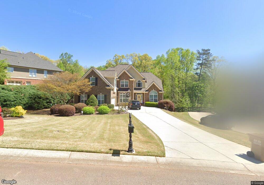
5620 Battle Ridge Dr Flowery Branch, GA 30542
Estimated Value: $570,904 - $752,000
4
Beds
4
Baths
3,486
Sq Ft
$185/Sq Ft
Est. Value
About This Home
This home is located at 5620 Battle Ridge Dr, Flowery Branch, GA 30542 and is currently estimated at $645,226, approximately $185 per square foot. 5620 Battle Ridge Dr is a home located in Hall County with nearby schools including Chestnut Mountain Elementary School, Cherokee Bluff Middle School, and Cherokee Bluff High School.
Ownership History
Date
Name
Owned For
Owner Type
Purchase Details
Closed on
Aug 24, 2006
Sold by
Williamson John Anthony and Williamson Stephanie
Bought by
Orr Kenneth L and Orr Linda J
Current Estimated Value
Home Financials for this Owner
Home Financials are based on the most recent Mortgage that was taken out on this home.
Original Mortgage
$378,955
Outstanding Balance
$227,148
Interest Rate
6.73%
Mortgage Type
New Conventional
Estimated Equity
$418,078
Purchase Details
Closed on
Dec 2, 2002
Sold by
Lynn Steve E
Bought by
Malone Homes Inc
Create a Home Valuation Report for This Property
The Home Valuation Report is an in-depth analysis detailing your home's value as well as a comparison with similar homes in the area
Home Values in the Area
Average Home Value in this Area
Purchase History
| Date | Buyer | Sale Price | Title Company |
|---|---|---|---|
| Orr Kenneth L | $398,900 | -- | |
| Malone Homes Inc | $385,000 | -- |
Source: Public Records
Mortgage History
| Date | Status | Borrower | Loan Amount |
|---|---|---|---|
| Open | Orr Kenneth L | $378,955 |
Source: Public Records
Tax History Compared to Growth
Tax History
| Year | Tax Paid | Tax Assessment Tax Assessment Total Assessment is a certain percentage of the fair market value that is determined by local assessors to be the total taxable value of land and additions on the property. | Land | Improvement |
|---|---|---|---|---|
| 2024 | $5,579 | $220,600 | $37,200 | $183,400 |
| 2023 | $5,053 | $217,000 | $37,200 | $179,800 |
| 2022 | $3,995 | $151,960 | $12,320 | $139,640 |
| 2021 | $3,940 | $147,120 | $12,320 | $134,800 |
| 2020 | $3,875 | $139,360 | $12,320 | $127,040 |
| 2019 | $3,792 | $135,120 | $12,320 | $122,800 |
| 2018 | $3,775 | $130,200 | $12,320 | $117,880 |
| 2017 | $3,397 | $118,120 | $12,320 | $105,800 |
| 2016 | $3,317 | $118,120 | $12,320 | $105,800 |
| 2015 | $2,908 | $102,439 | $10,480 | $91,959 |
| 2014 | $2,908 | $102,439 | $10,480 | $91,959 |
Source: Public Records
Map
Nearby Homes
- 5437 Evergreen Forest Ct Unit 11
- 5717 Winding Rose Trail
- 5763 Union Church Rd
- 5503 Amber Cove Way
- 5874 Heritage Ridge
- 5309 Rushing Creek Way
- 7301 Mulberry Trace Ln Unit LOT 175
- 7297 Mulberry Trace Ln
- 7313 Mulberry Trace Ln Unit LOT 172
- 7317 Mulberry Trace Ln
- 7301 Mulberry Trace Ln
- 7313 Mulberry Trace Ln
- 7285 Mulberry Trace Ln
- 7265 Mulberry Trace Ln Unit LOT 213
- 7265 Mulberry Trace Ln
- 7325 Mulberry Trace Ln
- 7277 Mulberry Trace Ln Unit LOT 210
- 7273 Mulberry Trace Ln
- 7317 Mulberry Trace Ln Unit LOT 171
- 7297 Mulberry Trace Ln Unit LOT 176
- 5616 Battle Ridge Dr
- 5632 Aves Bluff
- 5619 Battle Ridge Dr
- 5612 Battle Ridge Dr
- 5636 Aves Bluff
- 5509 Elders Ridge Dr
- 5513 Elders Ridge Dr
- 5631 Aves Bluff
- 0 Battle Ridge Dr Unit 8354692
- 0 Battle Ridge Dr Unit 8762127
- 0 Battle Ridge Dr
- 5505 Elders Ridge Dr
- 5611 Battle Ridge Dr
- 5635 Aves Bluff
- 5608 Battle Ridge Dr
- 5517 Elders Ridge Dr
- 5639 Aves Bluff
- 5643 Battle Ridge Dr
- 0 Elders Ridge Dr Unit 7145553
- 0 Elders Ridge Dr Unit 8646555