Estimated Value: $318,000 - $442,000
2
Beds
2
Baths
1,714
Sq Ft
$209/Sq Ft
Est. Value
About This Home
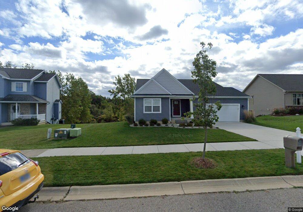
This home is located at 5621 Ladderback, Holt, MI 48842 and is currently estimated at $357,636, approximately $208 per square foot. 5621 Ladderback is a home with nearby schools including Horizon Elementary School, Washington Woods Middle School, and Holt Junior High School.
Ownership History
Date
Name
Owned For
Owner Type
Purchase Details
Closed on
Oct 12, 2023
Sold by
Hoffman Maureen Ann
Bought by
Theuerkorn William B
Current Estimated Value
Purchase Details
Closed on
Sep 20, 2021
Sold by
El Holding Co Llc
Bought by
Theuerkorn William B and Hoffman Maureen Ann
Home Financials for this Owner
Home Financials are based on the most recent Mortgage that was taken out on this home.
Original Mortgage
$262,325
Interest Rate
2.7%
Mortgage Type
New Conventional
Purchase Details
Closed on
Apr 5, 2021
Sold by
Delhi Inc
Bought by
E L Holdings Co Llc
Create a Home Valuation Report for This Property
The Home Valuation Report is an in-depth analysis detailing your home's value as well as a comparison with similar homes in the area
Home Values in the Area
Average Home Value in this Area
Purchase History
| Date | Buyer | Sale Price | Title Company |
|---|---|---|---|
| Theuerkorn William B | $20,000 | None Listed On Document | |
| Theuerkorn William B | $41,750 | Bell Ttl Agcy Of East Lansin | |
| E L Holdings Co Llc | $75,000 | Bell Ttl Agcy Of East Lansin |
Source: Public Records
Mortgage History
| Date | Status | Borrower | Loan Amount |
|---|---|---|---|
| Previous Owner | Theuerkorn William B | $262,325 |
Source: Public Records
Tax History
| Year | Tax Paid | Tax Assessment Tax Assessment Total Assessment is a certain percentage of the fair market value that is determined by local assessors to be the total taxable value of land and additions on the property. | Land | Improvement |
|---|---|---|---|---|
| 2025 | $7,559 | $167,800 | $31,600 | $136,200 |
| 2024 | $18 | $161,400 | $28,600 | $132,800 |
| 2023 | $7,057 | $145,100 | $24,000 | $121,100 |
| 2022 | $6,673 | $129,900 | $25,900 | $104,000 |
| 2021 | $133 | $21,200 | $21,200 | $0 |
| 2020 | $115 | $17,500 | $17,500 | $0 |
| 2019 | $207 | $14,500 | $14,500 | $0 |
| 2018 | $207 | $14,500 | $14,500 | $0 |
| 2017 | $139 | $14,500 | $14,500 | $0 |
| 2016 | $139 | $18,800 | $18,800 | $0 |
| 2015 | $99 | $18,800 | $0 | $0 |
| 2014 | $99 | $18,000 | $0 | $0 |
Source: Public Records
Map
Nearby Homes
- 1851 Hollowbrook Dr
- 5653 Skylar Dr
- 5386 Auben Ln
- 5360 Holt Rd
- 2145 Aspenwood Dr
- 1463 N Onondaga Rd
- 5170 Beaumaris Cir
- V L 00 Holt Rd
- 5091 Runnymede Dr
- 5071 Haddon Hall Dr
- 2340 Washington Rd
- 1532 N Eifert Rd
- 6935 Vernson Dr
- 2520 Lanier Ct
- 2658 Sanibel Hollow
- 1951 Cromwell St
- 6411 Pleasant River Dr
- 6454 Pleasant River Dr
- 2245 Main St
- 921 E Willoughby Rd
Your Personal Tour Guide
Ask me questions while you tour the home.