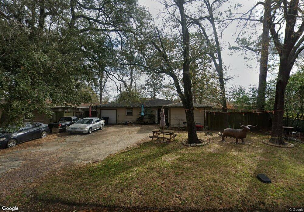
5621 Milart St Houston, TX 77021
OST-South Union NeighborhoodEstimated Value: $156,671 - $256,000
3
Beds
1
Bath
976
Sq Ft
$215/Sq Ft
Est. Value
About This Home
This home is located at 5621 Milart St, Houston, TX 77021 and is currently estimated at $209,418, approximately $214 per square foot. 5621 Milart St is a home located in Harris County with nearby schools including Peck Elementary School, Cullen Middle School, and Yates High School.
Ownership History
Date
Name
Owned For
Owner Type
Purchase Details
Closed on
May 9, 2017
Sold by
Grigsby Tiffany V
Bought by
Khan Shahzad H
Current Estimated Value
Purchase Details
Closed on
Dec 15, 2005
Sold by
Spencer Donald
Bought by
Grigsby Tiffany
Purchase Details
Closed on
Jun 10, 2005
Sold by
Grigsby Bessie Anne Walker
Bought by
Spencer Donald
Create a Home Valuation Report for This Property
The Home Valuation Report is an in-depth analysis detailing your home's value as well as a comparison with similar homes in the area
Home Values in the Area
Average Home Value in this Area
Purchase History
| Date | Buyer | Sale Price | Title Company |
|---|---|---|---|
| Khan Shahzad H | -- | Capital Title | |
| Grigsby Tiffany | -- | None Available | |
| Spencer Donald | -- | -- |
Source: Public Records
Tax History Compared to Growth
Tax History
| Year | Tax Paid | Tax Assessment Tax Assessment Total Assessment is a certain percentage of the fair market value that is determined by local assessors to be the total taxable value of land and additions on the property. | Land | Improvement |
|---|---|---|---|---|
| 2025 | $3,989 | $190,647 | $142,650 | $47,997 |
| 2024 | $3,989 | $190,647 | $142,650 | $47,997 |
| 2023 | $3,989 | $192,133 | $142,650 | $49,483 |
| 2022 | $4,333 | $187,034 | $126,800 | $60,234 |
| 2021 | $3,529 | $151,412 | $110,950 | $40,462 |
| 2020 | $2,992 | $117,969 | $79,250 | $38,719 |
| 2019 | $2,860 | $108,109 | $71,325 | $36,784 |
| 2018 | $2,611 | $103,184 | $61,419 | $41,765 |
| 2017 | $2,361 | $89,315 | $47,550 | $41,765 |
| 2016 | $1,965 | $74,335 | $31,700 | $42,635 |
| 2015 | $1,531 | $63,678 | $31,700 | $31,978 |
| 2014 | $1,531 | $59,549 | $31,700 | $27,849 |
Source: Public Records
Map
Nearby Homes
- 5610 Milart St
- 5706 Milart St
- 5314 Dezirae Ln
- 5002 Elizabeth City St
- 5102 Cortelyou Ln
- 5004 Elizabeth City St
- 4930 Culmore Dr
- 5009 Elizabeth City St
- 5151 Martin Luther King Blvd
- 4914 Gammage St
- 5003 Yesenia Palm St
- 4918 Culmore Dr
- 4826 Ventura Ln
- 5142 Oasis Park
- 4850 Marietta Ln
- 4902 Marietta Ln
- 4838 Marietta Ln
- 5166 Oasis Park
- 4910 Eppes St
- 5201 Martin Luther King Blvd
- 5615 Milart St
- 5606 Tallow Ln
- 5625 Milart St
- 5602 Tallow Ln
- 5620 Milart St
- 5626 Milart St
- 5618 Milart St
- 5633 Milart St
- 5611 Milart St
- 5630 Milart St
- 5605 Tallow Ln
- 5514 Tallow Ln
- 5601 Tallow Ln
- 5611 Tallow Ln
- 5614 Milart St
- 5634 Milart St
- 5747 Belvedere St
- 5743 Belvedere St
- 5707 Milart St
- 5607 Milart St