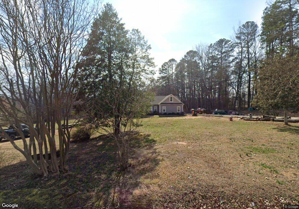
5621 Old Mocksville Rd Salisbury, NC 28144
Estimated Value: $300,000 - $465,404
--
Bed
2
Baths
1,991
Sq Ft
$198/Sq Ft
Est. Value
About This Home
This home is located at 5621 Old Mocksville Rd, Salisbury, NC 28144 and is currently estimated at $393,601, approximately $197 per square foot. 5621 Old Mocksville Rd is a home located in Rowan County with nearby schools including North Rowan Elementary School, North Rowan Middle School, and North Rowan High School.
Ownership History
Date
Name
Owned For
Owner Type
Purchase Details
Closed on
Dec 4, 2015
Sold by
Pemberton Webb Mary and Webb John R
Bought by
Pemberton Webb Mary and Webb John R
Current Estimated Value
Home Financials for this Owner
Home Financials are based on the most recent Mortgage that was taken out on this home.
Original Mortgage
$75,000
Interest Rate
3.83%
Mortgage Type
Commercial
Create a Home Valuation Report for This Property
The Home Valuation Report is an in-depth analysis detailing your home's value as well as a comparison with similar homes in the area
Home Values in the Area
Average Home Value in this Area
Purchase History
| Date | Buyer | Sale Price | Title Company |
|---|---|---|---|
| Pemberton Webb Mary | -- | None Available |
Source: Public Records
Mortgage History
| Date | Status | Borrower | Loan Amount |
|---|---|---|---|
| Closed | Pemberton Webb Mary | $75,000 |
Source: Public Records
Tax History Compared to Growth
Tax History
| Year | Tax Paid | Tax Assessment Tax Assessment Total Assessment is a certain percentage of the fair market value that is determined by local assessors to be the total taxable value of land and additions on the property. | Land | Improvement |
|---|---|---|---|---|
| 2025 | $2,606 | $391,853 | $63,478 | $328,375 |
| 2024 | $2,606 | $391,853 | $63,478 | $328,375 |
| 2023 | $2,606 | $391,853 | $63,478 | $328,375 |
| 2022 | $1,984 | $267,191 | $52,560 | $214,631 |
| 2021 | $1,984 | $267,191 | $52,560 | $214,631 |
| 2020 | $1,984 | $267,191 | $52,560 | $214,631 |
| 2019 | $1,984 | $267,191 | $52,560 | $214,631 |
| 2018 | $1,778 | $241,517 | $52,559 | $188,958 |
| 2017 | $716 | $97,223 | $52,559 | $44,664 |
| 2016 | $716 | $97,223 | $52,559 | $44,664 |
| 2015 | $727 | $97,223 | $52,559 | $44,664 |
| 2014 | $712 | $99,532 | $52,559 | $46,973 |
Source: Public Records
Map
Nearby Homes
- 0 Long Bow Rd Unit 1200498
- 1207 + River Trace Ln Unit 9,15-19,21&21
- 510 Newport Dr
- 5020 Old Mocksville Rd
- 175 Country Ln
- 1206 Archer Farm Dr
- 4100 Hampton Rd
- 3870 Old Mocksville Rd
- 335 Young Rd
- 6404 Fox Trace
- 204 S Deerfield Cir
- 450 E Ridge Rd
- 302 Forest Winds Dr
- 0 Elizabeth Ave Unit 48-49 CAR4299122
- 4355 Franklin Community Center Rd
- 250 Lariat Cir
- 2605 Boones Cave Rd
- 270 North St
- 3435 E Ridge Rd
- 240 Eldon Ln
- 5620 Old Mocksville Rd
- 5560 Old Mocksville Rd
- 5560 Old Mocksville Rd Unit NULL
- 5590 Old Mocksville Rd
- 5661 Old Mocksville Rd
- 0 Pickler Rd
- 265 Baymount Dr
- 5520 Old Mocksville Rd
- 5681 Old Mocksville Rd
- 0 Long Bow Rd
- 0 Long Bow Rd Unit CAR4153929
- 0 Long Bow Rd Unit 975120
- 0 Long Bow Rd Unit 187-194 3565500
- 0 Long Bow Rd Unit 182-186 3565533
- 170 Long Bow Rd
- 275 Baymount Dr
- 145 Baymount Dr
- 5450 Old Mocksville Rd
- 5760 Old Mocksville Rd
- 240 Long Bow Rd