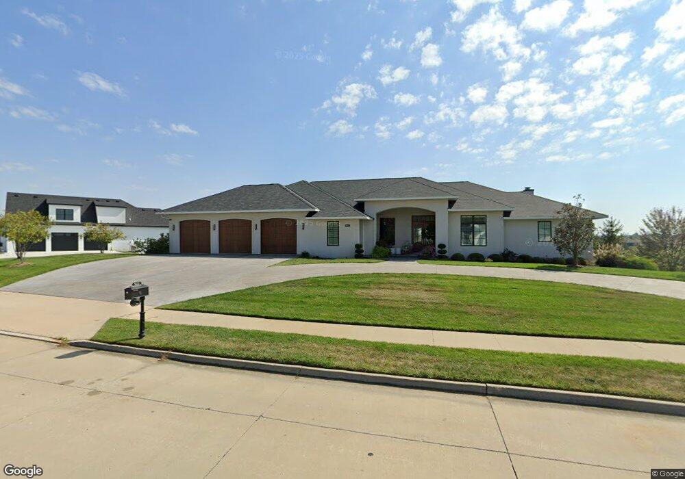
5622 Lightpost Dr Columbia, MO 65201
Old Hawthorne NeighborhoodEstimated Value: $1,531,000 - $2,070,364
5
Beds
6
Baths
5,833
Sq Ft
$309/Sq Ft
Est. Value
About This Home
This home is located at 5622 Lightpost Dr, Columbia, MO 65201 and is currently estimated at $1,800,682, approximately $308 per square foot. 5622 Lightpost Dr is a home with nearby schools including Cedar Ridge Elementary School, Oakland Middle School, and Muriel W. Battle High School.
Ownership History
Date
Name
Owned For
Owner Type
Purchase Details
Closed on
Jun 26, 2013
Sold by
Old Hawthorne Development Llc
Bought by
Woods William L and Woods Susan M
Current Estimated Value
Home Financials for this Owner
Home Financials are based on the most recent Mortgage that was taken out on this home.
Original Mortgage
$750,000
Interest Rate
3.54%
Mortgage Type
Construction
Create a Home Valuation Report for This Property
The Home Valuation Report is an in-depth analysis detailing your home's value as well as a comparison with similar homes in the area
Home Values in the Area
Average Home Value in this Area
Purchase History
| Date | Buyer | Sale Price | Title Company |
|---|---|---|---|
| Woods William L | -- | Boone Central Title Company |
Source: Public Records
Mortgage History
| Date | Status | Borrower | Loan Amount |
|---|---|---|---|
| Closed | Woods William L | $750,000 |
Source: Public Records
Tax History
| Year | Tax Paid | Tax Assessment Tax Assessment Total Assessment is a certain percentage of the fair market value that is determined by local assessors to be the total taxable value of land and additions on the property. | Land | Improvement |
|---|---|---|---|---|
| 2025 | $14,787 | $225,815 | $28,500 | $197,315 |
| 2024 | $13,305 | $197,220 | $28,500 | $168,720 |
| 2023 | $13,195 | $197,220 | $28,500 | $168,720 |
| 2022 | $13,181 | $197,220 | $28,500 | $168,720 |
| 2021 | $13,206 | $197,220 | $28,500 | $168,720 |
| 2020 | $14,054 | $197,220 | $28,500 | $168,720 |
| 2019 | $14,054 | $197,220 | $28,500 | $168,720 |
| 2018 | $14,153 | $0 | $0 | $0 |
| 2017 | $13,957 | $197,220 | $28,500 | $168,720 |
| 2016 | $13,957 | $197,220 | $28,500 | $168,720 |
| 2015 | $12,818 | $197,220 | $28,500 | $168,720 |
| 2014 | $3,879 | $59,489 | $28,500 | $30,989 |
Source: Public Records
Map
Nearby Homes
- LOT 215 Lightpost Dr
- 5624 Lightpost Dr
- 5602 Lightpost Ct
- LOT 216 Lightpost Ct
- 801 Sunstone Ln
- 1210 Marcassin Dr
- 5959 Screaming Eagle Ln
- 5947 Screaming Eagle Ln
- 1205 Shallow Ridge Cir
- 1303 Morning Dove Dr
- 1101 S Cedar Grove Blvd
- 1301 Morning Dove Dr
- 5402 Wild Horse Ct
- LOT 202 Portrush Dr
- LOT 212 Portrush Dr
- LOT 220 Portrush Dr
- LOT 170 Portrush Dr
- LOT 198 Portrush Dr
- LOT 115 Old Hawthorne Dr
- LOT 120 Old Hawthorne Dr
- LOT 213 Lightpost Dr
- LOT 106 Lightpost Dr
- 5704 Lightpost Dr
- LOT 207 Lightpost Dr
- 5623 Lightpost Dr
- 5618 Lightpost Dr
- 5702 Open Gate Dr
- 5617 Lightpost Dr
- 5704 Open Gate Dr
- LOT 214 Lightpost Dr
- 5603 Lightpost Ct
- 5700 Open Gate Dr
- 5706 Open Gate Dr
- 5701 Open Gate Dr
- 5614 Lightpost Dr
- 5720 Green Gate Ln
- 5710 Open Gate Dr
- 5601 Lightpost Ct
- 5806 Lightpost Dr
- 5612 Lightpost Dr
Your Personal Tour Guide
Ask me questions while you tour the home.