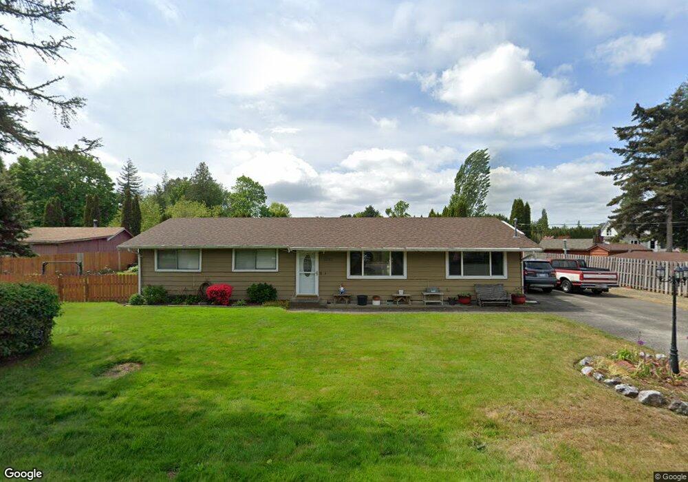
5623 Deer Creek Dr Ferndale, WA 98248
Estimated Value: $495,523 - $538,000
3
Beds
1
Bath
1,296
Sq Ft
$397/Sq Ft
Est. Value
About This Home
This home is located at 5623 Deer Creek Dr, Ferndale, WA 98248 and is currently estimated at $514,881, approximately $397 per square foot. 5623 Deer Creek Dr is a home located in Whatcom County with nearby schools including Cascadia Elementary School, Vista Middle School, and Ferndale High School.
Ownership History
Date
Name
Owned For
Owner Type
Purchase Details
Closed on
Jan 18, 2002
Sold by
Mcmurtry Robert L
Bought by
Burger Kenneth H and Burger Linda M
Current Estimated Value
Home Financials for this Owner
Home Financials are based on the most recent Mortgage that was taken out on this home.
Original Mortgage
$111,240
Interest Rate
7.11%
Mortgage Type
VA
Purchase Details
Closed on
Jan 23, 2001
Sold by
Mcmurtry Brenda Kay
Bought by
Mcmurtry Robert Leroy
Create a Home Valuation Report for This Property
The Home Valuation Report is an in-depth analysis detailing your home's value as well as a comparison with similar homes in the area
Home Values in the Area
Average Home Value in this Area
Purchase History
| Date | Buyer | Sale Price | Title Company |
|---|---|---|---|
| Burger Kenneth H | $92,831 | First American Title Insuran | |
| Mcmurtry Robert Leroy | -- | -- |
Source: Public Records
Mortgage History
| Date | Status | Borrower | Loan Amount |
|---|---|---|---|
| Previous Owner | Burger Kenneth H | $111,240 |
Source: Public Records
Tax History Compared to Growth
Tax History
| Year | Tax Paid | Tax Assessment Tax Assessment Total Assessment is a certain percentage of the fair market value that is determined by local assessors to be the total taxable value of land and additions on the property. | Land | Improvement |
|---|---|---|---|---|
| 2024 | $3,131 | $420,751 | $198,608 | $222,143 |
| 2023 | $3,131 | $438,599 | $225,000 | $213,599 |
| 2022 | $2,746 | $359,829 | $148,834 | $210,995 |
| 2021 | $2,772 | $297,379 | $123,003 | $174,376 |
| 2020 | $2,669 | $275,358 | $113,895 | $161,463 |
| 2019 | $2,131 | $239,829 | $99,199 | $140,630 |
| 2018 | $2,440 | $219,268 | $90,695 | $128,573 |
| 2017 | $2,033 | $192,155 | $79,480 | $112,675 |
| 2016 | $1,919 | $171,027 | $77,168 | $93,859 |
| 2015 | $1,931 | $161,144 | $73,059 | $88,085 |
| 2014 | -- | $0 | $0 | $0 |
| 2013 | -- | $0 | $0 | $0 |
Source: Public Records
Map
Nearby Homes
- 1371 W Axton Rd
- 1300 W Axton Rd
- 1245 W Axton Rd
- 1411 Woods Point Loop
- 1142 Deer Creek Ln
- 1655 Main St
- 5350 Kaitlyn Ct
- 5502 Northwest Dr
- 5400 Barrett Rd
- 5330 Bel Dr W
- 5306 Myers Dr
- 1333 W Smith Rd
- 0 W Axton Rd
- 5295 Graveline Rd
- 5391 La Bounty Dr
- 0 Riverside Dr Unit NWM2356867
- 5925 Longdin Rd
- 5162 Spoonbill Ln
- 5094 Labounty Rd
- 5786 Portal Way
- 5629 Deer Creek Dr
- 5615 Deer Creek Dr
- 5626 Deer Creek Dr
- 5620 Deer Creek Dr
- 5611 Deer Creek Dr
- 5614 Deer Creek Dr
- 5632 Deer Creek Dr
- 5608 Deer Creek Dr
- 5607 Deer Creek Dr
- 5618 Hazel Ct
- 5619 Hazel Ct
- 5639 Deer Creek Dr
- 5638 Deer Creek Dr
- 5603 Deer Creek Dr
- 1338 Deer Creek Dr
- 5644 Deer Creek Dr
- 1341 Deer Creek Dr
- 5620 Hazel Ct
- 1349 Deer Creek Dr