Estimated Value: $296,000 - $347,000
3
Beds
2
Baths
1,674
Sq Ft
$193/Sq Ft
Est. Value
About This Home
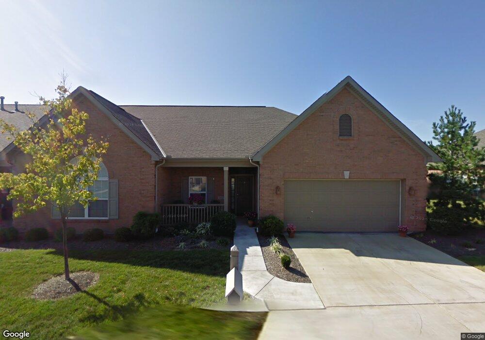
This home is located at 5625 Harbourside Dr, Mason, OH 45040 and is currently estimated at $323,400, approximately $193 per square foot. 5625 Harbourside Dr is a home located in Warren County with nearby schools including Mason Intermediate Elementary School, Mason Middle School, and William Mason High School.
Ownership History
Date
Name
Owned For
Owner Type
Purchase Details
Closed on
Mar 3, 2016
Sold by
Bills Kathryn L. Trustee
Bought by
Hawkins Janice Carol
Current Estimated Value
Home Financials for this Owner
Home Financials are based on the most recent Mortgage that was taken out on this home.
Interest Rate
3.64%
Purchase Details
Closed on
Nov 15, 2006
Sold by
Gillespie Benjamin M and Gillespie Deborah J
Bought by
Bills Kenneth G and Bills Kathryn L
Purchase Details
Closed on
Aug 12, 2003
Sold by
Harbour Watch Llc
Bought by
Gillespie Benjamin M and Gillespie Deborah J
Home Financials for this Owner
Home Financials are based on the most recent Mortgage that was taken out on this home.
Original Mortgage
$110,000
Interest Rate
6.33%
Mortgage Type
Purchase Money Mortgage
Create a Home Valuation Report for This Property
The Home Valuation Report is an in-depth analysis detailing your home's value as well as a comparison with similar homes in the area
Home Values in the Area
Average Home Value in this Area
Purchase History
We collect this data history from publicly available records. To have your information removed, we recommend requesting removal directly through your county’s website.
| Date | Buyer | Sale Price | Title Company |
|---|---|---|---|
| Hawkins Janice Carol | $179,000 | -- | |
| Bills Kenneth G | -- | Lawyers Title Of Cinti | |
| Gillespie Benjamin M | $197,900 | Superior Title Agency Inc |
Source: Public Records
Mortgage History
We collect this data history from publicly available records. To have your information removed, we recommend requesting removal directly through your county’s website.
| Date | Status | Borrower | Loan Amount |
|---|---|---|---|
| Closed | Hawkins Janice Carol | -- | |
| Previous Owner | Gillespie Benjamin M | $110,000 |
Source: Public Records
Tax History
| Year | Tax Paid | Tax Assessment Tax Assessment Total Assessment is a certain percentage of the fair market value that is determined by local assessors to be the total taxable value of land and additions on the property. | Land | Improvement |
|---|---|---|---|---|
| 2025 | $3,864 | $90,840 | $21,000 | $69,840 |
| 2024 | $3,864 | $90,840 | $21,000 | $69,840 |
| 2023 | $3,584 | $70,682 | $8,610 | $62,072 |
| 2022 | $3,584 | $70,683 | $8,610 | $62,073 |
| 2021 | $3,408 | $70,683 | $8,610 | $62,073 |
| 2020 | $3,263 | $57,467 | $7,000 | $50,467 |
| 2019 | $3,023 | $57,467 | $7,000 | $50,467 |
| 2018 | $3,035 | $57,467 | $7,000 | $50,467 |
| 2017 | $2,924 | $51,086 | $6,332 | $44,755 |
| 2016 | $3,006 | $51,086 | $6,332 | $44,755 |
| 2015 | $2,491 | $51,086 | $6,332 | $44,755 |
| 2014 | $2,491 | $47,740 | $5,920 | $41,830 |
| 2013 | $2,496 | $56,470 | $7,000 | $49,470 |
Source: Public Records
Map
Nearby Homes
- 5562 Baywatch Way
- 5625 Baywatch Way
- 5625 Baywatch Way Unit 204
- 5661 Baywatch Way
- 5570 Harbourwatch Way
- 8300 Cherrydale Ct
- 7648 Waterfront Way
- 7601 Waterfront Way
- 5369 N Shore Place
- 8678 Hampton Bay Place
- 7511 Somerset Rd
- 5576 Winding Cape Way
- 555 Shawnee Ln
- 9071 Quincy Ct
- 9024 Beacon St
- 7064 Celebration Way
- 7076 Celebration Way
- 7080 Celebration Way
- 7068 Celebration Way
- 7054 Celebration Way
- 5625 Harbourside Dr Unit 10104
- 5625 Harbourside Dr Unit G250
- 5625 Harbourside Dr Unit 104
- 5619 Harbourside Dr Unit 103
- 5619 Harbourside Dr Unit 103
- 5619 Harbourside Dr Unit G249
- 5619 Harbourside Dr
- 5615 Harbourside Dr Unit 102
- 5615 Harbourside Dr Unit G248
- 5615 Harbourside Dr
- 5647 Harbourside Dr Unit 101
- 5647 Harbourside Dr Unit 101
- 5647 Harbourside Dr Unit G55
- 5647 Harbourside Dr
- 5621 Dockside Dr Unit 7301
- 5621 Dockside Dr Unit G196
- 5621 Dockside Dr
- 5623 Dockside Dr Unit 7302
- 5623 Dockside Dr
- 5619 Dockside Dr Unit 7201
Your Personal Tour Guide
Ask me questions while you tour the home.