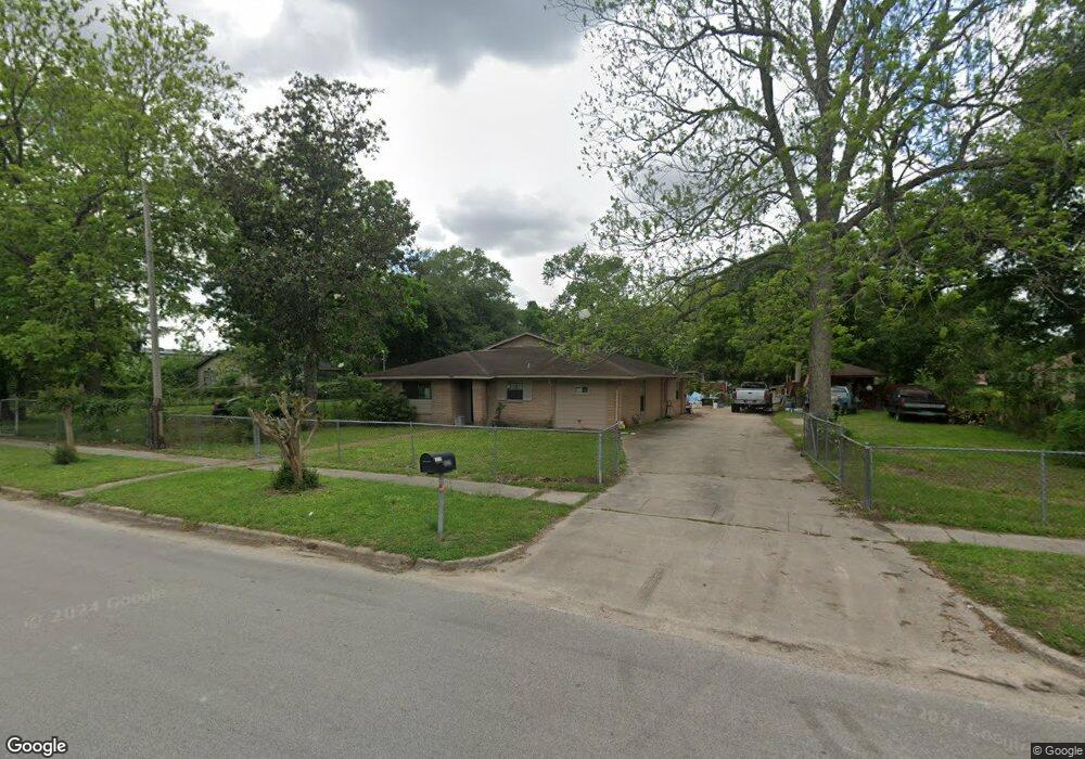
5625 Knox St Houston, TX 77091
Acres Homes NeighborhoodEstimated Value: $380,000 - $607,000
3
Beds
2
Baths
1,742
Sq Ft
$309/Sq Ft
Est. Value
About This Home
This home is located at 5625 Knox St, Houston, TX 77091 and is currently estimated at $538,203, approximately $308 per square foot. 5625 Knox St is a home located in Harris County with nearby schools including Highland Heights Elementary School, Williams Middle, and Booker T Washington Sr High.
Ownership History
Date
Name
Owned For
Owner Type
Purchase Details
Closed on
Mar 9, 2009
Sold by
Neal Marilyn Patricia Nicholas
Bought by
Nicholas Ltanya and Nicholas Ricky J
Current Estimated Value
Home Financials for this Owner
Home Financials are based on the most recent Mortgage that was taken out on this home.
Original Mortgage
$84,550
Interest Rate
5.06%
Mortgage Type
Stand Alone Refi Refinance Of Original Loan
Create a Home Valuation Report for This Property
The Home Valuation Report is an in-depth analysis detailing your home's value as well as a comparison with similar homes in the area
Home Values in the Area
Average Home Value in this Area
Purchase History
| Date | Buyer | Sale Price | Title Company |
|---|---|---|---|
| Nicholas Ltanya | -- | Startex Title Company |
Source: Public Records
Mortgage History
| Date | Status | Borrower | Loan Amount |
|---|---|---|---|
| Closed | Nicholas Ltanya | $84,550 |
Source: Public Records
Tax History Compared to Growth
Tax History
| Year | Tax Paid | Tax Assessment Tax Assessment Total Assessment is a certain percentage of the fair market value that is determined by local assessors to be the total taxable value of land and additions on the property. | Land | Improvement |
|---|---|---|---|---|
| 2025 | $183 | $547,699 | $466,298 | $81,401 |
| 2024 | $183 | $572,735 | $466,298 | $106,437 |
| 2023 | $183 | $572,735 | $466,298 | $106,437 |
| 2022 | $3,355 | $352,751 | $287,550 | $65,201 |
| 2021 | $3,228 | $278,959 | $217,606 | $61,353 |
| 2020 | $3,049 | $204,751 | $139,889 | $64,862 |
| 2019 | $2,896 | $129,509 | $40,524 | $88,985 |
| 2018 | $1,815 | $104,059 | $40,524 | $63,535 |
| 2017 | $2,592 | $104,059 | $40,524 | $63,535 |
| 2016 | $2,356 | $104,059 | $40,524 | $63,535 |
| 2015 | $1,412 | $90,360 | $31,518 | $58,842 |
| 2014 | $1,412 | $77,011 | $31,518 | $45,493 |
Source: Public Records
Map
Nearby Homes
- 946 Benchfield Dr
- 5427 Alba Rd
- 953 Green Vines Ln
- 864 Paul Quinn St Unit G
- 959 Green Vines Ln
- 1006 Tuskegee Heights Ln
- 862 Paul Quinn St Unit A
- 956 Green Vines Ln
- 930 Mansfield St
- 825 Paul Quinn St Unit F
- 825 Paul Quinn St Unit B
- 825 Paul Quinn St Unit C
- 825 Paul Quinn St Unit E
- 1119 Marcella St
- 5922 Knox St
- 1103 W Donovan St
- 845 Elkhart St Unit C
- 5728 Wheatley St
- 982 W Donovan St
- 5732 Wheatley St