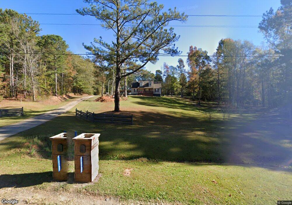
5628 Crest Hwy Thomaston, GA 30286
Estimated Value: $225,000 - $261,000
3
Beds
2
Baths
1,170
Sq Ft
$206/Sq Ft
Est. Value
About This Home
This home is located at 5628 Crest Hwy, Thomaston, GA 30286 and is currently estimated at $241,279, approximately $206 per square foot. 5628 Crest Hwy is a home located in Upson County with nearby schools including Upson-Lee South Elementary School, Upson-Lee North Elementary School, and Upson-Lee Middle School.
Ownership History
Date
Name
Owned For
Owner Type
Purchase Details
Closed on
Mar 27, 2007
Sold by
Moye William H
Bought by
Releford Adrian C
Current Estimated Value
Home Financials for this Owner
Home Financials are based on the most recent Mortgage that was taken out on this home.
Original Mortgage
$146,989
Outstanding Balance
$88,873
Interest Rate
6.15%
Mortgage Type
New Conventional
Estimated Equity
$152,406
Create a Home Valuation Report for This Property
The Home Valuation Report is an in-depth analysis detailing your home's value as well as a comparison with similar homes in the area
Home Values in the Area
Average Home Value in this Area
Purchase History
| Date | Buyer | Sale Price | Title Company |
|---|---|---|---|
| Releford Adrian C | $148,500 | -- |
Source: Public Records
Mortgage History
| Date | Status | Borrower | Loan Amount |
|---|---|---|---|
| Open | Releford Adrian C | $146,989 |
Source: Public Records
Tax History Compared to Growth
Tax History
| Year | Tax Paid | Tax Assessment Tax Assessment Total Assessment is a certain percentage of the fair market value that is determined by local assessors to be the total taxable value of land and additions on the property. | Land | Improvement |
|---|---|---|---|---|
| 2024 | $2,128 | $81,088 | $19,010 | $62,078 |
| 2023 | $2,129 | $73,550 | $19,010 | $54,540 |
| 2022 | $1,698 | $61,250 | $19,010 | $42,240 |
| 2021 | $1,460 | $55,418 | $19,010 | $36,408 |
| 2020 | $1,466 | $51,979 | $19,010 | $32,969 |
| 2019 | $1,468 | $47,917 | $19,010 | $28,907 |
| 2018 | $1,469 | $47,917 | $19,010 | $28,907 |
| 2017 | $1,540 | $45,817 | $19,010 | $26,807 |
| 2016 | $1,538 | $44,998 | $19,010 | $25,988 |
| 2015 | $1,538 | $44,998 | $19,010 | $25,988 |
| 2014 | $1,541 | $44,998 | $19,010 | $25,988 |
Source: Public Records
Map
Nearby Homes
- 36 ACRES Firetower Rd
- 735 Firetower Rd
- 1600 Firetower Rd
- 6177 Crest Hwy
- 0 Firetower Rd Unit 10615379
- 0 Crest Hwy Unit 10563363
- 0 Crest Hwy Unit 10563371
- 575 Skelton Rd
- 0 Hamp Smith Rd Unit 10626396
- 686 Burkett Rd
- 0 Ellerbeetown Rd Unit 10599300
- 975 Thurston School Rd
- 2037 Jeff Davis Rd
- 146 Burkett Rd
- 1138 Smyrna Church Rd
- L-2 Smyrna Church Rd
- 30 Grandview Dr
- 000 (948) Smyrna Church Rd
- 105 Alexandria Way
- 101 Alexandria Way
- 0 Jay Dee Rd Unit 2955487
- 0 Jay Dee Rd Unit 7097191
- 0 Jay Dee Rd Unit 7390436
- 0 Jay Dee Rd Unit 5147257
- 0 Jay Dee Rd Unit 5386780
- 0 Jay Dee Rd Unit 20008987
- 0 Jay Dee Rd Unit 8714593
- 4161 Jeff Davis Rd
- 4171 Jeff Davis Rd
- 4191 Jeff Davis Rd
- 4151 Jeff Davis Rd
- 4141 Jeff Davis Rd
- 4131 Jeff Davis Rd
- 5537 Crest Hwy
- 4121 Jeff Davis Rd
- 4111 Jeff Davis Rd
- 5488 Crest Hwy
- 5610 Crest Hwy
- 4101 Jeff Davis Rd
- 4101 Jeff Davis Rd Unit 19