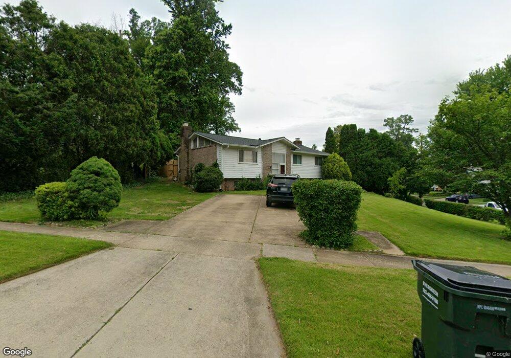
5628 Southampton Dr Springfield, VA 22151
Estimated Value: $678,007 - $734,000
3
Beds
3
Baths
1,200
Sq Ft
$594/Sq Ft
Est. Value
About This Home
This home is located at 5628 Southampton Dr, Springfield, VA 22151 and is currently estimated at $712,252, approximately $593 per square foot. 5628 Southampton Dr is a home located in Fairfax County with nearby schools including Kings Park Elementary School, Kings Glen Elementary School, and Lake Braddock Secondary School.
Ownership History
Date
Name
Owned For
Owner Type
Purchase Details
Closed on
Jun 28, 2005
Sold by
Do Paul
Bought by
Ha Quay
Current Estimated Value
Home Financials for this Owner
Home Financials are based on the most recent Mortgage that was taken out on this home.
Original Mortgage
$352,600
Outstanding Balance
$184,893
Interest Rate
5.73%
Mortgage Type
New Conventional
Estimated Equity
$527,359
Purchase Details
Closed on
Sep 9, 1997
Sold by
Nguyen Thanh V and Nguyen Susan T
Bought by
Do Paul and Do Carol
Home Financials for this Owner
Home Financials are based on the most recent Mortgage that was taken out on this home.
Original Mortgage
$132,000
Interest Rate
7.36%
Mortgage Type
New Conventional
Create a Home Valuation Report for This Property
The Home Valuation Report is an in-depth analysis detailing your home's value as well as a comparison with similar homes in the area
Home Values in the Area
Average Home Value in this Area
Purchase History
| Date | Buyer | Sale Price | Title Company |
|---|---|---|---|
| Ha Quay | $450,000 | -- | |
| Do Paul | $165,000 | -- |
Source: Public Records
Mortgage History
| Date | Status | Borrower | Loan Amount |
|---|---|---|---|
| Open | Ha Quay | $352,600 | |
| Previous Owner | Do Paul | $132,000 |
Source: Public Records
Tax History
| Year | Tax Paid | Tax Assessment Tax Assessment Total Assessment is a certain percentage of the fair market value that is determined by local assessors to be the total taxable value of land and additions on the property. | Land | Improvement |
|---|---|---|---|---|
| 2025 | $7,196 | $683,820 | $310,000 | $373,820 |
| 2024 | $7,196 | $621,130 | $275,000 | $346,130 |
| 2023 | $6,943 | $615,260 | $275,000 | $340,260 |
| 2022 | $6,938 | $606,740 | $270,000 | $336,740 |
| 2021 | $6,071 | $517,380 | $240,000 | $277,380 |
| 2020 | $5,878 | $496,680 | $235,000 | $261,680 |
| 2019 | $5,664 | $478,620 | $227,000 | $251,620 |
| 2018 | $5,286 | $459,620 | $208,000 | $251,620 |
| 2017 | $5,174 | $445,620 | $194,000 | $251,620 |
| 2016 | $5,163 | $445,620 | $194,000 | $251,620 |
Source: Public Records
Map
Nearby Homes
- 5613 Eastbourne Dr
- 5626 Fort Corloran Dr
- 5519 Yorkshire St
- 5506 Kempton Dr
- 9009 Lake Braddock Dr
- 9008 Lake Braddock Dr
- 8942 Kenilworth Dr
- 5510 Eastbourne Dr
- 5810 Hall St
- 8952 Kenilworth Dr
- 8927 Cromwell Dr
- 5915 Lovejoy Ct
- 5812 Royal Ridge Dr Unit C
- 5300 Kings Park Dr
- 5672 Kirkham Ct
- 5401 Southampton Dr
- 5407 Point Longstreet Way
- 8909 Victoria Rd
- 5824 Rexford Dr Unit 731
- 9010 Brook Ford Rd
- 5630 Southampton Dr
- 5608 Kings Park Dr
- 5626 Southampton Dr
- 5606 Kings Park Dr
- 5615 Rolling Rd
- 5639 Eastbourne Dr
- 5609 Kings Park Dr
- 5613 Rolling Rd
- 5629 Southampton Dr
- 5625 Southampton Dr
- 5607 Kings Park Dr
- 5604 Kings Park Dr
- 5611 Rolling Rd
- 5624 Southampton Dr
- 5631 Southampton Dr
- 8710 Ramsey Ct
- 5605 Kings Park Dr
- 5636 Eastbourne Dr
- 5602 Kings Park Dr
- 5609 Rolling Rd
Your Personal Tour Guide
Ask me questions while you tour the home.