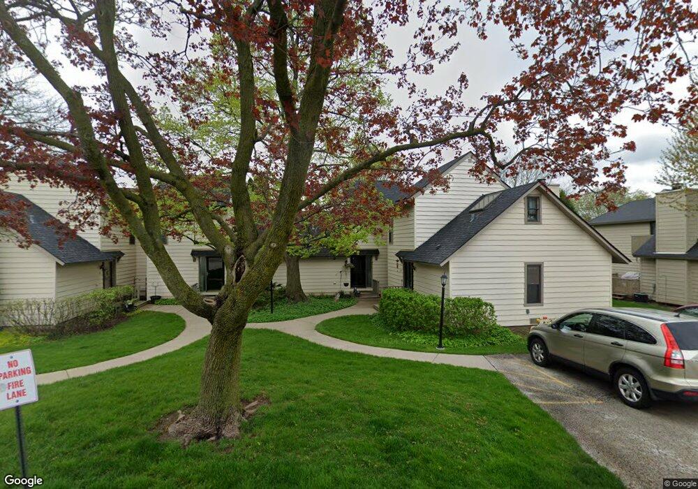
563 Dunham Rd Unit U289 Gurnee, IL 60031
Estimated Value: $209,425 - $218,000
2
Beds
2
Baths
1,162
Sq Ft
$185/Sq Ft
Est. Value
About This Home
This home is located at 563 Dunham Rd Unit U289, Gurnee, IL 60031 and is currently estimated at $214,606, approximately $184 per square foot. 563 Dunham Rd Unit U289 is a home located in Lake County with nearby schools including Woodland Primary School, Woodland Elementary School, and Woodland Intermediate School.
Ownership History
Date
Name
Owned For
Owner Type
Purchase Details
Closed on
Sep 8, 2015
Sold by
Janda Susan M
Bought by
Janda Susan M and The Susan M Janda Irrevocable Spendthrif
Current Estimated Value
Purchase Details
Closed on
Mar 5, 2004
Sold by
Sullivan James H and Sullivan Barbara
Bought by
Janda Susan M
Home Financials for this Owner
Home Financials are based on the most recent Mortgage that was taken out on this home.
Original Mortgage
$116,850
Outstanding Balance
$54,993
Interest Rate
5.77%
Mortgage Type
Unknown
Estimated Equity
$159,613
Create a Home Valuation Report for This Property
The Home Valuation Report is an in-depth analysis detailing your home's value as well as a comparison with similar homes in the area
Home Values in the Area
Average Home Value in this Area
Purchase History
| Date | Buyer | Sale Price | Title Company |
|---|---|---|---|
| Janda Susan M | -- | Attorney | |
| Janda Susan M | $123,000 | Golden Title |
Source: Public Records
Mortgage History
| Date | Status | Borrower | Loan Amount |
|---|---|---|---|
| Open | Janda Susan M | $116,850 |
Source: Public Records
Tax History
| Year | Tax Paid | Tax Assessment Tax Assessment Total Assessment is a certain percentage of the fair market value that is determined by local assessors to be the total taxable value of land and additions on the property. | Land | Improvement |
|---|---|---|---|---|
| 2024 | $2,373 | $56,983 | $8,185 | $48,798 |
| 2023 | $3,736 | $52,904 | $7,599 | $45,305 |
| 2022 | $3,736 | $44,333 | $5,929 | $38,404 |
| 2021 | $3,141 | $40,146 | $5,369 | $34,777 |
| 2020 | $3,031 | $39,159 | $5,237 | $33,922 |
| 2019 | $2,939 | $38,022 | $5,085 | $32,937 |
| 2018 | $2,434 | $32,973 | $2,676 | $30,297 |
| 2017 | $2,403 | $32,028 | $2,599 | $29,429 |
| 2016 | $2,365 | $30,602 | $2,483 | $28,119 |
| 2015 | $1,785 | $29,023 | $2,355 | $26,668 |
| 2014 | $1,631 | $27,502 | $2,323 | $25,179 |
| 2012 | $2,718 | $27,713 | $2,341 | $25,372 |
Source: Public Records
Map
Nearby Homes
- 650 Whitney Ct Unit 211
- 598 Dunham Rd Unit U297
- 690 Chandler Rd Unit 211
- 690 Chandler Rd Unit 302
- 651 White Ct
- 705 Colby Ct Unit U78
- 6167 Golfview Dr
- 748 Chandler Rd
- 727 Colby Ct Unit U57
- 6296 Doral Dr
- 649 Wilbur Ct
- 801 Dunhill Ct
- 920 Vose Dr Unit 304
- 920 Vose Dr Unit 106
- 256 Hill n Dale Ct
- 6349 Braxton Ct
- 33430 N Hunt Club Rd
- 6230 Old Farm Ln
- 17150 W Washington St
- 6091 Washington St
- 565 Dunham Rd Unit U290
- 561 Dunham Rd Unit U292
- 559 Dunham Rd Unit U287
- 569 Dunham Rd
- 571 Dunham Rd Unit U293
- 573 Dunham Rd
- 575 Dunham Rd Unit U303
- 577 Dunham Rd
- 579 Dunham Rd Unit U305
- 6001 Pebble Creek Ct
- 581 Dunham Rd Unit U306
- 588 Dunham Rd
- 586 Dunham Rd Unit 302
- 590 Dunham Rd Unit U298
- 587 Dunham Rd
- 596 Dunham Rd Unit U299
- 6009 Pebble Creek Ct
- 600 Dunham Rd Unit U295
- 600 Dunham Rd Unit 600
Your Personal Tour Guide
Ask me questions while you tour the home.