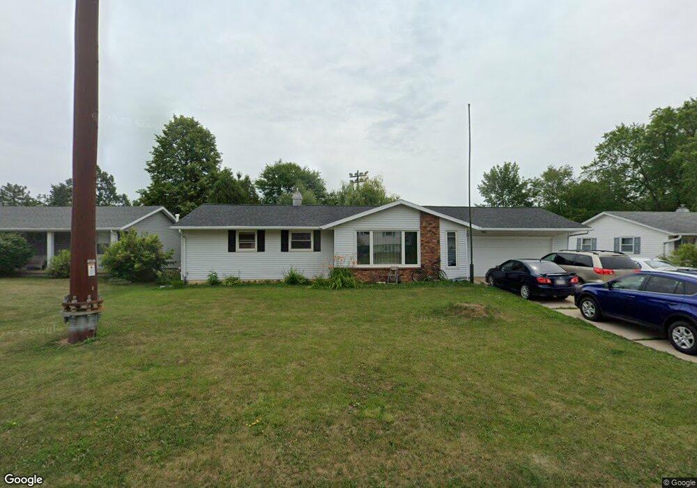
563 Menlo Park Rd Green Bay, WI 54302
Preble NeighborhoodEstimated Value: $289,394 - $327,000
3
Beds
2
Baths
1,208
Sq Ft
$253/Sq Ft
Est. Value
About This Home
This home is located at 563 Menlo Park Rd, Green Bay, WI 54302 and is currently estimated at $305,849, approximately $253 per square foot. 563 Menlo Park Rd is a home located in Brown County with nearby schools including Martin Elementary School, Edison Middle School, and Preble High School.
Ownership History
Date
Name
Owned For
Owner Type
Purchase Details
Closed on
Apr 14, 2016
Sold by
Lee Ger
Bought by
Lee Youa Moua
Current Estimated Value
Home Financials for this Owner
Home Financials are based on the most recent Mortgage that was taken out on this home.
Original Mortgage
$60,600
Outstanding Balance
$48,143
Interest Rate
3.68%
Mortgage Type
New Conventional
Estimated Equity
$257,706
Purchase Details
Closed on
Oct 15, 2014
Sold by
Vasiliev Alexandru
Bought by
Lee Mai L
Create a Home Valuation Report for This Property
The Home Valuation Report is an in-depth analysis detailing your home's value as well as a comparison with similar homes in the area
Home Values in the Area
Average Home Value in this Area
Purchase History
| Date | Buyer | Sale Price | Title Company |
|---|---|---|---|
| Lee Youa Moua | -- | Liberty Title | |
| Lee Mai L | $188,900 | -- |
Source: Public Records
Mortgage History
| Date | Status | Borrower | Loan Amount |
|---|---|---|---|
| Open | Lee Youa Moua | $60,600 |
Source: Public Records
Tax History Compared to Growth
Tax History
| Year | Tax Paid | Tax Assessment Tax Assessment Total Assessment is a certain percentage of the fair market value that is determined by local assessors to be the total taxable value of land and additions on the property. | Land | Improvement |
|---|---|---|---|---|
| 2024 | $3,400 | $185,400 | $39,900 | $145,500 |
| 2023 | $3,234 | $185,400 | $39,900 | $145,500 |
| 2022 | $3,172 | $185,400 | $39,900 | $145,500 |
| 2021 | $2,755 | $123,500 | $27,000 | $96,500 |
| 2020 | $2,801 | $123,500 | $27,000 | $96,500 |
| 2019 | $2,706 | $123,500 | $27,000 | $96,500 |
| 2018 | $2,648 | $123,500 | $27,000 | $96,500 |
| 2017 | $2,625 | $123,500 | $27,000 | $96,500 |
| 2016 | $2,582 | $123,500 | $27,000 | $96,500 |
| 2015 | $2,686 | $123,500 | $27,000 | $96,500 |
| 2014 | $2,804 | $123,500 | $27,000 | $96,500 |
| 2013 | $2,804 | $123,500 | $27,000 | $96,500 |
Source: Public Records
Map
Nearby Homes
- 2615 Finger Rd Unit 2617
- 537 Alpine Dr
- 2722 Finger Rd
- 2570 Edgewood Ln
- 537 Edward Dr
- 856 Alpine Dr
- 448 Harvest Rd
- 1015 Aphrodite Rd
- 2490 Deerpath Dr
- 2737 Canyon Bluff Rd
- 2360 Hillside Ln
- 2679 Radinz Rd
- 215 Alpine Dr
- 2400 Ruffed Ct
- 650 Calvin Ct
- 2648 Pecan St
- 442 Robert Ln
- 2490 Deckner Ave
- 3060 Gilbert Dr
- 3069 Gilbert Dr
- 555 Menlo Park Rd
- 605 Menlo Park Rd
- 543 Menlo Park Rd
- 611 Menlo Park Rd
- 560 Menlo Park Rd
- 604 Menlo Park Rd
- 552 Menlo Park Rd
- 2645 Sherry Ln
- 610 Menlo Park Rd
- 542 Menlo Park Rd
- 527 Menlo Park Rd
- 534 Menlo Park Rd
- 597 Delwiche Rd
- 603 Delwiche Rd
- 553 Delwiche Rd
- 613 Delwiche Rd
- 543 Delwiche Rd
- 526 Menlo Park Rd
- 517 Menlo Park Rd
- 2646 Sherry Ln Unit 2648