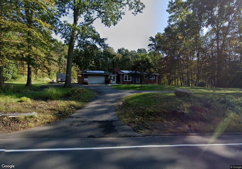
563 Merrow Rd Tolland, CT 06084
Estimated Value: $303,000 - $407,180
3
Beds
2
Baths
1,214
Sq Ft
$280/Sq Ft
Est. Value
About This Home
This home is located at 563 Merrow Rd, Tolland, CT 06084 and is currently estimated at $340,295, approximately $280 per square foot. 563 Merrow Rd is a home located in Tolland County with nearby schools including Birch Grove Primary School, Tolland Intermediate School, and Tolland Middle School.
Ownership History
Date
Name
Owned For
Owner Type
Purchase Details
Closed on
Jun 30, 2025
Sold by
Baker Stephan S and Baker Laurie K
Bought by
Sheehan Michael and Kluntz Toree
Current Estimated Value
Home Financials for this Owner
Home Financials are based on the most recent Mortgage that was taken out on this home.
Original Mortgage
$294,566
Outstanding Balance
$294,071
Interest Rate
6.89%
Mortgage Type
New Conventional
Estimated Equity
$46,224
Purchase Details
Closed on
Aug 28, 2006
Sold by
Schneider-Ott Matilda
Bought by
Baker Stephen and Baker Laurie
Home Financials for this Owner
Home Financials are based on the most recent Mortgage that was taken out on this home.
Original Mortgage
$180,200
Interest Rate
8.62%
Create a Home Valuation Report for This Property
The Home Valuation Report is an in-depth analysis detailing your home's value as well as a comparison with similar homes in the area
Home Values in the Area
Average Home Value in this Area
Purchase History
| Date | Buyer | Sale Price | Title Company |
|---|---|---|---|
| Sheehan Michael | $300,000 | -- | |
| Sheehan Michael | $300,000 | -- | |
| Baker Stephen | $212,000 | -- | |
| Baker Stephen | $212,000 | -- |
Source: Public Records
Mortgage History
| Date | Status | Borrower | Loan Amount |
|---|---|---|---|
| Open | Sheehan Michael | $294,566 | |
| Closed | Sheehan Michael | $294,566 | |
| Previous Owner | Baker Stephen | $216,964 | |
| Previous Owner | Baker Stephen | $216,000 | |
| Previous Owner | Baker Stephen | $180,200 |
Source: Public Records
Tax History Compared to Growth
Tax History
| Year | Tax Paid | Tax Assessment Tax Assessment Total Assessment is a certain percentage of the fair market value that is determined by local assessors to be the total taxable value of land and additions on the property. | Land | Improvement |
|---|---|---|---|---|
| 2025 | $6,077 | $223,500 | $76,700 | $146,800 |
| 2024 | $5,730 | $151,700 | $73,700 | $78,000 |
| 2023 | $5,592 | $149,800 | $73,700 | $76,100 |
| 2022 | $5,480 | $149,800 | $73,700 | $76,100 |
| 2021 | $5,559 | $149,800 | $73,700 | $76,100 |
| 2020 | $5,400 | $149,800 | $73,700 | $76,100 |
| 2019 | $5,299 | $147,000 | $75,700 | $71,300 |
| 2018 | $5,145 | $147,000 | $75,700 | $71,300 |
| 2017 | $5,026 | $147,000 | $75,700 | $71,300 |
| 2016 | $5,026 | $147,000 | $75,700 | $71,300 |
| 2015 | $4,904 | $147,000 | $75,700 | $71,300 |
| 2014 | $4,946 | $159,300 | $82,900 | $76,400 |
Source: Public Records
Map
Nearby Homes
- 527 Merrow Rd
- 454 Merrow Rd
- 10 Summit Dr
- 88 Anthony Rd
- 312 Merrow Rd
- 97 Cassidy Hill Rd
- 226 Goose Ln
- 284 Merrow Rd
- 248 Merrow Rd
- 10 Depot Rd Unit 25
- 38 Homestead Dr
- 300 Geraldine Dr
- 35 Fern Dr
- 12 Stone Pond Rd
- 18 Stone Pond Rd
- 6 Timber Ln
- 19 Thomas Dr
- 710 Merrow Rd
- 38 Crystal Ln Unit D
- 45 Crystal Ln Unit D