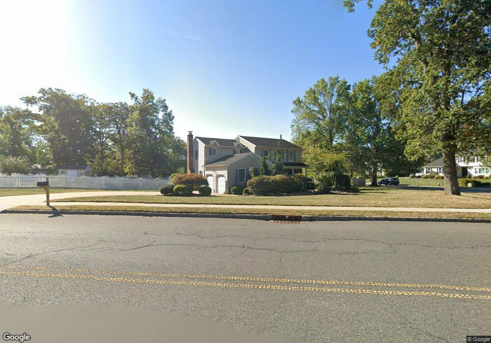
563 New Brunswick Rd Somerset, NJ 08873
Estimated Value: $708,000 - $800,000
--
Bed
--
Bath
2,438
Sq Ft
$305/Sq Ft
Est. Value
About This Home
This home is located at 563 New Brunswick Rd, Somerset, NJ 08873 and is currently estimated at $744,689, approximately $305 per square foot. 563 New Brunswick Rd is a home located in Somerset County with nearby schools including Franklin High School, Thomas Edison EnergySmart Charter School, and Cedar Hill Preparatory School.
Ownership History
Date
Name
Owned For
Owner Type
Purchase Details
Closed on
Jun 10, 2024
Sold by
Eid Kelly Ann and Eid Joseph E
Bought by
Eid Joseph E
Current Estimated Value
Purchase Details
Closed on
Mar 25, 1994
Sold by
Venkataramani Thayankulamkara
Bought by
Antoine Joseph and Eid Emile
Home Financials for this Owner
Home Financials are based on the most recent Mortgage that was taken out on this home.
Original Mortgage
$200,000
Interest Rate
7.27%
Create a Home Valuation Report for This Property
The Home Valuation Report is an in-depth analysis detailing your home's value as well as a comparison with similar homes in the area
Home Values in the Area
Average Home Value in this Area
Purchase History
| Date | Buyer | Sale Price | Title Company |
|---|---|---|---|
| Eid Joseph E | -- | None Listed On Document | |
| Antoine Joseph | $215,000 | -- |
Source: Public Records
Mortgage History
| Date | Status | Borrower | Loan Amount |
|---|---|---|---|
| Previous Owner | Antoine Joseph | $200,000 |
Source: Public Records
Tax History Compared to Growth
Tax History
| Year | Tax Paid | Tax Assessment Tax Assessment Total Assessment is a certain percentage of the fair market value that is determined by local assessors to be the total taxable value of land and additions on the property. | Land | Improvement |
|---|---|---|---|---|
| 2025 | $11,046 | $701,900 | $318,100 | $383,800 |
| 2024 | $11,046 | $607,600 | $318,100 | $289,500 |
| 2023 | $10,499 | $543,700 | $254,200 | $289,500 |
| 2022 | $10,693 | $524,700 | $235,200 | $289,500 |
| 2021 | $10,570 | $477,200 | $187,700 | $289,500 |
| 2020 | $10,374 | $458,200 | $168,700 | $289,500 |
| 2019 | $10,110 | $439,200 | $149,700 | $289,500 |
| 2018 | $9,774 | $420,200 | $130,700 | $289,500 |
| 2017 | $9,807 | $420,200 | $130,700 | $289,500 |
| 2016 | $9,879 | $420,200 | $130,700 | $289,500 |
| 2015 | $9,702 | $415,500 | $126,000 | $289,500 |
| 2014 | $9,454 | $410,700 | $121,200 | $289,500 |
Source: Public Records
Map
Nearby Homes
- 43 Pinecrest Rd
- 561 New Brunswick Rd
- 564 New Brunswick Rd
- 45 Pinecrest Rd
- 562 New Brunswick Rd
- 566 New Brunswick Rd
- 42 Pinecrest Rd
- 559 New Brunswick Rd
- 47 Pinecrest Rd
- 44 Pinecrest Rd
- 560 New Brunswick Rd
- 46 Pinecrest Rd
- 557 New Brunswick Rd
- 49 Pinecrest Rd
- 5 Driftwood Dr
- 6 Driftwood Dr
- 141 Bayberry Dr
- 138 Hickory Rd
- 139 Bayberry Dr
- 8 Driftwood Dr