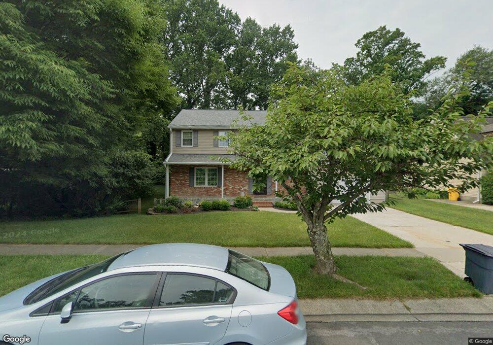
563 Norton Ln Arnold, MD 21012
Estimated Value: $602,000 - $675,000
Studio
3
Baths
2,178
Sq Ft
$294/Sq Ft
Est. Value
About This Home
This home is located at 563 Norton Ln, Arnold, MD 21012 and is currently estimated at $639,524, approximately $293 per square foot. 563 Norton Ln is a home located in Anne Arundel County with nearby schools including Broadneck Elementary School, Magothy River Middle School, and Broadneck High School.
Ownership History
Date
Name
Owned For
Owner Type
Purchase Details
Closed on
Sep 14, 2022
Sold by
Mckeldin Robert A and Mckeldin Jeanne S
Bought by
Mckeldin Family Trust
Current Estimated Value
Purchase Details
Closed on
Jul 7, 1983
Bought by
Mckeldin Robert A and Mckeldin Jeanne S
Home Financials for this Owner
Home Financials are based on the most recent Mortgage that was taken out on this home.
Original Mortgage
$78,500
Interest Rate
13.08%
Create a Home Valuation Report for This Property
The Home Valuation Report is an in-depth analysis detailing your home's value as well as a comparison with similar homes in the area
Home Values in the Area
Average Home Value in this Area
Purchase History
| Date | Buyer | Sale Price | Title Company |
|---|---|---|---|
| Mckeldin Family Trust | -- | -- | |
| Mckeldin Family Trust | -- | None Listed On Document | |
| Mckeldin Robert A | $94,400 | -- |
Source: Public Records
Mortgage History
| Date | Status | Borrower | Loan Amount |
|---|---|---|---|
| Previous Owner | Mckeldin Robert A | $78,500 |
Source: Public Records
Tax History
| Year | Tax Paid | Tax Assessment Tax Assessment Total Assessment is a certain percentage of the fair market value that is determined by local assessors to be the total taxable value of land and additions on the property. | Land | Improvement |
|---|---|---|---|---|
| 2025 | $3,657 | $508,133 | -- | -- |
| 2024 | $3,657 | $478,300 | $267,700 | $210,600 |
Source: Public Records
Map
Nearby Homes
- 371 Freshfield Ln
- 1254 Masters Dr
- 1467 Eagle Ct
- 136 Collington Ct
- 508 Bay Hills Dr
- 1233 Birchcrest Ct
- 312 Rosslare Dr
- 434 College Pkwy
- 559 Melissa Ct
- 303 Ternwing Dr
- 1553 Star Pine Dr
- 1420 Gilbert Rd
- 1411 Peregrine Path
- 1410 Greendale Ct Unit 2-1410
- 1250 Stonewood Ct
- 618 Newbridge Ct Unit 3-618
- 1078 Brightleaf Ct
- 656 Newbridge Ct Unit 4-656
- 1420 Mariner Dr
- 930 Whitstable Blvd
- 561 Norton Ln
- 1249 Viking Dr S
- 1247 Viking Dr S
- 1241 Viking Dr S
- 1245 Viking Dr S
- 1243 Viking Dr S
- 560 Norton Ln
- 1251 Viking Dr S
- 558 Norton Ln
- 1224 Viking Dr N
- 400 Colonial Ridge Ln Unit 1
- 400 Colonial Ridge Ln
- 1253 Viking Dr S
- 555 Norton Ln
- 402 Colonial Ridge Ln
- 401 Colonial Ridge Ln
- 404 Colonial Ridge Ln
- 1248 Viking Dr S
- 1222 Viking Dr N
- 406 Colonial Ridge Ln
Your Personal Tour Guide
Ask me questions while you tour the home.