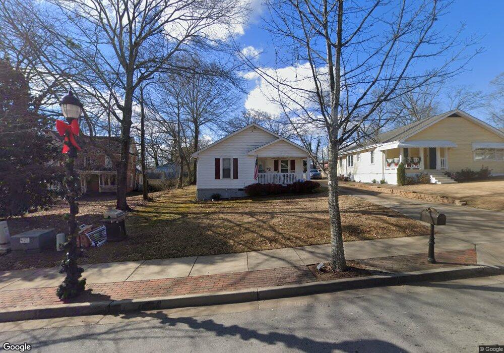
563 S Hill St Buford, GA 30518
Estimated Value: $285,000 - $407,365
3
Beds
2
Baths
1,232
Sq Ft
$275/Sq Ft
Est. Value
About This Home
This home is located at 563 S Hill St, Buford, GA 30518 and is currently estimated at $338,591, approximately $274 per square foot. 563 S Hill St is a home located in Gwinnett County with nearby schools including Buford Elementary School, Buford Senior Academy, and Buford Academy.
Ownership History
Date
Name
Owned For
Owner Type
Purchase Details
Closed on
May 26, 2011
Sold by
Parker J Mark
Bought by
Taylor Nicholas A
Current Estimated Value
Home Financials for this Owner
Home Financials are based on the most recent Mortgage that was taken out on this home.
Original Mortgage
$95,020
Outstanding Balance
$65,402
Interest Rate
4.75%
Mortgage Type
FHA
Estimated Equity
$273,189
Purchase Details
Closed on
Jul 28, 1995
Sold by
Veal Ryman L
Bought by
Boggs Jane V
Purchase Details
Closed on
Jan 29, 1994
Sold by
Higgins Julia and Carter Mary
Bought by
Veal Ryman L
Create a Home Valuation Report for This Property
The Home Valuation Report is an in-depth analysis detailing your home's value as well as a comparison with similar homes in the area
Home Values in the Area
Average Home Value in this Area
Purchase History
| Date | Buyer | Sale Price | Title Company |
|---|---|---|---|
| Taylor Nicholas A | $97,500 | -- | |
| Boggs Jane V | $42,500 | -- | |
| Veal Ryman L | $26,500 | -- |
Source: Public Records
Mortgage History
| Date | Status | Borrower | Loan Amount |
|---|---|---|---|
| Open | Taylor Nicholas A | $95,020 |
Source: Public Records
Tax History Compared to Growth
Tax History
| Year | Tax Paid | Tax Assessment Tax Assessment Total Assessment is a certain percentage of the fair market value that is determined by local assessors to be the total taxable value of land and additions on the property. | Land | Improvement |
|---|---|---|---|---|
| 2025 | $353 | $115,400 | $40,000 | $75,400 |
| 2024 | $353 | $118,960 | $33,600 | $85,360 |
| 2023 | $353 | $91,120 | $26,000 | $65,120 |
| 2022 | $353 | $91,120 | $26,000 | $65,120 |
| 2021 | $353 | $55,480 | $16,800 | $38,680 |
| 2020 | $353 | $55,480 | $16,800 | $38,680 |
| 2019 | $319 | $55,480 | $16,800 | $38,680 |
| 2018 | $279 | $31,320 | $5,600 | $25,720 |
| 2016 | $278 | $31,320 | $5,600 | $25,720 |
| 2015 | $289 | $31,320 | $5,600 | $25,720 |
| 2014 | $267 | $29,360 | $5,600 | $23,760 |
Source: Public Records
Map
Nearby Homes
- 5065 Cooper Farm Dr
- 480 S Hill St
- 2051 Harvester Ln
- 449 S Hill St
- 401 Pirkle Ave
- 4817 Cooper Farm Dr
- 489 Williams St
- 460 Espy St
- 2255 Buford Hwy
- 2255 Buford Hwy
- 27 Morgan St
- 25 Morgan St
- 4942 Greenard Watson Ln
- 4831 Miller Hill Rd
- 4933 Greenard Watson Ln
- 21 Buford Village Walk
- 3 Buford Village Walk
- 185 Scott St
- 4895 Sterling Close
- 553 S Hill St
- 583 S Hill St
- 533 S Hill St
- 1270 Hillcrest Dr Unit 4414.1412130
- 1270 Hillcrest Dr Unit 3310.1412128
- 1270 Hillcrest Dr Unit 3116.1412127
- 1270 Hillcrest Dr Unit 4309.1412129
- 1270 Hillcrest Dr Unit 2410.1412126
- 1270 Hillcrest Dr Unit 2208.1410246
- 1270 Hillcrest Dr Unit 2004.1410242
- 1270 Hillcrest Dr Unit 3213.1410243
- 1270 Hillcrest Dr Unit 3217.1410244
- 1270 Hillcrest Dr Unit 3417.1410245
- 1270 Hillcrest Dr Unit 3518.1408543
- 1270 Hillcrest Dr Unit 3309.1408544
- 1270 Hillcrest Dr Unit 3008.1408541
- 1270 Hillcrest Dr Unit 2205.1408548
- 1270 Hillcrest Dr Unit 4315.1408542
- 1270 Hillcrest Dr Unit 3302.1408545
- 1270 Hillcrest Dr Unit 2515.1408546