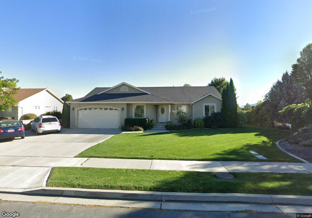
563 W 990 N American Fork, UT 84003
Estimated Value: $566,000 - $714,000
3
Beds
2
Baths
3,576
Sq Ft
$172/Sq Ft
Est. Value
About This Home
This home is located at 563 W 990 N, American Fork, UT 84003 and is currently estimated at $616,293, approximately $172 per square foot. 563 W 990 N is a home located in Utah County with nearby schools including Shelley Elementary School, American Fork Junior High School, and American Fork High School.
Ownership History
Date
Name
Owned For
Owner Type
Purchase Details
Closed on
Mar 23, 2003
Sold by
Alpine School Dist Technology Education
Bought by
Uibel John R and Uibel Jill C
Current Estimated Value
Home Financials for this Owner
Home Financials are based on the most recent Mortgage that was taken out on this home.
Original Mortgage
$148,700
Interest Rate
5.77%
Mortgage Type
Purchase Money Mortgage
Purchase Details
Closed on
Jun 3, 1999
Sold by
S & L Excavating Inc
Bought by
England Fred L and England Diana H
Create a Home Valuation Report for This Property
The Home Valuation Report is an in-depth analysis detailing your home's value as well as a comparison with similar homes in the area
Home Values in the Area
Average Home Value in this Area
Purchase History
| Date | Buyer | Sale Price | Title Company |
|---|---|---|---|
| Uibel John R | -- | First American Title Co | |
| England Fred L | -- | -- |
Source: Public Records
Mortgage History
| Date | Status | Borrower | Loan Amount |
|---|---|---|---|
| Previous Owner | Uibel John R | $148,700 |
Source: Public Records
Tax History Compared to Growth
Tax History
| Year | Tax Paid | Tax Assessment Tax Assessment Total Assessment is a certain percentage of the fair market value that is determined by local assessors to be the total taxable value of land and additions on the property. | Land | Improvement |
|---|---|---|---|---|
| 2025 | $364 | $304,260 | $224,800 | $328,400 |
| 2024 | $364 | $287,430 | $0 | $0 |
| 2023 | $377 | $291,335 | $0 | $0 |
| 2022 | $828 | $304,590 | $0 | $0 |
| 2021 | $566 | $407,900 | $161,300 | $246,600 |
| 2020 | $542 | $370,200 | $144,000 | $226,200 |
| 2019 | $1,951 | $355,400 | $133,200 | $222,200 |
| 2018 | $1,833 | $319,200 | $126,000 | $193,200 |
| 2017 | $1,762 | $165,660 | $0 | $0 |
| 2016 | $1,733 | $151,305 | $0 | $0 |
| 2015 | $1,757 | $145,640 | $0 | $0 |
| 2014 | $1,652 | $135,025 | $0 | $0 |
Source: Public Records
Map
Nearby Homes
- 471 W 1040 N
- 987 N 410 W
- 602 W 860 N
- 425 W 1120 N
- 914 N 400 W Unit A
- 3889 W 950 Cir N Unit 366
- 344 W 1080 N
- 3935 W 1000 N Unit 438
- 3983 W 1000 N Unit 442
- 4007 W 1000 N
- 3947 W 1000 N Unit 439
- 3959 W 1000 N
- 984 N 300 W
- 822 W 800 St N Unit LOT319
- 822 N 860 W Unit 317
- 962 N 780 St W Unit 508
- 974 N 780 St W Unit 509
- 916 N 780 St W Unit 501
- 356 W 1300 N
- 641 N 420 W