Estimated Value: $261,642 - $271,000
3
Beds
2
Baths
1,202
Sq Ft
$221/Sq Ft
Est. Value
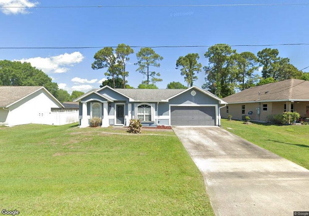
About This Home
This home is located at 5630 Graham St, Cocoa, FL 32927 and is currently estimated at $265,911, approximately $221 per square foot. 5630 Graham St is a home located in Brevard County with nearby schools including Enterprise Elementary School, Space Coast Junior/Senior High School, and East Atlantic Prep of Brevard County.
Ownership History
Date
Name
Owned For
Owner Type
Purchase Details
Closed on
Dec 30, 1993
Sold by
Mercedes Homes Inc
Bought by
Nattile Samuel A and Nattile Dawn M
Current Estimated Value
Home Financials for this Owner
Home Financials are based on the most recent Mortgage that was taken out on this home.
Original Mortgage
$78,300
Interest Rate
7.09%
Purchase Details
Closed on
Aug 31, 1993
Sold by
Atlantic Gulf Com Corp
Bought by
J M S D Inc
Purchase Details
Closed on
Aug 25, 1993
Sold by
J M S D Inc
Bought by
Mercedes Homes Inc
Create a Home Valuation Report for This Property
The Home Valuation Report is an in-depth analysis detailing your home's value as well as a comparison with similar homes in the area
Home Values in the Area
Average Home Value in this Area
Purchase History
| Date | Buyer | Sale Price | Title Company |
|---|---|---|---|
| Nattile Samuel A | $77,900 | -- | |
| J M S D Inc | $10,500 | -- | |
| Mercedes Homes Inc | $14,500 | -- |
Source: Public Records
Mortgage History
| Date | Status | Borrower | Loan Amount |
|---|---|---|---|
| Closed | Nattile Samuel A | $78,300 |
Source: Public Records
Tax History Compared to Growth
Tax History
| Year | Tax Paid | Tax Assessment Tax Assessment Total Assessment is a certain percentage of the fair market value that is determined by local assessors to be the total taxable value of land and additions on the property. | Land | Improvement |
|---|---|---|---|---|
| 2025 | $951 | $72,940 | -- | -- |
| 2024 | $930 | $70,890 | -- | -- |
| 2023 | $930 | $68,830 | $0 | $0 |
| 2022 | $934 | $66,830 | $0 | $0 |
| 2021 | $935 | $64,890 | $0 | $0 |
| 2020 | $889 | $64,000 | $0 | $0 |
| 2019 | $836 | $62,570 | $0 | $0 |
| 2018 | $837 | $61,410 | $0 | $0 |
| 2017 | $837 | $60,150 | $0 | $0 |
| 2016 | $844 | $58,920 | $18,000 | $40,920 |
| 2015 | $849 | $58,520 | $15,000 | $43,520 |
| 2014 | $854 | $58,060 | $11,000 | $47,060 |
Source: Public Records
Map
Nearby Homes
- 7065 Hundred Acre Dr
- TBD Freeport Rd
- 7230 Venus Ave
- 5730 Friendly St
- 7358 Crepe Myrtle Ct
- 7368 Crepe Myrtle Ct
- 7635 Fringe Place
- 6581 Bancroft Ave
- 6615 Dock Ave
- 6760 Cairo Rd
- 5165 Patricia St
- 7469 Hackberry Rd
- 5155 Mayflower St
- 7545 Fringe Place
- 5130 Carter St
- 5575 Curtis Blvd
- 6775 Buxton Ave
- 6665 Addie Ave
- 4650 N Highway 1 Hwy
- 5715 Fairbridge St