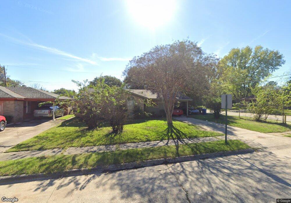
5631 Benjai Dr Shreveport, LA 71109
Mooretown and Hollywood Heights NeighborhoodEstimated Value: $53,000 - $59,000
3
Beds
2
Baths
990
Sq Ft
$56/Sq Ft
Est. Value
About This Home
This home is located at 5631 Benjai Dr, Shreveport, LA 71109 and is currently estimated at $55,333, approximately $55 per square foot. 5631 Benjai Dr is a home located in Caddo Parish with nearby schools including Oak Park Elementary School, Judson Fundamental Elementary School, and Fairfield Magnet School.
Ownership History
Date
Name
Owned For
Owner Type
Purchase Details
Closed on
Aug 10, 2018
Sold by
Gaskins Juanita Johnson and Harrison Andrew J
Bought by
Taylor Made Real Estates Investements Ll
Current Estimated Value
Home Financials for this Owner
Home Financials are based on the most recent Mortgage that was taken out on this home.
Original Mortgage
$27,300
Interest Rate
4.5%
Mortgage Type
New Conventional
Create a Home Valuation Report for This Property
The Home Valuation Report is an in-depth analysis detailing your home's value as well as a comparison with similar homes in the area
Home Values in the Area
Average Home Value in this Area
Purchase History
| Date | Buyer | Sale Price | Title Company |
|---|---|---|---|
| Taylor Made Real Estates Investements Ll | $39,000 | None Available |
Source: Public Records
Mortgage History
| Date | Status | Borrower | Loan Amount |
|---|---|---|---|
| Closed | Taylor Made Real Estates Investements Ll | $27,300 |
Source: Public Records
Tax History Compared to Growth
Tax History
| Year | Tax Paid | Tax Assessment Tax Assessment Total Assessment is a certain percentage of the fair market value that is determined by local assessors to be the total taxable value of land and additions on the property. | Land | Improvement |
|---|---|---|---|---|
| 2024 | $687 | $4,405 | $910 | $3,495 |
| 2023 | $695 | $4,362 | $867 | $3,495 |
| 2022 | $695 | $4,362 | $867 | $3,495 |
| 2021 | $685 | $4,362 | $867 | $3,495 |
| 2020 | $685 | $4,362 | $867 | $3,495 |
| 2019 | $686 | $4,242 | $867 | $3,375 |
| 2018 | $546 | $4,242 | $867 | $3,375 |
| 2017 | $697 | $4,242 | $867 | $3,375 |
| 2015 | $590 | $4,550 | $870 | $3,680 |
| 2014 | $594 | $4,550 | $870 | $3,680 |
| 2013 | -- | $4,550 | $870 | $3,680 |
Source: Public Records
Map
Nearby Homes
- 4302 Illinois Ave
- 5415 Norton St
- 4310 Saint Louis Ave
- 5600 Norton St
- 0 Miles St
- 4536 Curtis Ln
- 4056 Powell St
- 5222 Broadway Ave
- 4130 Mayfield St
- 4136 Mayfield St
- 3924 Miles St
- 3922 Miles St
- 3735 Tate St
- 4814 Mcdaniel Dr
- 4122 Carver St
- 3812 Mayfield St
- 4210 Via St
- 3918 Adrian St
- 4718 Gloria Cir
- 4102 Via St
- 5627 Benjai Dr
- 5623 Benjai Dr
- 5628 Benjai Dr
- 5706 Kennedy Dr
- 5710 Kennedy Dr
- 5624 Benjai Dr
- 5619 Benjai Dr
- 5618 Benjai Dr
- 5612 Kennedy Dr
- 5615 Benjai Dr
- 4250 Hollywood Ave
- 5705 Fallowmont St
- 5701 Fallowmont St
- 5612 Benjai Dr
- 5709 Fallowmont St
- 5629 Fallowmont St
- 5608 Kennedy Dr
- 5625 Fallowmont St
- 5605 Kennedy Dr
- 5608 Benjai Dr