Estimated Value: $345,000 - $568,000
3
Beds
3
Baths
2,408
Sq Ft
$174/Sq Ft
Est. Value
About This Home
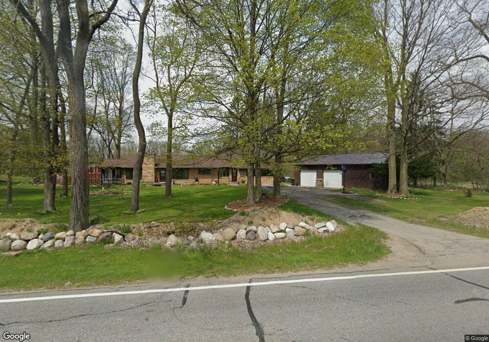
This home is located at 5631 Riverside Dr, Lyons, MI 48851 and is currently estimated at $418,318, approximately $173 per square foot. 5631 Riverside Dr is a home located in Ionia County with nearby schools including Ionia High School.
Ownership History
Date
Name
Owned For
Owner Type
Purchase Details
Closed on
Oct 18, 2013
Sold by
Haunter Marilyn and Breen Patricia
Bought by
Thelen Joshua and Thelen Elizabeth
Current Estimated Value
Home Financials for this Owner
Home Financials are based on the most recent Mortgage that was taken out on this home.
Original Mortgage
$153,122
Outstanding Balance
$115,416
Interest Rate
4.58%
Mortgage Type
VA
Estimated Equity
$302,902
Create a Home Valuation Report for This Property
The Home Valuation Report is an in-depth analysis detailing your home's value as well as a comparison with similar homes in the area
Home Values in the Area
Average Home Value in this Area
Purchase History
| Date | Buyer | Sale Price | Title Company |
|---|---|---|---|
| Thelen Joshua | $14,900 | Sun Title Agency Of Michigan |
Source: Public Records
Mortgage History
| Date | Status | Borrower | Loan Amount |
|---|---|---|---|
| Open | Thelen Joshua | $153,122 |
Source: Public Records
Tax History
| Year | Tax Paid | Tax Assessment Tax Assessment Total Assessment is a certain percentage of the fair market value that is determined by local assessors to be the total taxable value of land and additions on the property. | Land | Improvement |
|---|---|---|---|---|
| 2025 | $4,781 | $172,500 | $21,600 | $150,900 |
| 2024 | $17 | $172,500 | $21,600 | $150,900 |
| 2023 | $1,576 | $162,300 | $19,900 | $142,400 |
| 2022 | $1,501 | $162,300 | $19,900 | $142,400 |
| 2021 | $4,220 | $162,400 | $19,800 | $142,600 |
| 2020 | $1,441 | $162,400 | $19,800 | $142,600 |
| 2019 | $895 | $91,700 | $18,000 | $73,700 |
| 2018 | $2,521 | $92,400 | $18,000 | $74,400 |
| 2017 | $902 | $92,400 | $18,000 | $74,400 |
| 2016 | $895 | $89,000 | $16,100 | $72,900 |
| 2015 | -- | $89,000 | $16,100 | $72,900 |
| 2014 | $941 | $81,700 | $16,100 | $65,600 |
Source: Public Records
Map
Nearby Homes
- 109 Libhart St
- 134 Prairie St
- 645 Lyons St
- 265 S Tabor St
- 1067 Somers Rd
- 1170 Somers Rd
- 1273 E Bridge St
- 402 Liberty St
- 1100 Hayes Rd
- 214 Wilson Ln
- 3721 E Stage Rd
- 781 Hopkins Rd
- 8125 Kimball Rd
- 2713 Hillcrest Dr
- 7394 Reeder Rd
- 2822 Olmstead Rd
- 2275 Kingston Farm Ln
- 735 Prairie Creek Rd
- 2239 Kingston Farm Ln
- Lot 17 Field Crest Point
- 5631 Riverside Dr
- 5501 Riverside Dr
- 5540 Riverside Dr
- 5651 Riverside Dr
- 5705 Riverside Dr
- 5701 Riverside Dr
- 5701 Riverside Dr
- 5515 Riverside Dr
- 5741 Riverside Dr
- 5741 Riverside Dr
- 5700 Riverside Dr
- 5710 Riverside Dr
- 5710 Riverside Dr
- 133 Libhart St
- 5476 Riverside Dr
- 105 Libhart St
- 5793 Riverside Dr
- 5748 Riverside Dr
- 5975 Riverside Dr
- 233 Libhart St
Your Personal Tour Guide
Ask me questions while you tour the home.