Estimated Value: $252,610 - $270,000
About This Home
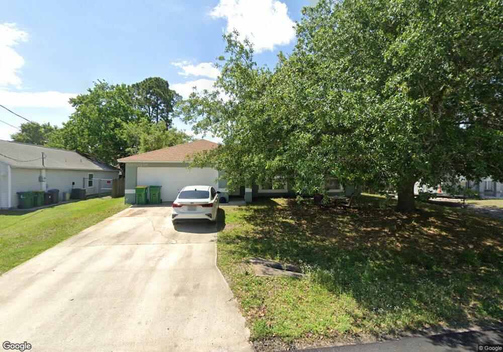
This home is located at 5635 Graham St, Cocoa, FL 32927 and is currently estimated at $261,403, approximately $240 per square foot. 5635 Graham St is a home located in Brevard County with nearby schools including Enterprise Elementary School, Space Coast Junior/Senior High School, and East Atlantic Prep of Brevard County.
Ownership History
We collect this data history from publicly available records. To have your information removed, we recommend requesting removal directly through your county’s website.
Purchase Details
Home Financials for this Owner
Home Financials are based on the most recent Mortgage that was taken out on this home.Purchase Details
Home Values in the Area
Average Home Value in this Area
Purchase History
We collect this data history from publicly available records. To have your information removed, we recommend requesting removal directly through your county’s website.
| Date | Buyer | Sale Price | Title Company |
|---|---|---|---|
| $83,800 | -- | ||
| $13,000 | -- |
Mortgage History
We collect this data history from publicly available records. To have your information removed, we recommend requesting removal directly through your county’s website.
| Date | Status | Borrower | Loan Amount |
|---|---|---|---|
| Open | $82,432 |
Tax History
We collect this data history from publicly available records. To have your information removed, we recommend requesting removal directly through your county’s website.
| Year | Tax Paid | Tax Assessment Tax Assessment Total Assessment is a certain percentage of the fair market value that is determined by local assessors to be the total taxable value of land and additions on the property. | Land | Improvement |
|---|---|---|---|---|
| 2025 | $971 | $75,870 | -- | -- |
| 2024 | $952 | $73,740 | -- | -- |
| 2023 | $952 | $71,600 | $0 | $0 |
| 2022 | $897 | $69,520 | $0 | $0 |
| 2021 | $901 | $67,500 | $0 | $0 |
| 2020 | $868 | $66,570 | $0 | $0 |
| 2019 | $816 | $65,080 | $0 | $0 |
| 2018 | $818 | $63,870 | $0 | $0 |
| 2017 | $822 | $62,560 | $0 | $0 |
| 2016 | $829 | $61,280 | $18,000 | $43,280 |
| 2015 | $836 | $60,860 | $15,000 | $45,860 |
| 2014 | $840 | $60,380 | $11,000 | $49,380 |
Map
- 5640 Brandon St
- 6990 Marvin Ave
- 5555 Brandon St
- 6965 Hundred Acre Dr
- 7200 Oakwood Ave
- 6643 Emil Ave
- 6581 Bancroft Ave
- 6615 Dock Ave
- 5551 Cinnamon Fern Blvd
- 6570 Bancroft Ave
- 7368 Crepe Myrtle Ct
- 6574 Haven Ave
- 6813 Cecil Rd
- 5165 Patricia St
- 5350 Cinnamon Fern Blvd
- 6560 Dock Ave
- 6601 Cedar Ave
- 5155 Mayflower St
- 5145 Carter St
- 6635 Homestead Ave
- 5645 Graham St
- 5625 Graham St
- 5705 Graham St
- 5670 Graham St
- 5630 Hemsing St
- 5640 Hemsing St
- 5620 Hemsing St
- 5655 Graham St
- 5615 Graham St
- 5630 Graham St
- 5640 Graham St
- 5610 Graham St
- 5650 Hemsing St
- 5610 Hemsing St
- 5665 Graham St
- 5605 Graham St
- 5660 Hemsing St
- 5600 Hemsing St
- 5660 Graham St
- 5635 Hemsing St
Ask me questions while you tour the home.