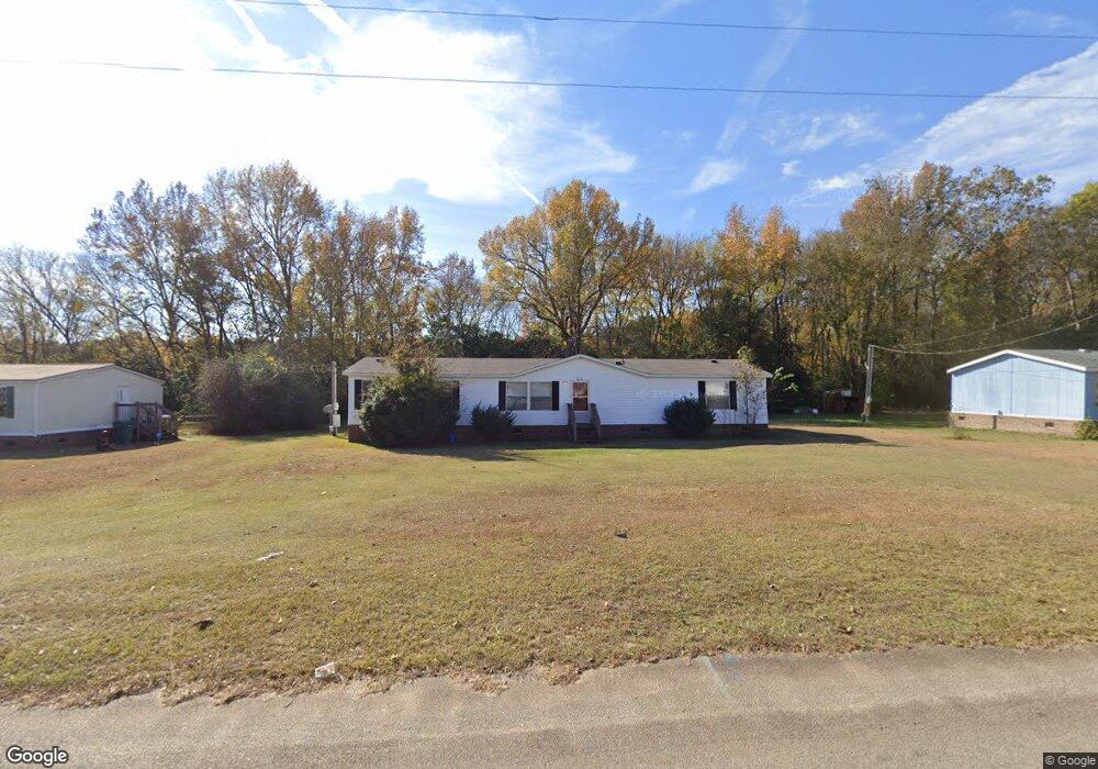
5635 Pear Tree Rd Wedgefield, SC 29168
Estimated Value: $16,517 - $110,000
4
Beds
2
Baths
1,848
Sq Ft
$34/Sq Ft
Est. Value
About This Home
This home is located at 5635 Pear Tree Rd, Wedgefield, SC 29168 and is currently estimated at $63,259, approximately $34 per square foot. 5635 Pear Tree Rd is a home located in Sumter County with nearby schools including F. J. Delaine Elementary, Furman Middle School, and Lakewood High School.
Ownership History
Date
Name
Owned For
Owner Type
Purchase Details
Closed on
May 3, 2013
Sold by
Lincoln Edward A and Lincoln Carrie J
Bought by
Mcleod Jesse E
Current Estimated Value
Purchase Details
Closed on
May 24, 2010
Sold by
Selene Rmof Reo Acquisition Ii Llc
Bought by
Lincoln Edward A and Lincoln Carrie J
Purchase Details
Closed on
Dec 21, 2009
Sold by
Taylor Bean & Whitaker Mortgage Corp
Bought by
Selene Rmof Reo Acquisition Ii Llc
Purchase Details
Closed on
Oct 28, 2005
Sold by
Parker Emily A
Bought by
Bean Taylor
Purchase Details
Closed on
Aug 3, 2004
Sold by
Smith Charles
Bought by
Parker Emily A
Create a Home Valuation Report for This Property
The Home Valuation Report is an in-depth analysis detailing your home's value as well as a comparison with similar homes in the area
Purchase History
| Date | Buyer | Sale Price | Title Company |
|---|---|---|---|
| Mcleod Jesse E | $8,000 | -- | |
| Lincoln Edward A | $18,950 | -- | |
| Selene Rmof Reo Acquisition Ii Llc | $11,716 | -- | |
| Bean Taylor | $10,000 | -- | |
| Parker Emily A | $72,000 | -- |
Source: Public Records
Tax History
| Year | Tax Paid | Tax Assessment Tax Assessment Total Assessment is a certain percentage of the fair market value that is determined by local assessors to be the total taxable value of land and additions on the property. | Land | Improvement |
|---|---|---|---|---|
| 2025 | $127 | $390 | $390 | -- |
| 2024 | $127 | $390 | $390 | -- |
| 2023 | $127 | $390 | $390 | $0 |
| 2022 | $127 | $390 | $390 | $0 |
| 2021 | $130 | $390 | $390 | $0 |
| 2020 | $130 | $390 | $390 | $0 |
| 2019 | $129 | $390 | $390 | $0 |
| 2018 | $129 | $390 | $390 | $0 |
| 2017 | $128 | $390 | $390 | $0 |
| 2016 | $167 | $390 | $390 | $0 |
| 2015 | -- | $510 | $510 | $0 |
| 2014 | -- | $510 | $510 | $0 |
| 2013 | -- | $720 | $720 | $0 |
Source: Public Records
Map
Nearby Homes
- 0 Vargas Ln Unit 9
- 5830 Arthur Rd
- 2120 Highway 261 S
- 4845 Patriot Pkwy
- 805 Eagle Rd
- 1 Ramblewood Ln
- 5925 Lost Creek Dr
- 4620 Chanson Ln
- 0 Lantern Ln
- 6632 S Mayrant Cir
- 942 Gene Dr
- 1531 Peach Orchard Rd
- 5590 Broad St
- 1726 Marden Rd
- 000 Stateburg Twns
- 00 Stateburg Twns
- 6645 Stateburg Hills Dr
- 705 George Washington Blvd
- 5740 Oakhill Rd
- 6250 Cougar Way
- 5625 Pear Tree Rd
- 50 Kiwi Ct
- 5630 Peartree Rd
- 5655 Peartree Rd
- 5640 Peartree Rd
- 5610 Peartree Rd
- 30 Kiwi Ct
- 5660 Peartree Rd
- 5625 Peachtree Rd
- 5645 Peach Tree Rd
- 70 Kiwi Ct
- 5675 Peartree Rd
- 5615 Peach Tree Rd
- 5655 Peachtree Rd
- 20 Kiwi Ct
- 5935 Dowry Rd
- 5262 Peach Tree Rd
- 5605 Peachtree Rd
- 5945 Dowry Rd
- 5845 Mclaurin Rd
Your Personal Tour Guide
Ask me questions while you tour the home.