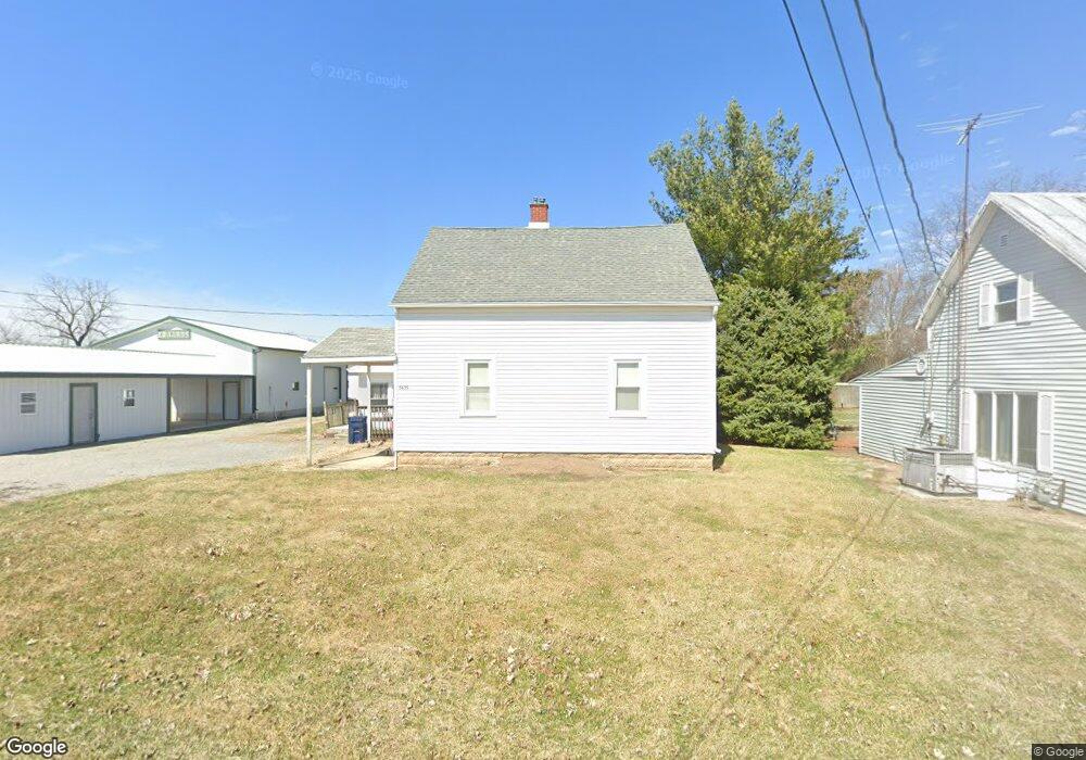
5635 Port St Columbus Grove, OH 45830
Estimated Value: $108,000 - $211,000
3
Beds
2
Baths
1,747
Sq Ft
$86/Sq Ft
Est. Value
About This Home
This home is located at 5635 Port St, Columbus Grove, OH 45830 and is currently estimated at $150,714, approximately $86 per square foot. 5635 Port St is a home located in Allen County with nearby schools including Bluffton Elementary School, Bluffton Middle School, and Bluffton High School.
Ownership History
Date
Name
Owned For
Owner Type
Purchase Details
Closed on
Nov 21, 1997
Sold by
Hunsaker Penny
Bought by
Edwards Brian
Current Estimated Value
Home Financials for this Owner
Home Financials are based on the most recent Mortgage that was taken out on this home.
Original Mortgage
$25,000
Interest Rate
7.38%
Mortgage Type
New Conventional
Purchase Details
Closed on
Jan 1, 1990
Bought by
Hunsaker Richard W
Create a Home Valuation Report for This Property
The Home Valuation Report is an in-depth analysis detailing your home's value as well as a comparison with similar homes in the area
Home Values in the Area
Average Home Value in this Area
Purchase History
| Date | Buyer | Sale Price | Title Company |
|---|---|---|---|
| Edwards Brian | $40,000 | -- | |
| Hunsaker Richard W | -- | -- |
Source: Public Records
Mortgage History
| Date | Status | Borrower | Loan Amount |
|---|---|---|---|
| Closed | Edwards Brian | $25,000 |
Source: Public Records
Tax History Compared to Growth
Tax History
| Year | Tax Paid | Tax Assessment Tax Assessment Total Assessment is a certain percentage of the fair market value that is determined by local assessors to be the total taxable value of land and additions on the property. | Land | Improvement |
|---|---|---|---|---|
| 2024 | $1,091 | $33,780 | $2,980 | $30,800 |
| 2023 | $972 | $27,690 | $2,450 | $25,240 |
| 2022 | $977 | $27,690 | $2,450 | $25,240 |
| 2021 | $1,008 | $27,690 | $2,450 | $25,240 |
| 2020 | $862 | $22,090 | $2,350 | $19,740 |
| 2019 | $862 | $22,090 | $2,350 | $19,740 |
| 2018 | $854 | $22,090 | $2,350 | $19,740 |
| 2017 | $824 | $20,310 | $2,350 | $17,960 |
| 2016 | $839 | $20,310 | $2,350 | $17,960 |
| 2015 | $779 | $20,310 | $2,350 | $17,960 |
| 2014 | $779 | $18,660 | $2,070 | $16,590 |
| 2013 | $724 | $18,660 | $2,070 | $16,590 |
Source: Public Records
Map
Nearby Homes
- 00000 Ohio 696
- 000 Ohio 696
- 0000 Ohio 696
- 7957 Hillville Rd
- 8305 Hillville Rd
- 8160 Columbus Grove-Bluffton Rd
- 6601 N Napoleon Rd
- 108 E Main St
- 207 W Prospect St
- 5025 N Cool Rd
- 8900 N Dixie Hwy
- 11059 Ottawa Rd
- 6476 Mickelson Ln
- 0 Lincoln Hwy
- 204 S Broadway St
- 205 S Broadway St
- 308 Delphos Rd
- 17429 Road 5
- 4619 N Thayer Rd
- 9290 Lincoln Hwy