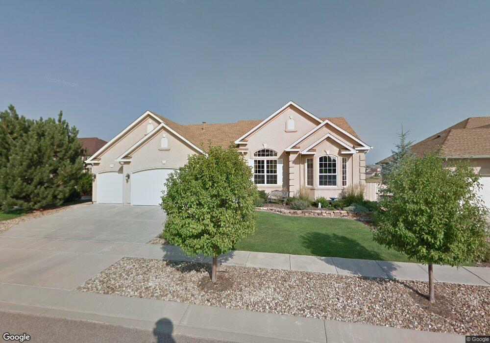
5636 Range Rider Dr Colorado Springs, CO 80923
Ridgeview NeighborhoodEstimated Value: $641,000 - $687,000
5
Beds
4
Baths
2,286
Sq Ft
$290/Sq Ft
Est. Value
About This Home
This home is located at 5636 Range Rider Dr, Colorado Springs, CO 80923 and is currently estimated at $661,816, approximately $289 per square foot. 5636 Range Rider Dr is a home located in El Paso County with nearby schools including Stetson Elementary School, Skyview Middle School, and Sand Creek High School.
Ownership History
Date
Name
Owned For
Owner Type
Purchase Details
Closed on
Sep 29, 2009
Sold by
Aicardi Stevenson John L and Aicardi Stevenson Margaret
Bought by
Hulin Donald and Hulin Carol
Current Estimated Value
Purchase Details
Closed on
Aug 29, 2003
Sold by
Elite Properties Of America Inc
Bought by
Aicardi Stevenson John L and Aicardi Stevenson Margaret
Home Financials for this Owner
Home Financials are based on the most recent Mortgage that was taken out on this home.
Original Mortgage
$140,000
Interest Rate
6.08%
Mortgage Type
Unknown
Purchase Details
Closed on
Mar 17, 2003
Sold by
Indigo Ranch Llc
Bought by
Elite Properties Of America Inc
Create a Home Valuation Report for This Property
The Home Valuation Report is an in-depth analysis detailing your home's value as well as a comparison with similar homes in the area
Home Values in the Area
Average Home Value in this Area
Purchase History
| Date | Buyer | Sale Price | Title Company |
|---|---|---|---|
| Hulin Donald | $330,000 | Land Title Guarantee Company | |
| Aicardi Stevenson John L | $409,638 | Land Title | |
| Elite Properties Of America Inc | $138,068 | Land Title |
Source: Public Records
Mortgage History
| Date | Status | Borrower | Loan Amount |
|---|---|---|---|
| Previous Owner | Aicardi Stevenson John L | $140,000 | |
| Closed | Aicardi Stevenson John L | $95,000 |
Source: Public Records
Tax History Compared to Growth
Tax History
| Year | Tax Paid | Tax Assessment Tax Assessment Total Assessment is a certain percentage of the fair market value that is determined by local assessors to be the total taxable value of land and additions on the property. | Land | Improvement |
|---|---|---|---|---|
| 2025 | $3,605 | $46,740 | -- | -- |
| 2024 | $3,250 | $46,810 | $7,400 | $39,410 |
| 2023 | $3,250 | $46,810 | $7,400 | $39,410 |
| 2022 | $2,597 | $35,510 | $6,670 | $28,840 |
| 2021 | $2,723 | $36,530 | $6,860 | $29,670 |
| 2020 | $2,235 | $32,860 | $5,720 | $27,140 |
| 2019 | $2,835 | $32,860 | $5,720 | $27,140 |
| 2018 | $2,603 | $29,810 | $4,840 | $24,970 |
| 2017 | $2,613 | $29,810 | $4,840 | $24,970 |
| 2016 | $2,604 | $30,280 | $4,710 | $25,570 |
| 2015 | $2,606 | $30,280 | $4,710 | $25,570 |
| 2014 | $2,268 | $25,990 | $4,460 | $21,530 |
Source: Public Records
Map
Nearby Homes
- 5625 Dusty Chaps Dr
- 5465 War Paint Place
- 6481 Summer Grace St
- 5715 Brennan Ave
- 6734 Akerman Dr
- 5739 Brennan Ave
- 6819 Barela Ct
- 5307 Belle Star Dr
- 6578 Summer Grace St
- 5275 Belle Star Dr
- 5315 War Paint Place
- 6145 Plowshare Ct
- 6771 Sunny Alp St
- 5918 Whiskey River Dr
- 7340 Amberly Dr
- 6853 Summer Grace St
- 6016 Wild Bill Way
- 5889 Brennan Ave
- 7368 Prythania Park Dr
- 7668 Amberly Dr
- 5648 Range Rider Dr
- 5624 Range Rider Dr
- 5612 Range Rider Dr
- 5592 Wyatt Earp Way
- 5672 Range Rider Dr
- 5593 Wyatt Earp Way
- 5588 Range Rider Dr
- 5574 Wyatt Earp Way
- 5611 Range Rider Dr
- 5684 Range Rider Dr
- 5557 Wyatt Earp Way
- 5587 Range Rider Dr
- 5556 Wyatt Earp Way
- 5696 Range Rider Dr
- 5576 Range Rider Dr
- 5568 Calamity Jane Ln
- 5575 Range Rider Dr
- 5539 Wyatt Earp Way
- 5538 Wyatt Earp Way
- 5518 Whiskey River Dr