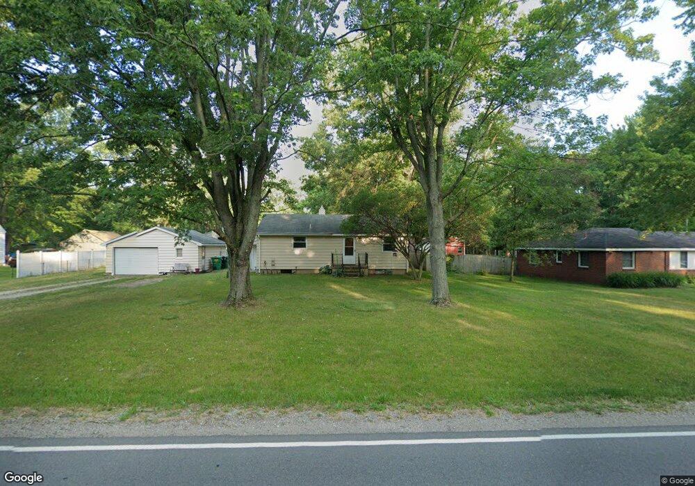
56365 Quince Rd South Bend, IN 46619
Estimated Value: $206,000 - $233,000
3
Beds
2
Baths
1,184
Sq Ft
$187/Sq Ft
Est. Value
About This Home
This home is located at 56365 Quince Rd, South Bend, IN 46619 and is currently estimated at $221,056, approximately $186 per square foot. 56365 Quince Rd is a home located in St. Joseph County with nearby schools including Paton-Churdan Elementary School, Warren Elementary School, and Clay Intermediate Center.
Ownership History
Date
Name
Owned For
Owner Type
Purchase Details
Closed on
May 8, 2009
Sold by
Fick Michael S
Bought by
Coffee Michael A
Current Estimated Value
Home Financials for this Owner
Home Financials are based on the most recent Mortgage that was taken out on this home.
Original Mortgage
$77,600
Outstanding Balance
$48,977
Interest Rate
4.83%
Mortgage Type
New Conventional
Estimated Equity
$172,079
Purchase Details
Closed on
Oct 26, 2005
Sold by
Fick Melba B
Bought by
Fick Michael S
Create a Home Valuation Report for This Property
The Home Valuation Report is an in-depth analysis detailing your home's value as well as a comparison with similar homes in the area
Home Values in the Area
Average Home Value in this Area
Purchase History
| Date | Buyer | Sale Price | Title Company |
|---|---|---|---|
| Coffee Michael A | -- | Meridian Title Corp | |
| Fick Michael S | -- | None Available | |
| Fick Melba B | -- | None Available |
Source: Public Records
Mortgage History
| Date | Status | Borrower | Loan Amount |
|---|---|---|---|
| Open | Coffee Michael A | $77,600 |
Source: Public Records
Tax History Compared to Growth
Tax History
| Year | Tax Paid | Tax Assessment Tax Assessment Total Assessment is a certain percentage of the fair market value that is determined by local assessors to be the total taxable value of land and additions on the property. | Land | Improvement |
|---|---|---|---|---|
| 2024 | $2,071 | $180,300 | $43,500 | $136,800 |
| 2023 | $1,962 | $190,100 | $43,500 | $146,600 |
| 2022 | $2,017 | $169,600 | $43,500 | $126,100 |
| 2021 | $1,607 | $136,400 | $22,700 | $113,700 |
| 2020 | $1,288 | $119,600 | $19,900 | $99,700 |
| 2019 | $1,168 | $125,600 | $20,900 | $104,700 |
| 2018 | $1,112 | $120,100 | $19,700 | $100,400 |
| 2017 | $1,172 | $120,500 | $19,700 | $100,800 |
| 2016 | $1,238 | $120,600 | $19,700 | $100,900 |
| 2014 | $845 | $98,400 | $16,400 | $82,000 |
Source: Public Records
Map
Nearby Homes
- 56451 Quince Rd
- 57115 White Pine Trail
- 55629 Cardinal Dr
- 57210 White Pine Trail
- 57223 Pine Needle Ct
- 26366 Hummingbird Rd
- 26541 Gaited Horse Trail
- 57248 Mcquade St
- 54962 Quince Rd
- 55915 Dorn St
- 27180 Harrison Rd
- 57860 Crumstown Hwy
- 56435 Eastlea Dr
- 57195 Pinewood Dr
- 54483 Whitesell Dr
- 54520 Norwood Dr
- 54492 Avalon Dr
- 0 Lakewood Dr
- 25849 Kenwood Dr
- 25260 Fillmore Rd
- 56387 Quince Rd
- 56351 Quince Rd
- 56423 Quince Rd
- 56333 Quince Rd
- 56311 Quince Rd
- 56408 Quince Rd
- 56450 Quince Rd
- 26481 State Road 2
- 26445 State Road 2
- 26481 Western Ave
- 26495 State Road 2
- 56259 Quince Rd
- 26547 State Road 2
- 26617 State Road 2
- 26559 State Road 2
- 26365 State Road 2
- 26333 State Road 2
- 56219 Quince Rd
- 56350 Quince Rd
- 26645 State Road 2