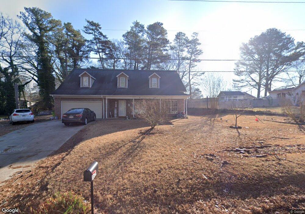
5639 Burrus Rd Austell, GA 30106
Estimated Value: $394,000 - $408,000
4
Beds
4
Baths
2,541
Sq Ft
$158/Sq Ft
Est. Value
About This Home
This home is located at 5639 Burrus Rd, Austell, GA 30106 and is currently estimated at $400,874, approximately $157 per square foot. 5639 Burrus Rd is a home with nearby schools including Deerwood Elementary School, Mableton Elementary School, and Garrett Middle School.
Ownership History
Date
Name
Owned For
Owner Type
Purchase Details
Closed on
Feb 5, 2007
Sold by
Soriano Julio
Bought by
Soriano Julio and Soriano Sonia I
Current Estimated Value
Home Financials for this Owner
Home Financials are based on the most recent Mortgage that was taken out on this home.
Original Mortgage
$208,850
Outstanding Balance
$124,321
Interest Rate
6.14%
Mortgage Type
New Conventional
Estimated Equity
$276,553
Purchase Details
Closed on
Feb 15, 2005
Sold by
Decoteau Oneil G
Bought by
K & E Venture Equities Inc
Home Financials for this Owner
Home Financials are based on the most recent Mortgage that was taken out on this home.
Original Mortgage
$108,675
Interest Rate
5.69%
Create a Home Valuation Report for This Property
The Home Valuation Report is an in-depth analysis detailing your home's value as well as a comparison with similar homes in the area
Home Values in the Area
Average Home Value in this Area
Purchase History
| Date | Buyer | Sale Price | Title Company |
|---|---|---|---|
| Soriano Julio | $208,875 | -- | |
| Soriano Julio | $208,900 | -- | |
| K & E Venture Equities Inc | -- | -- | |
| Decoteau Oneil G | $32,000 | -- |
Source: Public Records
Mortgage History
| Date | Status | Borrower | Loan Amount |
|---|---|---|---|
| Open | Soriano Julio | $208,850 | |
| Previous Owner | Decoteau Oneil G | $108,675 |
Source: Public Records
Tax History Compared to Growth
Tax History
| Year | Tax Paid | Tax Assessment Tax Assessment Total Assessment is a certain percentage of the fair market value that is determined by local assessors to be the total taxable value of land and additions on the property. | Land | Improvement |
|---|---|---|---|---|
| 2025 | $3,481 | $153,512 | $31,920 | $121,592 |
| 2024 | $3,484 | $153,512 | $31,920 | $121,592 |
| 2023 | $2,449 | $130,816 | $31,920 | $98,896 |
| 2022 | $2,368 | $101,220 | $20,160 | $81,060 |
| 2021 | $2,079 | $88,032 | $17,472 | $70,560 |
| 2020 | $1,991 | $84,000 | $13,440 | $70,560 |
| 2019 | $1,991 | $84,000 | $13,440 | $70,560 |
| 2018 | $1,750 | $72,976 | $7,728 | $65,248 |
| 2017 | $1,271 | $53,976 | $5,040 | $48,936 |
| 2016 | $1,272 | $53,976 | $5,040 | $48,936 |
| 2015 | $1,339 | $55,560 | $3,360 | $52,200 |
| 2014 | $1,214 | $49,692 | $0 | $0 |
Source: Public Records
Map
Nearby Homes
- 5531 Wild Cherry Dr SW
- 5590 Lakeview Dr SW
- 1676 Veterans Memorial Hwy SW
- 5832 Silver Lake Dr
- 1628 Pendley Dr
- 1582 Pine Cir
- 5425 Davis Dr
- 5393 Janet Ln
- 5320 Beth Dr
- 1397 Jewell Ct SW
- 5615 Hislop Ln Unit 82
- 5410 Beth Dr
- 0 Dogwood Cir Unit 7671035
- 0 Dogwood Cir Unit 10630776
- 5466 Davis Dr
- 0 Harris St Unit 7661273
- 1841 Mobley St
- 5800 Cedar Ln SW
- 1766 Blossom Ln
- 1426 Thunderwood Ln SW
- 5624 Burrus Rd
- 5671 Burrus Rd
- 5634 Zanola Dr SW
- 5620 Zanola Dr SW
- 5620 Zanola A&b Dr SW
- 5620 Zanola Dr SW
- 5620-A-B Zanola Dr SW
- 5648 Zanola Dr SW
- 5610 Zanola Dr SW
- 5670 Burrus Rd
- 5660 Zanola Dr SW
- 5602 Zanola Dr SW Unit 5604
- 5633 Zanola Dr SW
- 0 Zanola Dr SW Unit 3247529
- 0 Zanola Dr SW Unit 8243947
- 0 Zanola Dr SW Unit 8169092
- 0 Zanola Dr SW Unit 8106865
- 5575 Burrus Rd
- 5615 Zanola Dr SW
- 5596 Zanola Dr SW