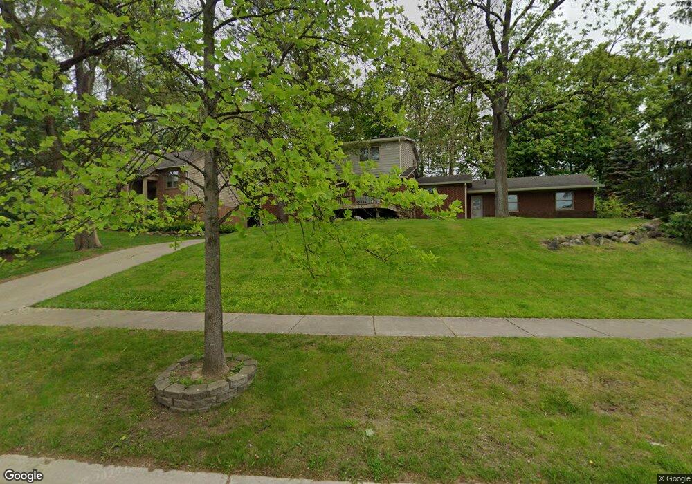
564 Bloomer Ridge Dr Unit Bldg-Unit Rochester, MI 48307
Estimated Value: $424,253 - $461,000
4
Beds
3
Baths
1,769
Sq Ft
$253/Sq Ft
Est. Value
About This Home
This home is located at 564 Bloomer Ridge Dr Unit Bldg-Unit, Rochester, MI 48307 and is currently estimated at $446,813, approximately $252 per square foot. 564 Bloomer Ridge Dr Unit Bldg-Unit is a home located in Oakland County with nearby schools including Hart Middle School, McGregor Elementary School, and Stoney Creek High School.
Ownership History
Date
Name
Owned For
Owner Type
Purchase Details
Closed on
Jul 6, 2023
Sold by
Parks Chad J
Bought by
Bittner Frederick A and Cuevas-Garcia Olivia
Current Estimated Value
Purchase Details
Closed on
Jul 9, 2018
Sold by
Beverly William R and Beverly Heidi M
Bought by
Parks Chad J
Home Financials for this Owner
Home Financials are based on the most recent Mortgage that was taken out on this home.
Original Mortgage
$264,810
Interest Rate
4.5%
Mortgage Type
New Conventional
Purchase Details
Closed on
Jun 20, 2000
Sold by
Beverly William R
Bought by
Beverly William R
Purchase Details
Closed on
Aug 29, 1999
Sold by
Beverly Robert W
Bought by
Beverly William R
Create a Home Valuation Report for This Property
The Home Valuation Report is an in-depth analysis detailing your home's value as well as a comparison with similar homes in the area
Home Values in the Area
Average Home Value in this Area
Purchase History
| Date | Buyer | Sale Price | Title Company |
|---|---|---|---|
| Bittner Frederick A | $385,000 | None Listed On Document | |
| Parks Chad J | $273,000 | None Available | |
| Beverly William R | -- | -- | |
| Beverly William R | -- | -- |
Source: Public Records
Mortgage History
| Date | Status | Borrower | Loan Amount |
|---|---|---|---|
| Previous Owner | Parks Chad J | $264,810 |
Source: Public Records
Tax History Compared to Growth
Tax History
| Year | Tax Paid | Tax Assessment Tax Assessment Total Assessment is a certain percentage of the fair market value that is determined by local assessors to be the total taxable value of land and additions on the property. | Land | Improvement |
|---|---|---|---|---|
| 2024 | $4,654 | $159,300 | $0 | $0 |
| 2023 | $3,465 | $131,590 | $0 | $0 |
| 2022 | $4,527 | $114,530 | $0 | $0 |
| 2021 | $3,463 | $113,420 | $0 | $0 |
| 2020 | $3,251 | $109,120 | $0 | $0 |
| 2019 | $3,575 | $105,260 | $0 | $0 |
| 2018 | $3,132 | $107,170 | $0 | $0 |
| 2017 | $3,071 | $105,990 | $0 | $0 |
| 2016 | $2,974 | $103,080 | $0 | $0 |
| 2015 | -- | $97,510 | $0 | $0 |
| 2014 | -- | $93,020 | $0 | $0 |
| 2011 | -- | $85,380 | $0 | $0 |
Source: Public Records
Map
Nearby Homes
- 435 Thornridge Ct
- 420 Baldwin Ave Unit 79
- 755 Legault Ct Unit 755
- 433 Miller Ave Unit 204
- 804 E Avon Rd
- 822 Hadley Rd
- 386 Dalton Dr
- 496 E Avon Rd
- 151 Dalton Dr
- 183 Marais Dr Unit 183
- 1051 E Avon Rd
- 1055 E Avon Rd
- 527 E University Dr Unit 1108
- 385 Tourangeau Dr Unit 385
- 959 Pine Trail Dr
- 509 E University Dr Unit 508
- 199 Marais Dr
- 428 East St
- 29 Carondelet Ct Unit 29
- 378 Tourangeau Dr
- 564 Bloomer Ridge Dr
- 570 Bloomer Ridge Dr
- 558 Bloomer Ridge Dr
- 561 Arlington Dr Unit Bldg-Unit
- 561 Arlington Dr
- 567 Arlington Dr
- 555 Arlington Dr
- 552 Bloomer Ridge Dr
- 745 Berry Nook Ln
- 120 Spruce Ln
- 549 Arlington Dr
- 555 Bloomer Ridge Dr
- 546 Bloomer Ridge Dr
- 582 Bloomer Ridge Dr
- 549 Bloomer Ridge Dr
- 126 Spruce Ln
- 543 Arlington Dr
- 796 Whitney Dr
- 560 Arlington Dr
- 566 Arlington Dr