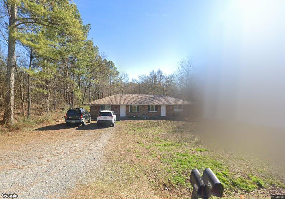
564 Clark Rd Unit 564 Tunnel Hill, GA 30755
Tunnel Hill NeighborhoodEstimated Value: $205,000 - $269,000
--
Bed
2
Baths
1,769
Sq Ft
$126/Sq Ft
Est. Value
About This Home
This home is located at 564 Clark Rd Unit 564, Tunnel Hill, GA 30755 and is currently estimated at $223,538, approximately $126 per square foot. 564 Clark Rd Unit 564 is a home located in Catoosa County with nearby schools including Tiger Creek Elementary School, Ringgold Middle School, and Ringgold High School.
Ownership History
Date
Name
Owned For
Owner Type
Purchase Details
Closed on
Aug 15, 2017
Sold by
Hunter Malinda
Bought by
Hunter William
Current Estimated Value
Home Financials for this Owner
Home Financials are based on the most recent Mortgage that was taken out on this home.
Original Mortgage
$105,552
Outstanding Balance
$87,255
Interest Rate
3.62%
Mortgage Type
FHA
Estimated Equity
$136,283
Purchase Details
Closed on
Mar 31, 2015
Sold by
Eades Michelle
Bought by
Hunter Malinda and Hunter Brian
Purchase Details
Closed on
Feb 9, 2012
Bought by
Eades Michelle
Purchase Details
Closed on
Nov 2, 2010
Sold by
Motley Perry
Bought by
First National Bank Of Chatswo
Purchase Details
Closed on
Feb 1, 2001
Bought by
Motley James Perry
Create a Home Valuation Report for This Property
The Home Valuation Report is an in-depth analysis detailing your home's value as well as a comparison with similar homes in the area
Home Values in the Area
Average Home Value in this Area
Purchase History
| Date | Buyer | Sale Price | Title Company |
|---|---|---|---|
| Hunter William | $107,500 | -- | |
| Hunter Malinda | $72,500 | -- | |
| Eades Michelle | $28,000 | -- | |
| First National Bank Of Chatswo | -- | -- | |
| Motley James Perry | $60,000 | -- |
Source: Public Records
Mortgage History
| Date | Status | Borrower | Loan Amount |
|---|---|---|---|
| Open | Hunter William | $105,552 |
Source: Public Records
Tax History Compared to Growth
Tax History
| Year | Tax Paid | Tax Assessment Tax Assessment Total Assessment is a certain percentage of the fair market value that is determined by local assessors to be the total taxable value of land and additions on the property. | Land | Improvement |
|---|---|---|---|---|
| 2024 | $1,271 | $100,736 | $4,754 | $95,982 |
| 2023 | $1,415 | $63,225 | $2,263 | $60,962 |
| 2022 | $1,061 | $47,375 | $2,155 | $45,220 |
| 2021 | $991 | $47,375 | $2,155 | $45,220 |
| 2020 | $928 | $40,100 | $2,052 | $38,048 |
| 2019 | $938 | $40,100 | $2,052 | $38,048 |
| 2018 | $991 | $40,100 | $2,052 | $38,048 |
| 2017 | $706 | $28,591 | $2,052 | $26,539 |
| 2016 | $682 | $26,230 | $2,052 | $24,178 |
| 2015 | -- | $19,986 | $2,052 | $17,934 |
| 2014 | -- | $21,786 | $3,852 | $17,934 |
| 2013 | -- | $21,785 | $3,852 | $17,933 |
Source: Public Records
Map
Nearby Homes
- 30 Ronnie Ln
- 12523 Highway 41
- 315 Mirror Lake Rd
- 562 Gordy Cir
- 219 Lineman Way
- 808 Gordy Cir
- 126 Marilyn Way
- 11759 Highway 41
- 219 Windbrook Dr
- 0 Buttercup Ln
- 153 Lees Chapel Rd
- 301 Harper Valley Dr
- 863 Bandy Ln
- 65 Henry Lee Ln
- 360 N Lakeshore Dr
- 0 Houston Valley Rd Unit 1398139
- 0 Greenwood Rd Unit RTC3013946
- 0 Greenwood Rd Unit 1522046
- 400 Crawford Terrace
- 97 Homeplace Dr
- 564 Clark Rd
- 584 Clark Rd
- 544 Clark Rd
- 55 Goldnickel Ln
- 330 Pine Hill Rd
- 300 Clark Rd
- 306 Pine Hill Rd
- 300 Pine Hill Rd
- 76 Robins Flight Ln
- 325 Pine Hill Rd
- 294 Pine Hill Rd
- 294 Pine Hill Rd
- 38 Griggs Rd
- 110 Robins Flight Ln
- 474 Clark Rd
- 113 Goldnickel Ln
- 272 Goldnickel Ln
- 668 Clark Rd
- 289 Pine Hill Rd
- 264 Pine Hill Rd