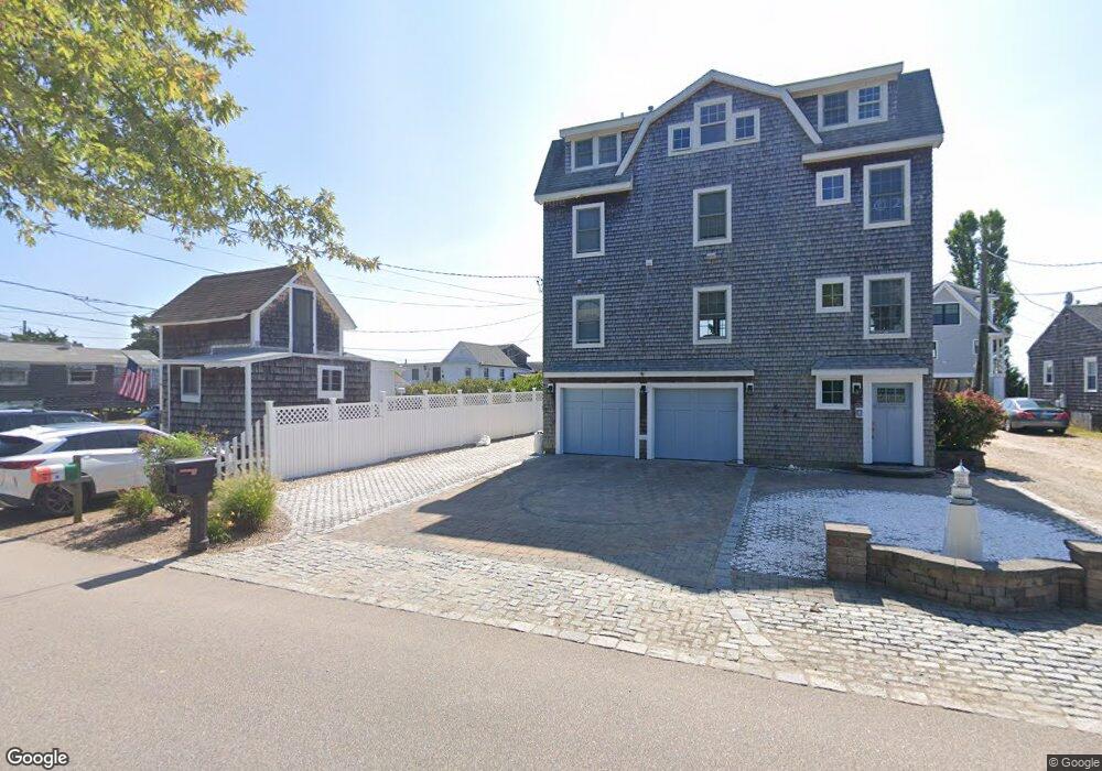
564 Seaside Ave Westbrook, CT 06498
Estimated Value: $635,000 - $950,248
About This Home
This home is located at 564 Seaside Ave, Westbrook, CT 06498 and is currently estimated at $864,062, approximately $1,263 per square foot. 564 Seaside Ave is a home located in Middlesex County with nearby schools including Daisy Ingraham School, Westbrook Middle School, and Westbrook High School.
Ownership History
We collect this data history from publicly available records. To have your information removed, we recommend requesting removal directly through your county’s website.
Purchase Details
Home Values in the Area
Average Home Value in this Area
Purchase History
We collect this data history from publicly available records. To have your information removed, we recommend requesting removal directly through your county’s website.
| Date | Buyer | Sale Price | Title Company |
|---|---|---|---|
| $1,175,000 | None Available |
Tax History
We collect this data history from publicly available records. To have your information removed, we recommend requesting removal directly through your county’s website.
| Year | Tax Paid | Tax Assessment Tax Assessment Total Assessment is a certain percentage of the fair market value that is determined by local assessors to be the total taxable value of land and additions on the property. | Land | Improvement |
|---|---|---|---|---|
| 2025 | $10,577 | $470,090 | $435,500 | $34,590 |
| 2024 | $10,201 | $470,090 | $435,500 | $34,590 |
| 2023 | $10,022 | $470,090 | $435,500 | $34,590 |
| 2022 | $9,759 | $470,090 | $435,500 | $34,590 |
| 2021 | $9,806 | $392,240 | $361,760 | $30,480 |
| 2020 | $9,806 | $392,240 | $361,760 | $30,480 |
| 2019 | $9,677 | $392,240 | $361,760 | $30,480 |
| 2018 | $9,559 | $392,240 | $361,760 | $30,480 |
| 2017 | $9,559 | $392,240 | $361,760 | $30,480 |
| 2016 | $13,604 | $587,890 | $553,280 | $34,610 |
| 2015 | $13,233 | $587,890 | $553,280 | $34,610 |
| 2014 | $12,810 | $587,890 | $553,280 | $34,610 |
Map
- 6 Leeway Dr
- 449 Seaside Ave
- 0 Boston Post Rd Unit 24080344
- 520 Marina Way Landing Unit 520
- 273 Seaside Ave
- 123 Old Mail Trail
- 47 Old Mail Trail
- 79 Wesley Ave
- 843 Old Clinton Rd
- 23 Linden Ave N
- 18 Broadway N
- 126 Magna Ln
- 15 Broadway N
- 44 Linden Ave N
- 68 Groveway
- 48 Groveway
- 7 Parker Ln
- 41 Trolley Rd
- 224 Salt Island Rd
- 29 Salt Island Rd
- 550 Seaside Ave
- 544 Seaside Ave
- 554 Seaside Ave
- 556 Seaside Ave
- 538 Seaside Ave
- 564 Seaside Ave 560 562 564
- 534 Seaside Ave
- 564/2/0 Seaside Ave
- 562 Seaside Ave
- 528 Seaside Ave
- 552 Seaside Ave
- 536 Seaside Ave
- 548 Seaside Ave
- 542 Seaside Ave
- 564,562 560 Seaside Ave
- 564 562 560 Seaside Ave
- 560 Seaside Ave
- 574 Seaside Ave
- 526 Seaside Ave
- 582 Seaside Ave
Ask me questions while you tour the home.