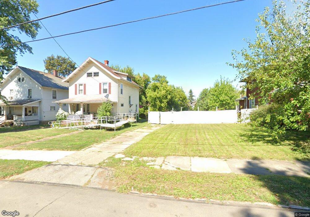
564 W 4th St Mansfield, OH 44903
Estimated Value: $81,000 - $128,000
--
Bed
1
Bath
--
Sq Ft
6,752
Sq Ft Lot
About This Home
This home is located at 564 W 4th St, Mansfield, OH 44903 and is currently estimated at $103,742. 564 W 4th St is a home located in Richland County with nearby schools including Goal Digital Academy, Mansfield Elective Academy, and Interactive Media & Construction (IMAC) Academy.
Ownership History
Date
Name
Owned For
Owner Type
Purchase Details
Closed on
Jul 6, 2015
Sold by
Wells Fargo Bank Na
Bought by
Stone Randall and Stone Michelle
Current Estimated Value
Purchase Details
Closed on
Jul 19, 2013
Sold by
Obryant Timothy E and Bryant Timothy E O
Bought by
Wells Fargo Bank Na
Purchase Details
Closed on
Apr 12, 2006
Sold by
Obryant Timothy E and Obryant Addie L
Bought by
Obryant Timothy E and Obryant Addie L
Home Financials for this Owner
Home Financials are based on the most recent Mortgage that was taken out on this home.
Original Mortgage
$64,601
Interest Rate
6.34%
Mortgage Type
FHA
Purchase Details
Closed on
Apr 27, 2001
Sold by
Blackston James A
Bought by
O'Bryant Timothy E
Home Financials for this Owner
Home Financials are based on the most recent Mortgage that was taken out on this home.
Original Mortgage
$53,953
Interest Rate
7.03%
Mortgage Type
FHA
Create a Home Valuation Report for This Property
The Home Valuation Report is an in-depth analysis detailing your home's value as well as a comparison with similar homes in the area
Home Values in the Area
Average Home Value in this Area
Purchase History
| Date | Buyer | Sale Price | Title Company |
|---|---|---|---|
| Stone Randall | $33,800 | Attorney | |
| Wells Fargo Bank Na | $4,000 | None Available | |
| Obryant Timothy E | -- | Southern Title | |
| O'Bryant Timothy E | $54,800 | -- |
Source: Public Records
Mortgage History
| Date | Status | Borrower | Loan Amount |
|---|---|---|---|
| Previous Owner | Obryant Timothy E | $64,601 | |
| Previous Owner | O'Bryant Timothy E | $53,953 |
Source: Public Records
Tax History Compared to Growth
Tax History
| Year | Tax Paid | Tax Assessment Tax Assessment Total Assessment is a certain percentage of the fair market value that is determined by local assessors to be the total taxable value of land and additions on the property. | Land | Improvement |
|---|---|---|---|---|
| 2024 | $62 | $1,300 | $1,300 | $0 |
| 2023 | $62 | $1,300 | $1,300 | $0 |
| 2022 | $72 | $1,260 | $1,260 | $0 |
| 2021 | $72 | $1,260 | $1,260 | $0 |
| 2020 | $74 | $1,260 | $1,260 | $0 |
| 2019 | $82 | $1,260 | $1,260 | $0 |
| 2018 | $81 | $1,260 | $1,260 | $0 |
| 2017 | $60 | $1,260 | $1,260 | $0 |
| 2016 | $764 | $11,830 | $3,320 | $8,510 |
| 2015 | $730 | $11,830 | $3,320 | $8,510 |
| 2014 | $704 | $11,830 | $3,320 | $8,510 |
| 2012 | $268 | $11,830 | $3,500 | $8,330 |
Source: Public Records
Map
Nearby Homes
- 237 Helen Ave
- 96 Helen Ave
- 120 Gettings Place
- 80 Rowland Ave
- 116 Penn Ave
- 406 Sherman Place
- 611 Park Ave W
- 132 Sycamore St
- 24 Stewart Ave S
- 21 Glenwood Blvd
- 38 Baldwin Ave
- 41 Parkwood Blvd
- 37 Baldwin Ave
- 71 Glenwood Blvd
- 76 Bartley Ave
- 88 Sherman Ave
- 0 State Route 314 Unit 9067316
- 0 State Route 314 Unit 225021979
- 688 Mcpherson St
- 426 Mcpherson St