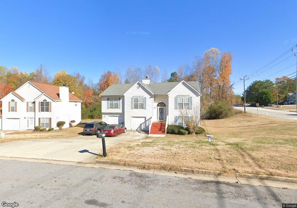
5640 Brenston Ln Unit 2 Ellenwood, GA 30294
Estimated Value: $260,000 - $308,000
3
Beds
3
Baths
2,184
Sq Ft
$128/Sq Ft
Est. Value
About This Home
This home is located at 5640 Brenston Ln Unit 2, Ellenwood, GA 30294 and is currently estimated at $280,086, approximately $128 per square foot. 5640 Brenston Ln Unit 2 is a home located in Clayton County with nearby schools including Thurgood Marshall Elementary School, Morrow Middle School, and Morrow High School.
Ownership History
Date
Name
Owned For
Owner Type
Purchase Details
Closed on
Aug 16, 2004
Sold by
Cendant Mtg Corp
Bought by
Ogletree Robert L
Current Estimated Value
Home Financials for this Owner
Home Financials are based on the most recent Mortgage that was taken out on this home.
Original Mortgage
$147,000
Outstanding Balance
$72,702
Interest Rate
5.96%
Mortgage Type
New Conventional
Estimated Equity
$207,384
Purchase Details
Closed on
May 4, 2004
Sold by
Newsome Astredia M
Bought by
Cendant Mtg Corp
Purchase Details
Closed on
Oct 13, 2000
Sold by
Gt Architecture Contractors Corp
Bought by
Newsome Astredia M
Home Financials for this Owner
Home Financials are based on the most recent Mortgage that was taken out on this home.
Original Mortgage
$148,160
Interest Rate
7.93%
Mortgage Type
FHA
Create a Home Valuation Report for This Property
The Home Valuation Report is an in-depth analysis detailing your home's value as well as a comparison with similar homes in the area
Home Values in the Area
Average Home Value in this Area
Purchase History
| Date | Buyer | Sale Price | Title Company |
|---|---|---|---|
| Ogletree Robert L | $147,000 | -- | |
| Cendant Mtg Corp | $130,905 | -- | |
| Newsome Astredia M | $149,200 | -- |
Source: Public Records
Mortgage History
| Date | Status | Borrower | Loan Amount |
|---|---|---|---|
| Open | Ogletree Robert L | $147,000 | |
| Previous Owner | Newsome Astredia M | $148,160 |
Source: Public Records
Tax History Compared to Growth
Tax History
| Year | Tax Paid | Tax Assessment Tax Assessment Total Assessment is a certain percentage of the fair market value that is determined by local assessors to be the total taxable value of land and additions on the property. | Land | Improvement |
|---|---|---|---|---|
| 2024 | $4,960 | $126,160 | $8,800 | $117,360 |
| 2023 | $4,425 | $122,560 | $8,800 | $113,760 |
| 2022 | $3,887 | $98,080 | $8,800 | $89,280 |
| 2021 | $3,322 | $83,160 | $8,800 | $74,360 |
| 2020 | $3,306 | $81,719 | $8,800 | $72,919 |
| 2019 | $3,156 | $76,800 | $6,400 | $70,400 |
| 2018 | $2,564 | $62,224 | $6,400 | $55,824 |
| 2017 | $2,109 | $50,885 | $6,400 | $44,485 |
| 2016 | $1,471 | $35,221 | $6,400 | $28,821 |
| 2015 | $1,459 | $0 | $0 | $0 |
| 2014 | $1,394 | $34,091 | $6,400 | $27,691 |
Source: Public Records
Map
Nearby Homes
- 0 Old Rex Morrow Rd Unit 7659496
- 0 Old Rex Morrow Rd Unit 10616003
- 5753 Gum Ct
- 2635 Luke Dr
- 2850 Amerson Trail
- 5712 Wesson Dr Unit 2
- 5838 Highway 42
- 5790 Twain Dr
- 2811 Appaloosa Run
- 5871 Dan Dr
- 2820 Rex Rd
- 2436 Rex Rd
- 6020 Cristie Dr
- 5705 Laney Dr
- 2382 Old Rex Morrow Rd
- 6050 Randy Ln
- 0 Poplar Ave Unit 10580022
- 0 Poplar Ave Unit 10481115
- 0 Poplar Ave Unit 7543163
- 6082 Kathie Ct
- 5632 Brenston Ln Unit 2
- 5624 Brenston Ln Unit 2
- 2745 Old Rex Morrow Rd
- 2761 Old Rex Morrow Rd
- 2737 Lolli Ct
- 2737 Old Rex Morrow Rd
- 5616 Brenston Ln
- 2769 Old Rex Morrow Rd
- 2729 Lolli Ct
- 2729 Old Rex Morrow Rd
- 2756 Holly Berry Dr
- 2748 Holly Berry Dr
- 5608 Brenston Ln Unit 2
- 2764 Holly Berry Dr
- 2764 Holly Berry Dr Unit 4
- 2764 Holly Berry Dr Unit 2
- 2740 Holly Berry Dr
- 2780 Holly Berry Dr
- 2721 Lolli Ct Unit 2
- 2721 Old Rex Morrow Rd