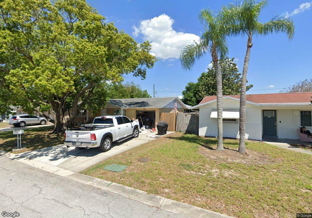
5641 Hamilton Harbor Dr New Port Richey, FL 34652
Estimated Value: $233,000 - $277,000
2
Beds
2
Baths
1,787
Sq Ft
$142/Sq Ft
Est. Value
About This Home
This home is located at 5641 Hamilton Harbor Dr, New Port Richey, FL 34652 and is currently estimated at $253,011, approximately $141 per square foot. 5641 Hamilton Harbor Dr is a home located in Pasco County with nearby schools including Mittye P. Locke Elementary School, Richey Elementary School, and Gulf Middle School.
Ownership History
Date
Name
Owned For
Owner Type
Purchase Details
Closed on
Sep 24, 2012
Sold by
Maxfield Jean M
Bought by
Stone Patricia Annette
Current Estimated Value
Purchase Details
Closed on
Aug 23, 2002
Sold by
Pompiean Thomas C
Bought by
Maxfield Jean M
Home Financials for this Owner
Home Financials are based on the most recent Mortgage that was taken out on this home.
Original Mortgage
$64,800
Interest Rate
6.53%
Mortgage Type
New Conventional
Create a Home Valuation Report for This Property
The Home Valuation Report is an in-depth analysis detailing your home's value as well as a comparison with similar homes in the area
Home Values in the Area
Average Home Value in this Area
Purchase History
| Date | Buyer | Sale Price | Title Company |
|---|---|---|---|
| Stone Patricia Annette | $125,500 | Dba Liberty Title Agency | |
| Maxfield Jean M | $81,000 | -- |
Source: Public Records
Mortgage History
| Date | Status | Borrower | Loan Amount |
|---|---|---|---|
| Previous Owner | Maxfield Jean M | $64,240 | |
| Previous Owner | Maxfield Jean M | $64,800 | |
| Previous Owner | Maxfield Jean M | $52,000 |
Source: Public Records
Tax History Compared to Growth
Tax History
| Year | Tax Paid | Tax Assessment Tax Assessment Total Assessment is a certain percentage of the fair market value that is determined by local assessors to be the total taxable value of land and additions on the property. | Land | Improvement |
|---|---|---|---|---|
| 2025 | $1,089 | $95,730 | -- | -- |
| 2024 | $1,089 | $93,040 | -- | -- |
| 2023 | $1,037 | $90,330 | $20,992 | $69,338 |
| 2022 | $917 | $87,700 | $0 | $0 |
| 2021 | $887 | $85,150 | $16,138 | $69,012 |
| 2020 | $864 | $83,980 | $16,138 | $67,842 |
| 2019 | $837 | $82,100 | $0 | $0 |
| 2018 | $812 | $80,578 | $0 | $0 |
| 2017 | $801 | $80,578 | $0 | $0 |
| 2016 | $746 | $77,298 | $0 | $0 |
| 2015 | -- | $76,761 | $0 | $0 |
| 2014 | -- | $76,152 | $16,138 | $60,014 |
Source: Public Records
Map
Nearby Homes
- 4614 Croton Dr
- 4548 Somerset Place
- 5753 10th Ave
- 4520 Iris Dr
- 4526 Annette St
- 5746 Embay Ave
- 5851 Lanate Ave
- 4853 Alcea St
- 4923 Alcea St
- 5744 Sunshine Park Dr
- 4746 Azalea Dr Unit 107
- 4746 Azalea Dr Unit 209
- 4746 Azalea Dr Unit 201
- 4746 Azalea Dr Unit 105
- 5732 Columbia Dr
- 5738 Columbia Dr
- 5419 Palm Dr Unit 130
- 6019 7th Ave
- 4744 Azalea Dr Unit 203
- 5330 Poinsettia Dr
- 5645 Hamilton Harbor Dr
- 5649 Hamilton Harbor Dr
- 4630 Croton Dr
- 4622 Croton Dr
- 4614 Somerset Place
- 5653 Hamilton Harbor Dr
- 4636 Croton Dr
- 4610 Somerset Place
- 4615 Stonehaven Place
- 5703 Hamilton Harbor Dr
- 4644 Croton Dr
- 4608 Croton Dr
- 4611 Stonehaven Place
- 4606 Somerset Place
- 5707 Hamilton Harbor Dr
- 4629 Croton Dr Unit 3
- 4623 Croton Dr
- 4602 Somerset Place
- 4602 Somerset Place
- 5711 Hamilton Harbor Dr