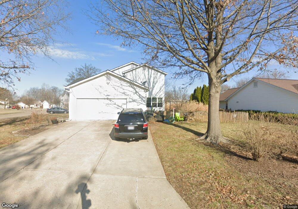
5641 Walnut Point Ln Saint Charles, MO 63304
Estimated Value: $394,133 - $473,000
4
Beds
3
Baths
2,374
Sq Ft
$182/Sq Ft
Est. Value
About This Home
This home is located at 5641 Walnut Point Ln, Saint Charles, MO 63304 and is currently estimated at $432,033, approximately $181 per square foot. 5641 Walnut Point Ln is a home located in St. Charles County with nearby schools including Independence Elementary School, Francis Howell Middle School, and Francis Howell Union High School.
Ownership History
Date
Name
Owned For
Owner Type
Purchase Details
Closed on
Aug 6, 2012
Sold by
Auer Scott and Auer Darla
Bought by
Dowell Timothy R and Dowell Amy M
Current Estimated Value
Home Financials for this Owner
Home Financials are based on the most recent Mortgage that was taken out on this home.
Original Mortgage
$183,150
Outstanding Balance
$126,937
Interest Rate
3.68%
Mortgage Type
New Conventional
Estimated Equity
$305,096
Purchase Details
Closed on
Dec 27, 1996
Sold by
Kaczmarczyk Dennis J Mary L
Bought by
Auer Scott and Auer Darla
Create a Home Valuation Report for This Property
The Home Valuation Report is an in-depth analysis detailing your home's value as well as a comparison with similar homes in the area
Home Values in the Area
Average Home Value in this Area
Purchase History
| Date | Buyer | Sale Price | Title Company |
|---|---|---|---|
| Dowell Timothy R | $203,500 | Continental Title Company | |
| Auer Scott | -- | -- |
Source: Public Records
Mortgage History
| Date | Status | Borrower | Loan Amount |
|---|---|---|---|
| Open | Dowell Timothy R | $183,150 |
Source: Public Records
Tax History
| Year | Tax Paid | Tax Assessment Tax Assessment Total Assessment is a certain percentage of the fair market value that is determined by local assessors to be the total taxable value of land and additions on the property. | Land | Improvement |
|---|---|---|---|---|
| 2025 | $3,871 | $73,062 | -- | -- |
| 2023 | $3,869 | $64,818 | -- | -- |
| 2022 | $3,377 | $52,518 | $0 | $0 |
| 2021 | $3,380 | $52,518 | $0 | $0 |
| 2020 | $3,078 | $46,262 | $0 | $0 |
| 2019 | $3,065 | $46,262 | $0 | $0 |
| 2018 | $2,917 | $42,089 | $0 | $0 |
| 2017 | $2,893 | $42,089 | $0 | $0 |
| 2016 | $2,732 | $38,261 | $0 | $0 |
| 2015 | $2,699 | $38,261 | $0 | $0 |
| 2014 | $2,646 | $36,397 | $0 | $0 |
Source: Public Records
Map
Nearby Homes
- 5744 Walnut Creek Blvd
- 14 Walnut Hill Ct
- 1317 Auburn Hills Dr
- 323 Wildberry Ln
- 0 Gutermuth Rd
- 5527 Hennsley Cir
- 1218 Saddlemaker Dr
- 1005 Waldo Ln
- 1 Belcourt Cir
- 5534 Wavecrest Cir
- 73 Morgantown Ct
- 106 Cottle Creek Way
- 110 Cottle Creek Way
- 116 Cottle Creek Way
- 1000 Santiago Trail
- 3009 Bruce Trail Ct
- 1004 Santiago Trail
- 611 Bennington Dr
- 2009 Butte Trail Ct
- 3004 Bruce Trail Ct
- 5637 Walnut Point Ln
- 112 Walnut Hill Dr
- 51 Walnut Run Ct
- 5633 Walnut Point Ln
- 5642 Walnut Point Ln
- 111 Walnut Hill Dr
- 109 Walnut Hill Dr
- 5638 Walnut Point Ln
- 40 Walnut Place Ct
- 113 Walnut Hill Dr
- 107 Walnut Hill Dr
- 5629 Walnut Point Ln
- 52 Walnut Run Ct
- 106 Walnut Hill Dr
- 55 Walnut Run Ct
- 41 Walnut Place Ct
- 28 Walnut Knoll Ct
- 114 Walnut Hill Dr
- 5623 Walnut Point Ln
- 105 Walnut Hill Dr
Your Personal Tour Guide
Ask me questions while you tour the home.