5643 Upper Burningtown Rd Franklin, NC 28734
Estimated Value: $888,000 - $1,404,721
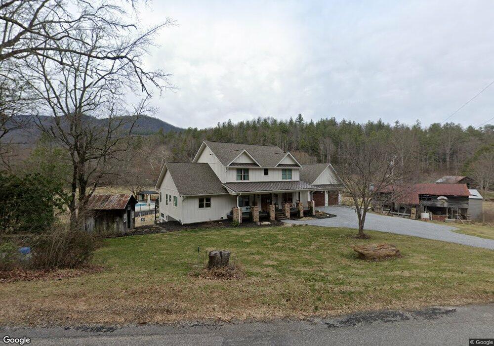
About This Home
This home is located at 5643 Upper Burningtown Rd, Franklin, NC 28734 and is currently estimated at $1,128,430, approximately $322 per square foot. 5643 Upper Burningtown Rd is a home located in Macon County with nearby schools including Iotla Valley Elementary School, Mountain View Intermediate School, and Macon Middle School.
Ownership History
We collect this data history from publicly available records. To have your information removed, we recommend requesting removal directly through your county’s website.
Purchase Details
Purchase Details
Home Financials for this Owner
Home Financials are based on the most recent Mortgage that was taken out on this home.Purchase Details
Purchase Details
Home Values in the Area
Average Home Value in this Area
Purchase History
We collect this data history from publicly available records. To have your information removed, we recommend requesting removal directly through your county’s website.
| Date | Buyer | Sale Price | Title Company |
|---|---|---|---|
| $5,000 | None Listed On Document | ||
| -- | None Available | ||
| -- | None Available | ||
| -- | None Available | ||
| $131,500 | None Available |
Mortgage History
We collect this data history from publicly available records. To have your information removed, we recommend requesting removal directly through your county’s website.
| Date | Status | Borrower | Loan Amount |
|---|---|---|---|
| Previous Owner | $405,000 |
Tax History
We collect this data history from publicly available records. To have your information removed, we recommend requesting removal directly through your county’s website.
| Year | Tax Paid | Tax Assessment Tax Assessment Total Assessment is a certain percentage of the fair market value that is determined by local assessors to be the total taxable value of land and additions on the property. | Land | Improvement |
|---|---|---|---|---|
| 2025 | $3,773 | $920,360 | $88,360 | $832,000 |
| 2024 | $3,773 | $920,360 | $88,360 | $832,000 |
| 2023 | $3,082 | $908,840 | $88,360 | $820,480 |
| 2022 | $3,082 | $576,120 | $62,060 | $514,060 |
| 2021 | $3,024 | $576,720 | $62,060 | $514,660 |
| 2020 | $2,878 | $576,720 | $62,060 | $514,660 |
| 2018 | $394 | $66,370 | $59,320 | $7,050 |
| 2017 | $394 | $66,370 | $59,320 | $7,050 |
| 2016 | $384 | $66,370 | $59,320 | $7,050 |
| 2015 | $361 | $66,370 | $59,320 | $7,050 |
| 2014 | $388 | $90,720 | $72,220 | $18,500 |
| 2013 | -- | $90,720 | $72,220 | $18,500 |
Map
- 90 Wilds Cove Rd
- 1474 Burningtown Falls Rd
- 000 Red Wolf Run
- 490 Red Wolf Run
- 0 Middle Burningtown Rd
- 10/11 Sequoyah View Trail
- 1926 Wilkes Knob Rd
- 1135 Daves Creek Rd
- 180 Younce Creek Rd
- 190 Grannys Knob Rd
- 640 Garden Branch Rd
- 2035 Wayah Rd
- 514C Oak Creek Rd
- 197 Mountain Whispers Dr
- Lot 36 Reserve Rd
- 531 Reserve Rd
- 15 Plum Tree Ln
- 691 Chalk Hill Rd
- 850 Country Club Dr
- 7098 Lower Burningtown Rd
- 5638 Upper Burningtown Rd
- 5650 Upper Burningtown Rd
- 5646 Upper Burningtown Rd
- 166 Roper Homestead Rd
- 254 Roper Homestead Rd
- 254 Roper Homestead Rd
- 5492 Upper Burningtown Rd
- 5899 Upper Burningtown Rd
- 44 Langston Howell Dr
- 5496 Upper Burningtown Rd
- 12 Ray Creek Rd
- 204 Langston Howell Dr
- 5371 Upper Burningtown Rd
- 27 Ray Creek Rd
- 183 Langston Howell Dr
- 0 Wilds Cove Rd Unit 27875
- 0 Wilds Cove Rd Unit 27420
- 5348 Upper Burningtown Rd
- 0 Upper Burningtown Rd
- 460 Wilds Cove Rd
Ask me questions while you tour the home.