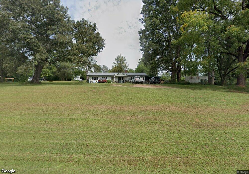
5644 Highway 254 Cleveland, GA 30528
Estimated Value: $146,437 - $404,000
3
Beds
1
Bath
1,152
Sq Ft
$233/Sq Ft
Est. Value
About This Home
This home is located at 5644 Highway 254, Cleveland, GA 30528 and is currently estimated at $268,359, approximately $232 per square foot. 5644 Highway 254 is a home located in White County with nearby schools including Mossy Creek Elementary School, White County 9th Grade Academy, and White County Middle School.
Ownership History
Date
Name
Owned For
Owner Type
Purchase Details
Closed on
Dec 28, 2015
Sold by
Hunt Philip O
Bought by
Cain Warren and Cain Carla
Current Estimated Value
Home Financials for this Owner
Home Financials are based on the most recent Mortgage that was taken out on this home.
Original Mortgage
$42,162
Interest Rate
3.97%
Mortgage Type
New Conventional
Purchase Details
Closed on
Oct 31, 2014
Sold by
Hunt Philip
Bought by
Hunt Philip O and Hunt Nancy E
Create a Home Valuation Report for This Property
The Home Valuation Report is an in-depth analysis detailing your home's value as well as a comparison with similar homes in the area
Home Values in the Area
Average Home Value in this Area
Purchase History
| Date | Buyer | Sale Price | Title Company |
|---|---|---|---|
| Cain Warren | $23,000 | -- | |
| Hunt Philip O | $1,000 | -- |
Source: Public Records
Mortgage History
| Date | Status | Borrower | Loan Amount |
|---|---|---|---|
| Closed | Cain Warren | $42,162 |
Source: Public Records
Tax History Compared to Growth
Tax History
| Year | Tax Paid | Tax Assessment Tax Assessment Total Assessment is a certain percentage of the fair market value that is determined by local assessors to be the total taxable value of land and additions on the property. | Land | Improvement |
|---|---|---|---|---|
| 2025 | $609 | $29,240 | $11,088 | $18,152 |
| 2024 | $609 | $29,240 | $11,088 | $18,152 |
| 2023 | $593 | $26,164 | $9,856 | $16,308 |
| 2022 | $458 | $22,708 | $8,624 | $14,084 |
| 2021 | $500 | $18,660 | $7,224 | $11,436 |
| 2020 | $493 | $17,528 | $6,708 | $10,820 |
| 2019 | $457 | $16,176 | $6,708 | $9,468 |
| 2018 | $457 | $16,176 | $6,708 | $9,468 |
| 2017 | $225 | $8,044 | $6,708 | $1,336 |
| 2016 | $225 | $8,044 | $6,708 | $1,336 |
| 2015 | $215 | $20,110 | $6,708 | $1,336 |
| 2014 | $77 | $35,990 | $0 | $0 |
Source: Public Records
Map
Nearby Homes
- 176 Westmoreland Meadows Dr
- 869 Mossy Creek Church Rd
- 1839 Westmoreland Rd
- 229 Samson Way
- 96 Joyce Dr Unit (OFF AIRPORT ROAD)
- 234 Mossy Creek Church Rd
- 640 Collins Rd
- 125 King Bird Dr
- 102 Trent Trail
- 2523 Westmoreland Rd
- 57 Autumnwood Way
- 201 Quail View Ridge
- LOT 2 Joe Turner Rd
- 1779 New Bridge Rd
- 2459 New Bridge Rd
- 8842 Shallow Creek Trail
- 5282 Highway 129 S
- 2011 Lothridge Rd
- 841 Yonah Meadow Dr
- 8465 Georgia 254
- 17 Janie Dr
- 55 Janie Dr
- 249 Westmoreland Rd
- 0 Georgia 254 Unit 8922280
- 0 Georgia 254 Unit 3144809
- 0 Georgia 254 Unit 8685006
- 0 Georgia 254 Unit 8623245
- 0 Georgia 254 Unit 8534099
- 0 Georgia 254 Unit 8471874
- 0 Georgia 254
- 5716 Highway 254
- 5852 Highway 254
- 197 Westmoreland Rd
- 163 Westmoreland Rd
- 3302 Highway 254
- 87 Westmoreland Rd
- 5262 Highway 254
- 51 Westmoreland Rd
- 3 Westmoreland Rd
- 5979 Highway 254