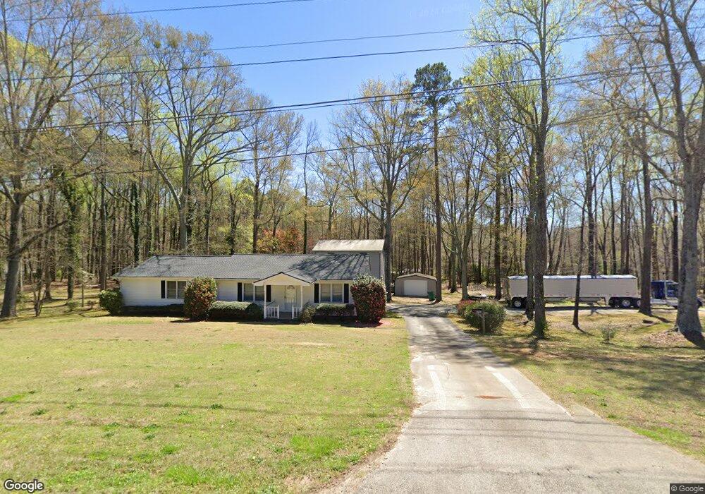
5645 Matt Hwy Cumming, GA 30028
Estimated Value: $599,000 - $694,000
2
Beds
1
Bath
992
Sq Ft
$642/Sq Ft
Est. Value
About This Home
This home is located at 5645 Matt Hwy, Cumming, GA 30028 and is currently estimated at $636,998, approximately $642 per square foot. 5645 Matt Hwy is a home with nearby schools including Matt Elementary School, Liberty Middle School, and North Forsyth High School.
Ownership History
Date
Name
Owned For
Owner Type
Purchase Details
Closed on
Mar 10, 2021
Sold by
Jennings Oliver Lewis
Bought by
Jennings Betty Lee Gilleland and Jennings Phillip Dwayne
Current Estimated Value
Purchase Details
Closed on
Jun 25, 2015
Sold by
Jennings Phillip Dwayne
Bought by
Jennings Oliver Lewis and Jennings Phillip Dwayne
Purchase Details
Closed on
Apr 13, 2004
Sold by
Jennings Oliver L
Bought by
Jennings Betty G
Create a Home Valuation Report for This Property
The Home Valuation Report is an in-depth analysis detailing your home's value as well as a comparison with similar homes in the area
Home Values in the Area
Average Home Value in this Area
Purchase History
| Date | Buyer | Sale Price | Title Company |
|---|---|---|---|
| Jennings Betty Lee Gilleland | -- | -- | |
| Jennings Oliver Lewis | -- | -- | |
| Jennings Betty G | -- | -- |
Source: Public Records
Tax History Compared to Growth
Tax History
| Year | Tax Paid | Tax Assessment Tax Assessment Total Assessment is a certain percentage of the fair market value that is determined by local assessors to be the total taxable value of land and additions on the property. | Land | Improvement |
|---|---|---|---|---|
| 2025 | $3,946 | $262,896 | $199,760 | $63,136 |
| 2024 | $3,946 | $160,908 | $99,880 | $61,028 |
| 2023 | $3,882 | $157,700 | $99,880 | $57,820 |
| 2022 | $3,686 | $131,084 | $90,800 | $40,284 |
| 2021 | $350 | $131,084 | $90,800 | $40,284 |
| 2020 | $349 | $129,944 | $90,800 | $39,144 |
| 2019 | $355 | $130,004 | $90,800 | $39,204 |
| 2018 | $372 | $117,344 | $90,800 | $26,544 |
| 2017 | $378 | $113,296 | $90,800 | $22,496 |
| 2016 | $369 | $107,324 | $85,200 | $22,124 |
| 2015 | $369 | $107,324 | $85,200 | $22,124 |
| 2014 | -- | $106,268 | $85,200 | $21,068 |
Source: Public Records
Map
Nearby Homes
- 5655 Elmo Rd
- 27.55 AC Bannister Rd
- 5815 Thornton Dr
- 4345 Sunflower Cir
- 4315 Sunflower Cir
- 5765 Thornton Dr
- 4655 Dandelion Way
- 6000 John Burruss Rd
- 4605 Dandelion Way
- 4575 Sunflower Cir
- 6015 Thrasher Ct
- 5905 Neisler Rd
- 5925 Crescent Landing Dr
- Sexton Rd
- 6025 Crescent Landing Dr
- 5860 Bannister Rd
- 5520 Allegre Place
- 5395 Coltman Dr
- 4650 Bramblett Grove Place
- 6440 Lantana Village Way